
Madagascar – Pieter Mortier, c. 1700
PIRATE HAVEN MADAGASCAR “Carte Particuliere de l’Isle Dauphine ou Madagascar et St. Laurens”, copper engraving on two sheets published by…
Lees verder€1.100
PIRATE HAVEN MADAGASCAR
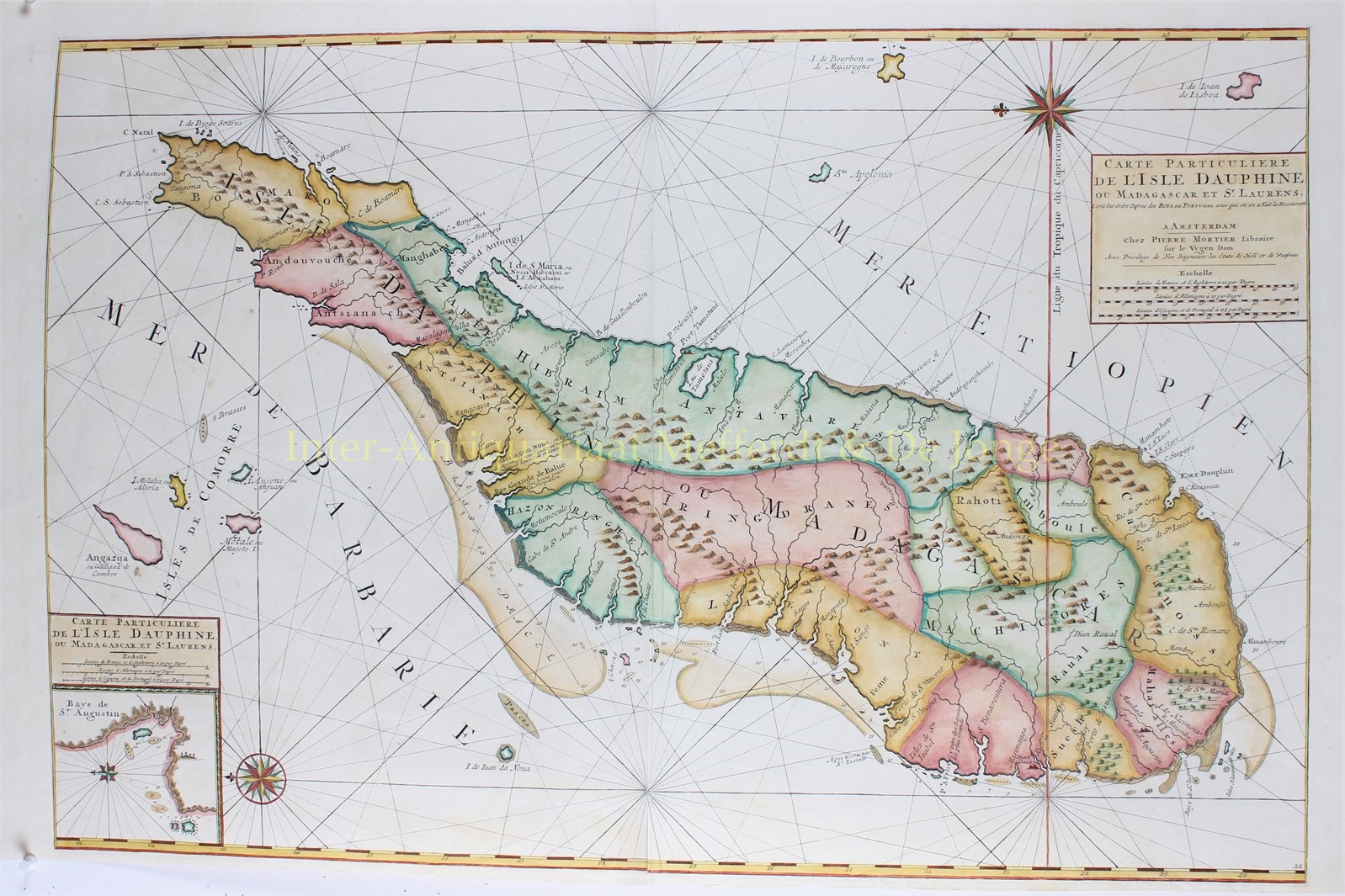
“Carte Particuliere de l’Isle Dauphine ou Madagascar et St. Laurens”, copper engraving on two sheets published by Pieter Mortier in Amsterdam approx. 1700. With original hand coluring. Size: 56,2 x 85,1 cm.
A large chart of Madagascar, including the islands of Isle De Bourbon ou de Mascaregne [Mauritius], Santa Apolonia [Réunion], Isle De Ioan de Lisboa [perhaps the island of Rodrigues] and Isles de Comorre [Comoro Islands]. In lower left hand corner an inset map of the bay of Saint Augustin on Madagascar. Madagascar itself shows a place called Masalagem Nova where the Portuguese from Mozambique trade their wines and fruits.
The map was published in Pieter Mortier’s monumental three-part sea-atlas, ‘Le Neptune François‘. The first part was a counterfeit of a French original; the second part, the ‘Atlas Maritime‘ contained charts engraved by Romeijn de Hooghe, including the famous chart of the Mediterranean; the third, the ‘Suite de Neptune François‘, contained charts from Portuguese sources.
This chart comes from a full-colour example rather than the usual outline. Of particular interest are the delineations of Antongil Bay and Nosy Boraha [Île Sainte-Marie] in the north east: at the time both were havens for European pirates preying on the East India trade and Mughal treasure ships. The actions of William Kidd, Henry Every, John Bowen and Thomas Tew in the region helped make the period of this chart the golden age of piracy.
Price: Euro 1.100,-