
Southeast Asia – De Vaugondy, 1750
MAP OF SOUTHEAST ASIA “Archipel des Indes Orientales, qui comprend les Isles de la Sonde, Moluques et Philippines, tirees des…
Lees verder
MAP OF SOUTHEAST ASIA
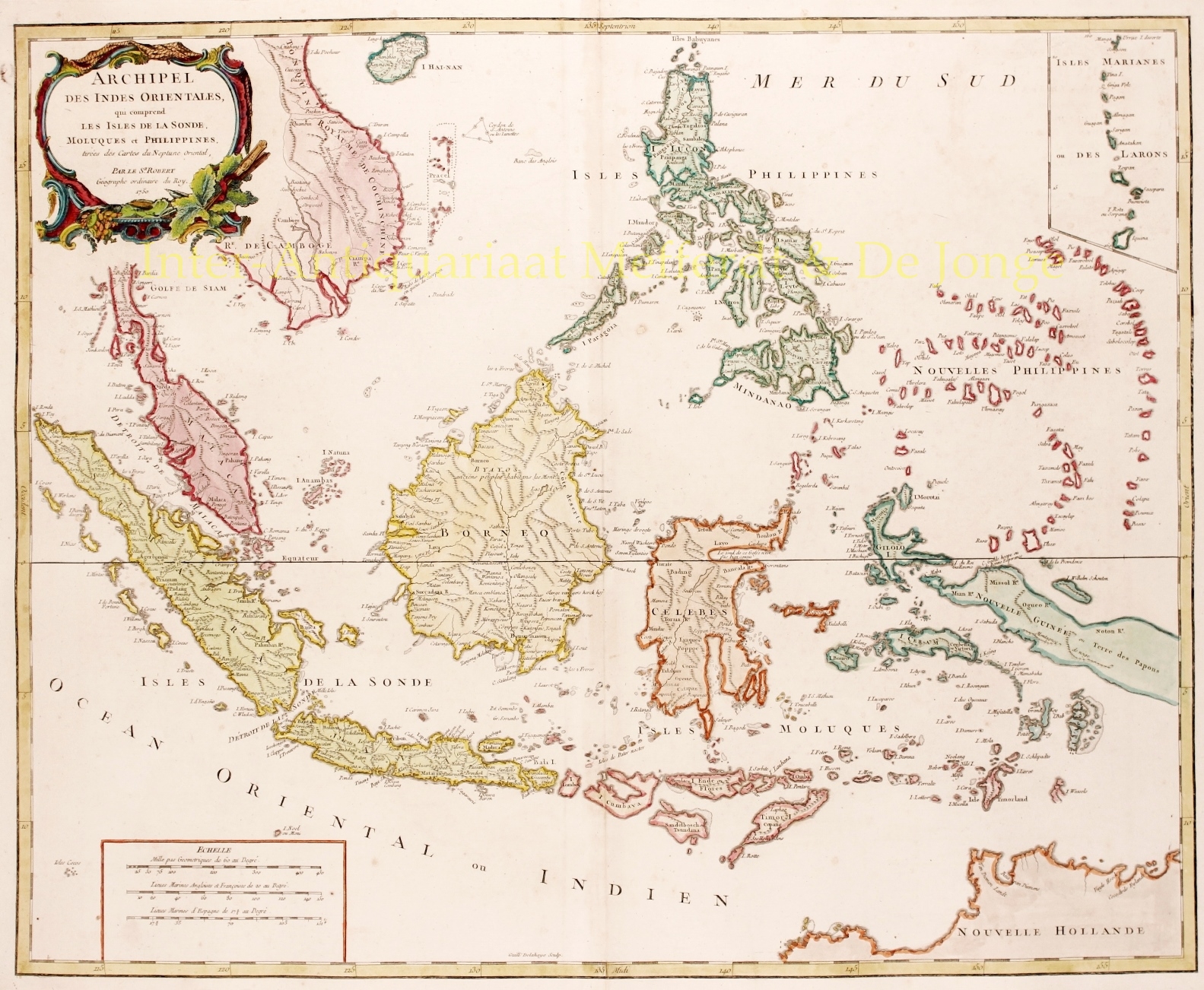
“Archipel des Indes Orientales, qui comprend les Isles de la Sonde, Moluques et Philippines, tirees des Cartes du Neptune Oriental.” Copper engraving of the East Indies and Southeast Asia engraved by Guillaume Delahaye in 1750, compiled by Robert de Vaugondy and published in 1757. With original hand colouring. Size: 48 x 59 cm.
The map covers the area from Vietnam and the Gulf of Siam eastward to include Malaysia, Sumatra, Indonesia, Philippines and part of New Guinea and further south the northern coast of Australia (Nouvelle Hollande). The island of Singapore is identified as Sincapoura. An inset at the top right features the Mariana Islands.
This map offers splendid detail throughout, including undersea shoals and reefs along the coastlines, mountain ranges, lakes, rivers and towns. New Guinea, which was largely unexplored well into the 19th century, is shown speculatively and remains largely unmapped.
The map was published in the Atlas Universel. Capital for the publication of the atlas was raised by subscription and the list of subscribers included illustrious names such as the mistress of Louis XV, Marquise de Pompadour, who ordered two copies.
Price: SOLD