
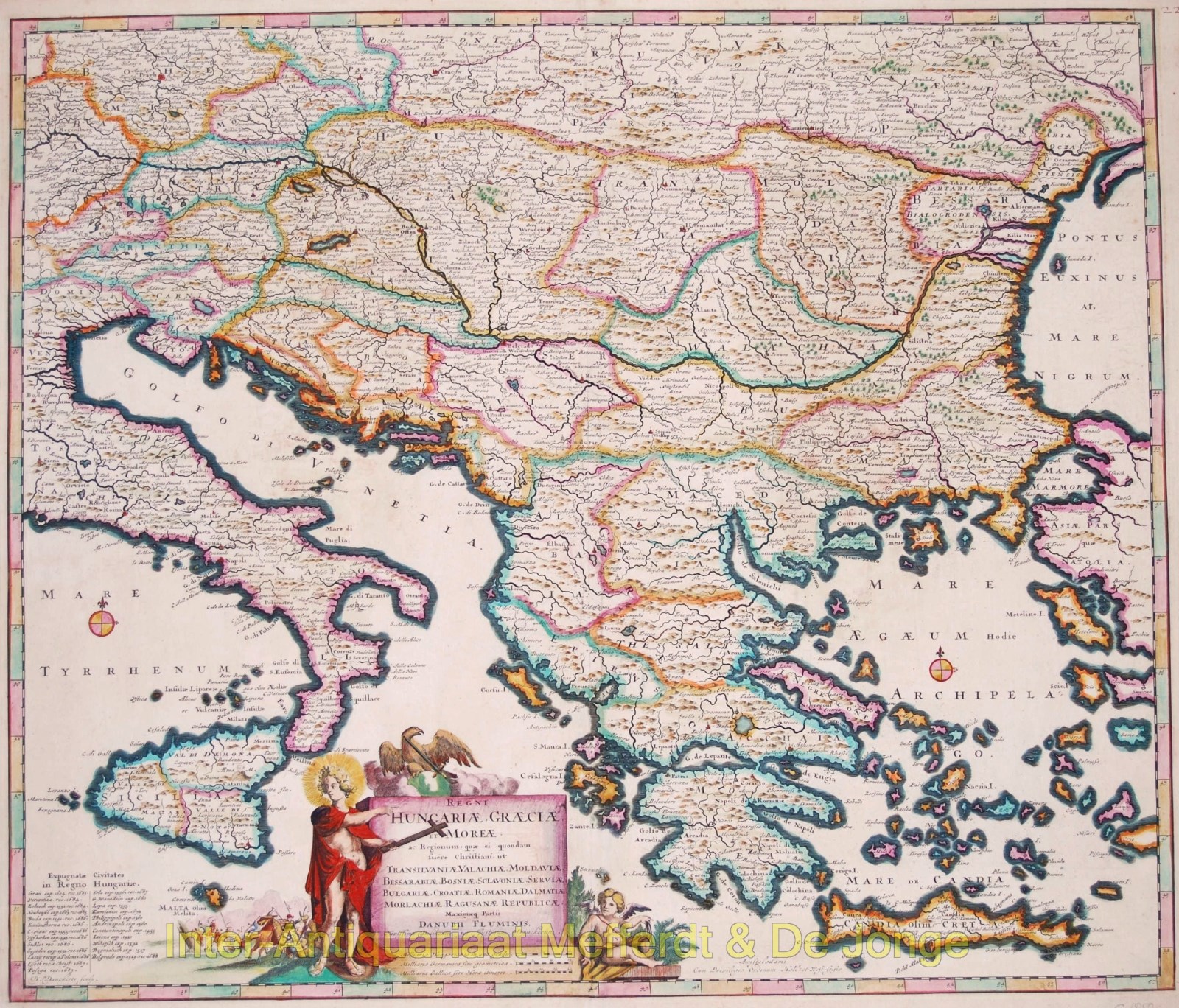
Griekenland, Balkan – Justus Danckerts, 1684
“Regni Hungariae, Graeciae et Moreae ac Regionum, quae ei quondam fuere Christiani ut Transilvaniae, Valachiae, Moldaviae, Bessarabiae, Croatiae, Romaniae, Dalmatiae,…
Lees verder€425
“Regni Hungariae, Graeciae et Moreae ac Regionum, quae ei quondam fuere Christiani ut Transilvaniae, Valachiae, Moldaviae, Bessarabiae, Croatiae, Romaniae, Dalmatiae, Morlachiae, Ragusanae Republicae, Maximaeq Partis Danubii Fluminis” [“The Kingdoms of Hungary, Greece, and Morea and regions which formerly belonged to Christians such as Transilvania, Wallachia, Moldavia, Bessarabia, Croatia, Romania, Dalmatia, Morlachia, Republic of Ragusa, and the greatest part of the Danube River”], copper engraving published in Amsterdam by Justus Danckerts in 1684. With original hand colouring. Size: 51,2 x 59,9 cm.
This nice map of the greater Balkan region, follows the course of the Danube from Passau to the Black Sea.
The map was engraved during the Great Turkish War between the Ottoman Empire and the Holy League consisting of the Holy Roman Empire, Poland-Lithuania, Venice, Russia, and Habsburg Hungary. Intensive fighting began in 1683 and ended with the signing of the Treaty of Karlowitz in 1699. The war was a defeat for the Ottoman Empire, which for the first time lost large amounts of territory, in Hungary and the Polish–Lithuanian Commonwealth, as well as part of the western Balkans.
The war is illustrated by a scene of fighting soldiers left of the title cartouche.
Price: Euro 425,-