
Middellandse Zee – anoniem, 19e-eeuw
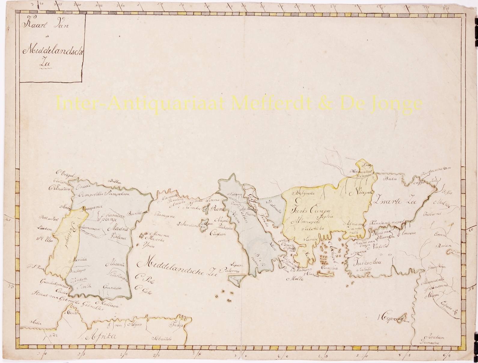
UNIQUE MANUSCRIPT MAP OF THE MEDITERRANEAN “Kaart van de Middellandsche Zee“, anonymous manuscript map in brown ink and watercolour on…
Lees verder€425
UNIQUE MANUSCRIPT MAP OF THE MEDITERRANEAN
“Kaart van de Middellandsche Zee“, anonymous manuscript map in brown ink and watercolour on vellum. Drawn by a Dutch hand in the first half of the 19th century. Size: 39 x 52 cm.
Centuries of trade and travel had mapped the Mediterranean area in great detail. Maybe an armchair traveller drew up this quite inaccurate map. Perhaps it served only for translation purposes of a non-Dutch language map.
Travelling the Mediterranean in the early 19th century was still very timing consuming. It depended very much on the type of ship, the time of year (and therefore the prevailing wind), which direction you travelled (trips towards the west were slower than trips towards the east) and the weather encountered along the way. With a medium-sized sailing ship – e.g. a brigantine or a frigate – it is estimated you needed 7-10 days from Rome (Ostia) to Gibraltar, 20-30 days from Sicily (Marsala) to Rhodes and 30-50 days to get back, 20-30 days to get from Marsala to Alexandria and up to 65 days to get back. A fast ship given perfect conditions would do better, and bad weather could mean the trip took a lot longer. And pirates could mean you didn’t finish it at all.
Price: Euro 425,-