
New Orleans – after John William Hill, 1852
SPLENDID LARGE VIEW OF NEW ORLEANS “New Orleans from the lower cotton press 1852” Lithograph made by David William Moody…
Read more
SPLENDID LARGE VIEW OF NEW ORLEANS
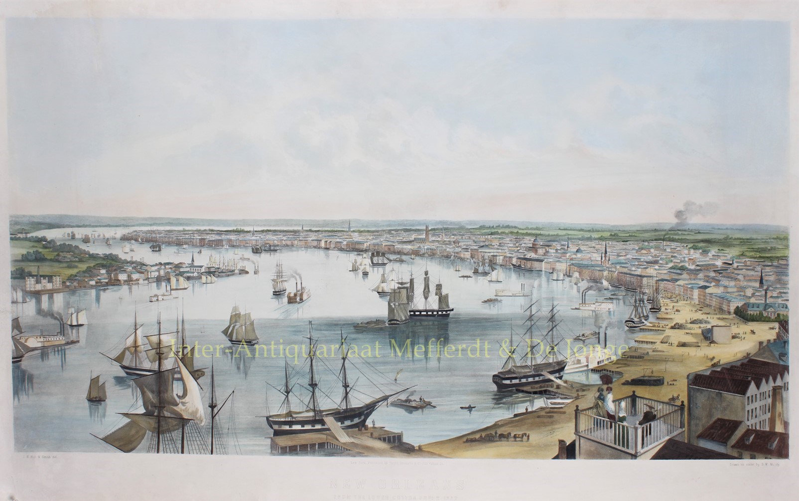
“New Orleans from the lower cotton press 1852” Lithograph made by David William Moody after a drawing by John Willian Hill, published in 1852 by Smith Brothers & Co. of New York. Colored by a later hand. Size: 67 x 111 cm.
New Orleans as seen from the top of the Lower Cotton Press in lower Marigny; visible is the city skyline across the Vieux Carre and including much of the city’s urban area; the curve of the Mississippi River at Algiers. The scene depicts numerous sailing ships, steamboats and other vessels. Many of the city’s landmarks and other points of interest are shown. (The vantage point, the New Orleans Lower Cotton Press, was a building where they used steam presses to make bales from the cotton brought from the plantations.)
The population of the city doubled in the 1830s with an influx of settlers. The addition of white immigrants to the white creole population enabled French-speakers to remain a majority of the white population until almost 1830. If a substantial proportion of free persons of color and slaves had not also spoken French, however, the Gallic community would have become a minority of the total population as early as 1820. Large numbers of German and Irish immigrants began arriving at this time. The population of the city doubled in the 1830s and by 1840 New Orleans had become the wealthiest and third-most populous city in the nation.
By 1840, the city’s population was approximately 102,000 and it was now the third-largest in the U.S, the largest city away from the Atlantic seaboard as well as the largest in the South.
The introduction of natural gas (about 1830); the building of the Pontchartrain Rail-Road (1830–31), one of the earliest in the United States; the introduction of the first steam-powered cotton press (1832), and the beginning of the public school system (1840) marked these years; foreign exports more than doubled in the period 1831–1833. In 1838 the commercially-important New Basin Canal opened a shipping route from the Lake to uptown New Orleans. The river trade caused more congestion in those days of river boats, steamers, and ocean-sailing craft than today. The institution of slavery was all around. There was a medley of Latin tongues and a disorder and carousing of the river-men and adventurers filled the city.
Altogether there was much of the wildness of a frontier town, and a seemingly boundless promise of prosperity. The crisis of 1837, indeed, was severely felt, but did not greatly retarded the city’s advancement, which continued unchecked until the Civil War. In 1849 Baton Rouge replaced New Orleans as the capital of the state. In 1850 telegraphic communication was established with St. Louis and New York City; in 1851 the New Orleans, Jackson and Great Northern railway, the first railway outlet northward, later part of the Illinois Central, and in 1854 the western outlet, now the Southern Pacific, were begun.
In 1836 the city was divided into three municipalities: the first being the French Quarter and Faubourg Tremé, the second being Uptown (then meaning all settled areas upriver from Canal Street), and the third being Downtown (the rest of the city from Esplanade Avenue on, downriver). For two decades the three Municipalities were essentially governed as separate cities, with the office of Mayor of New Orleans having only a minor role in facilitating discussions between municipal governments.
On May 3, 1849, a Mississippi River levee breach upriver from the city (around modern River Ridge, Louisiana) created the worst flooding the city had ever seen. The flood, known as at Sauvé’s Crevasse, left 12,000 people homeless. While New Orleans has experienced numerous floods large and small in its history, the flood of 1849 was of a more disastrous scale than any save the flooding after Hurricane Katrina in 2005.
The view of New Orleans is one of a series of remarkably fine large folio city views, issued during an eight year period beginning in 1848, by the four Smith brothers – Francis, George Warren, David Clifford and Benjamin Franklin. A few of these views were engraved, but about forty others were lithographed by highly skilled printers in Boston and New York. Probably the Smiths intended to include all of the important urban communities of the nation in their list of urban prints. While the results fell short of this ambitious goal, their efforts produced views from throughout the eastern half of the country.
The project had required more time than the brothers had anticipated and they could not deliver their lithographs on time to their subscribers. Nevertheless, the prints without exception were worth waiting for. Large and imposing in size, splendidly drawn from vantage points carefully selected to show each city to best advantage, skilfully lithographed and printed by some of the best craftsmen of the industry, the Smith brothers’ views achieved a standard that equalled or surpassed the best work of its kind.
Price: SOLD