
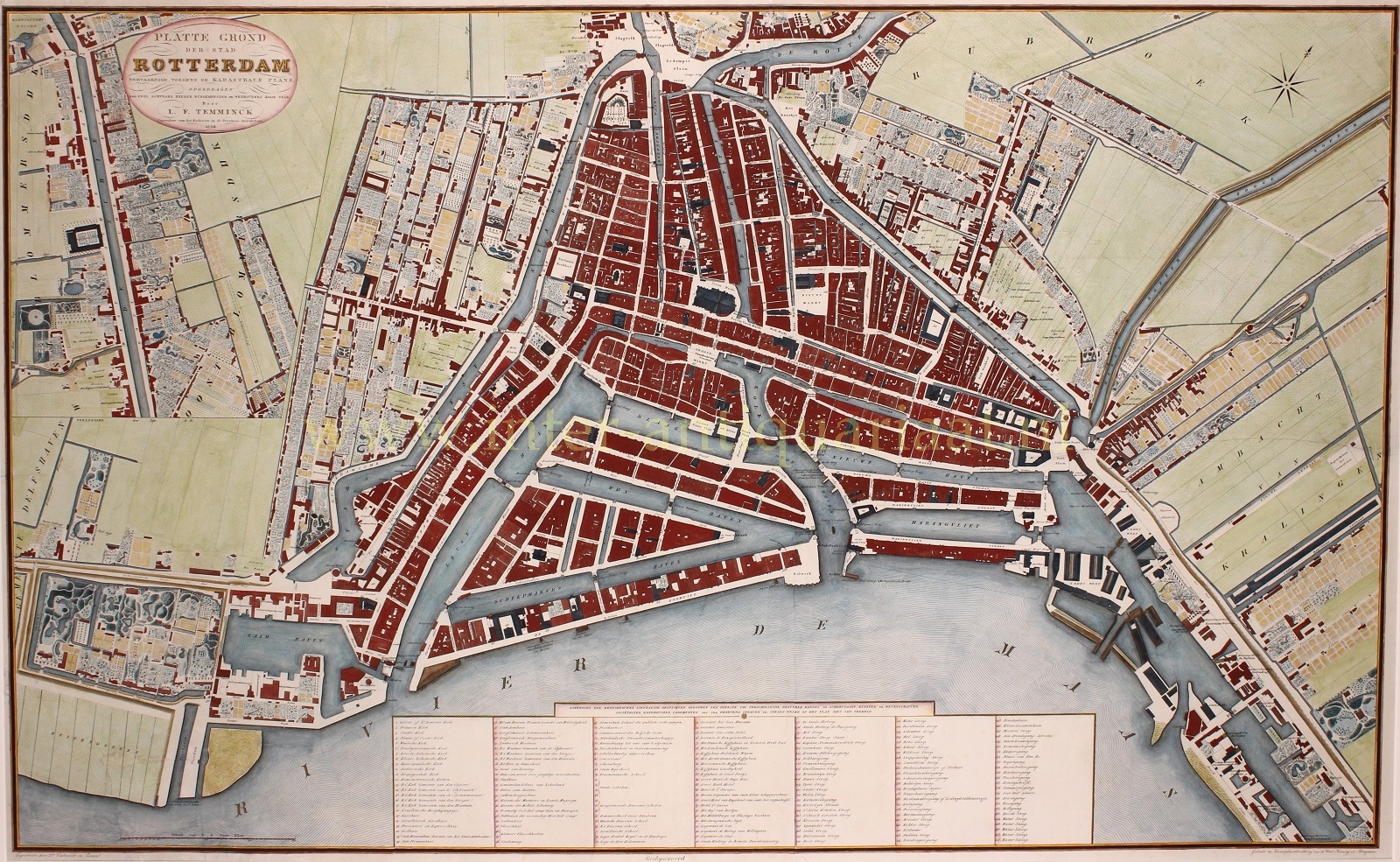


Rotterdam – Leonardus Temminck, 1839
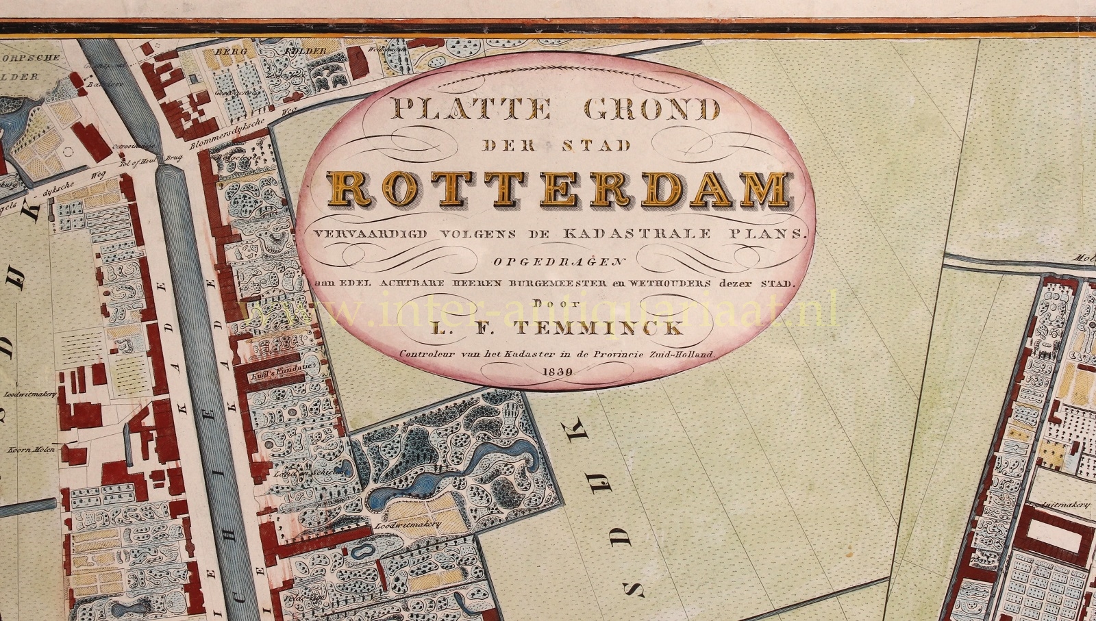
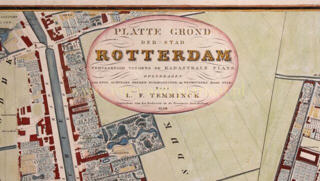
“Platte grond der stad Rotterdam, vervaardigd volgens kadastrale plans, opgedragen aan Edel Achtbare Heeren Burgemeester en Wethouders dezer stad.” Uitgegeven…
Read more€4.750
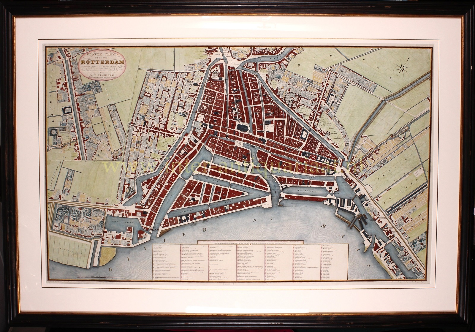
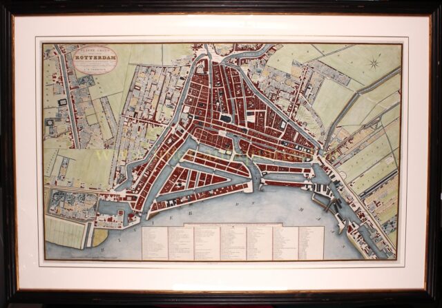
“Platte grond der stad Rotterdam, vervaardigd volgens kadastrale plans, opgedragen aan Edel Achtbare Heeren Burgemeester en Wethouders dezer stad.” Uitgegeven in 1839 door L.F. Temminck, in koper gegraveerd door D. Veelwaard en Zonen, gedrukt op vier bladen door Wed. Koning & Brugman. Deels later, deels in de tijd met de hand gekleurd. Afm. (prent) 75 x 123 cm.
“Platte grond der stad Rotterdam, vervaardigd volgens kadastrale plans, opgedragen aan Edel Achtbare Heeren Burgemeester en Wethouders dezer stad.” (Map of the city of Rotterdam, made according to cadastral plans, dedicated to the Honorable Mayor and Aldermen of this city.) Published in 1839 by Leonardus F. Temminck, engraved in copper by Daniel Veelwaard and Sons, printed on four sheets by Wed. Koning & Brugman. Partly original, partly later hand-coluring. Size: (print) 75 x 123 cm.
Rotterdam’s city officials repeatedly felt the need for a large-scale reliable map that indicated all the plots of land with its city boundaries. In 1827, the managers, who were in charge of ‘De Fabricage‘, the technical department of the city, urged the mayor and aldermen to have a new map of the municipality made. It took twelve more years for this wish to be fulfilled by Leonardus Temminck, inspector and custodian of Rotterdam’s cadastre. Five coloured and five uncoloured copies were given to the city government.
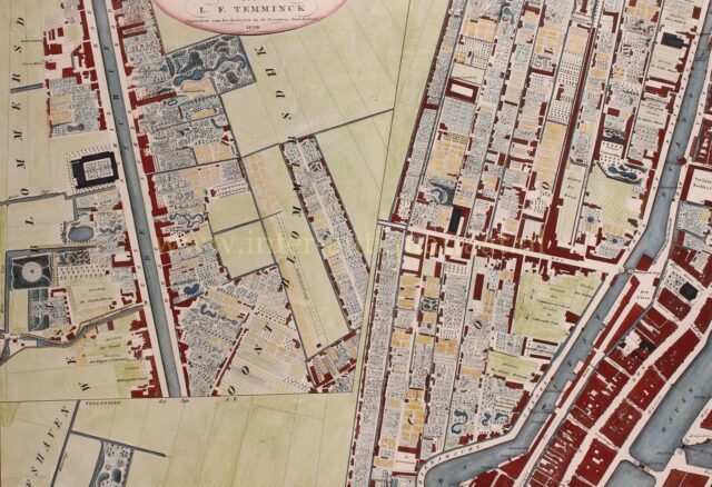
Since the appearance of the previous map (in 1800), the municipality’s area has significantly expanded. The municipality of Cool was incorporated, and West-Blommersdijk, Oost-Blommerswijk, and Rubroek are now shown for the first time on a map.
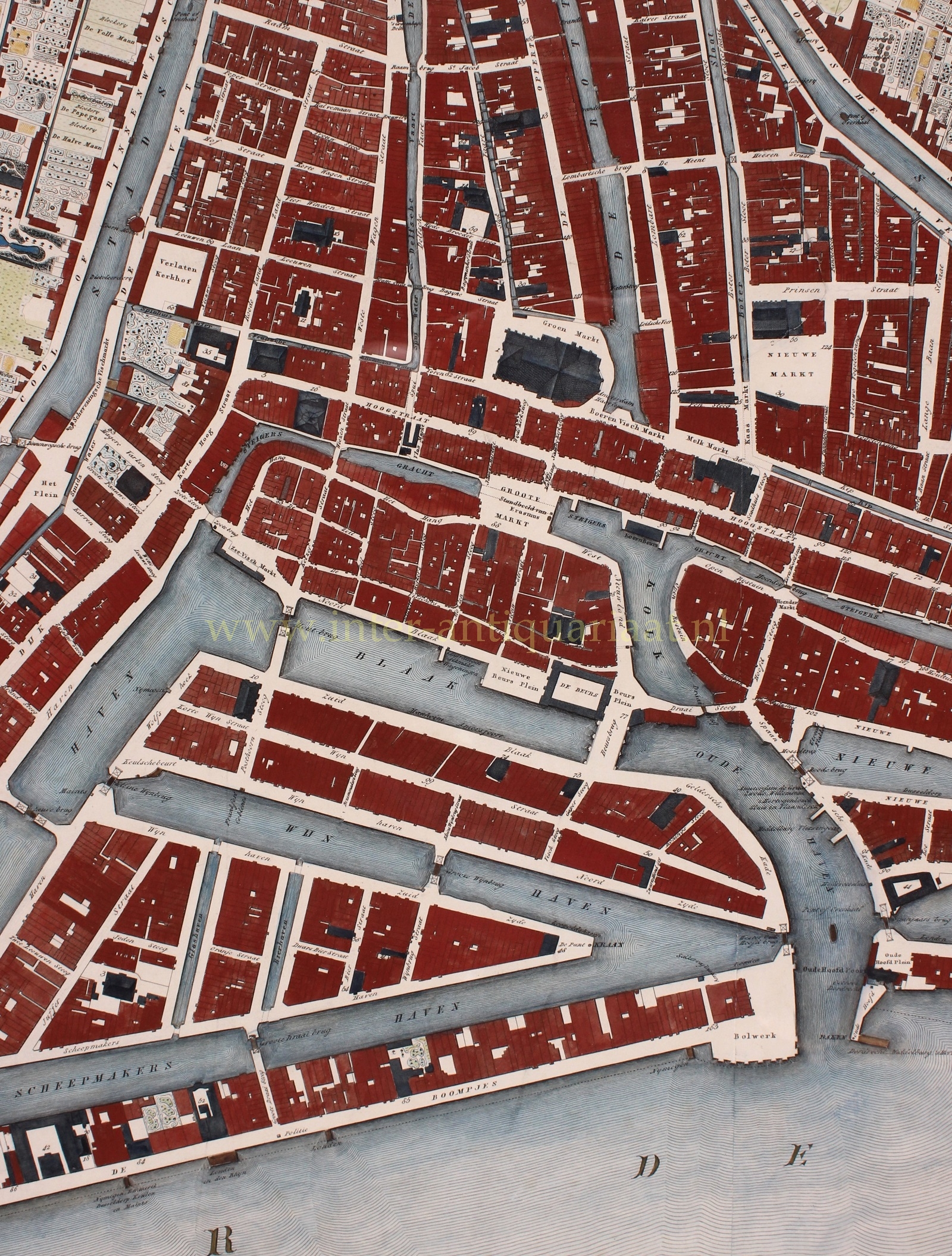
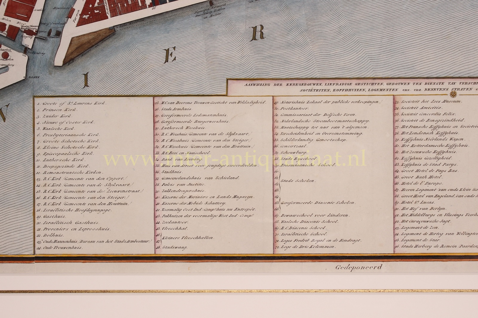
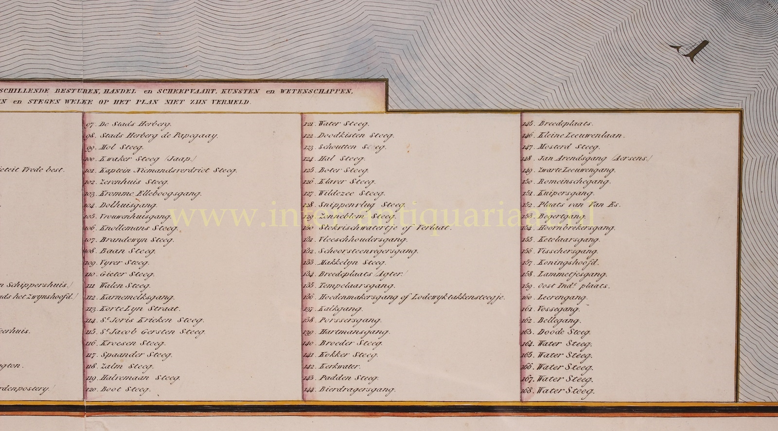
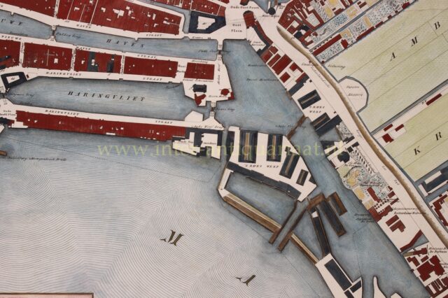
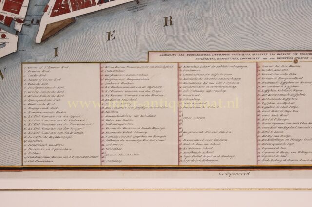
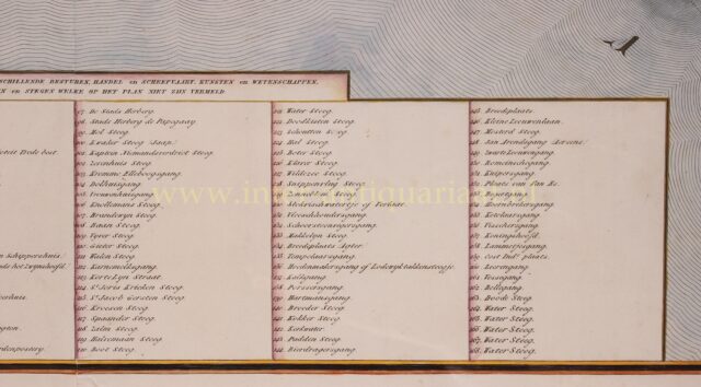
Due to the very dense urbanization of the city center, Temminck, due to lack of information, was not always able to represent the undeveloped parts of the plots but only the cadastral boundaries. Land use outside the canals, however, is well indicated on the map. Particularly, the layout of gardens is beautifully depicted. A large number of streets, alleys, waterways, public buildings, businesses, and country estates are marked. This, along with the extremely precise mapping, makes this map an very important source of knowledge about Rotterdam on the eve of the sweeping changes the city would undergo in the nineteenth century.
Price: Euro 4.750,- (incl. frame)