
Friesland, Groningen – Abraham Goos, Claes Jansz. Visscher, 1633
INFLUENTIAL MAP OF THE NORTH OF THE NETHERLANDS “Tabula Frisiae, Groninghae et Territoty Embdensis nec non circumjacentrium Regionum”, copper engraving…
Read more
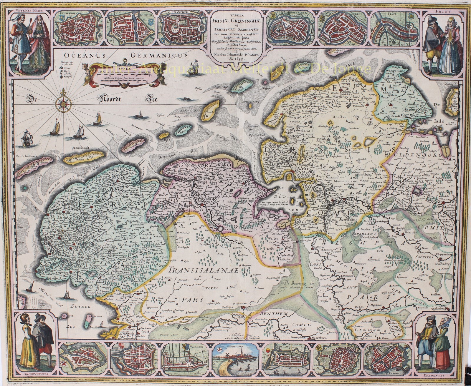
INFLUENTIAL MAP OF THE NORTH OF THE NETHERLANDS
“Tabula Frisiae, Groninghae et Territoty Embdensis nec non circumjacentrium Regionum”, copper engraving made by Abraham Goos, published in 1633 (2nd state) by Claes Jansz. Visscher. Coloured by a later hand. Size. 47 x 56,5 cm.
In 1628 Claes Jansz Visscher published a map of Friesland and Groningen that had a lasting influence on the mapping of the Dutch northern regions. The title is placed in a cartouche in the centre of the top border. In the North Sea is a cartouche with two bar scales. Next to it to the left is a legend with the symbols used on the map. The engraver’s name appears at the bottom centre.
Along the upper and lower edges of the map image run decorative borders with costumed figures, town plans and a single view. The map title in the top border is flanked on each side by three town plans (Leeuwarden, Dokkum, Franeker – Bolsward, Sneek, IJlst) and a depiction of costumed figures in the corners. The bottom border shows six town plans (Sloten, Harlingen, Worckum, Staveren, Groningen and Embden) and one town view (Hindelopen). The decorative borders were etched in Visscher’s workshop.
Reference:
- Günther Schilder – Monumenta Cartographica Neerlandica, VI 65.2
- J. Vrederberg-Alink – De kaarten van Groningerland, IV B 2
- P.J. de Rijke – Hoogtepunten van de Friese cartografie, 037-2
Price: VERKOCHT