
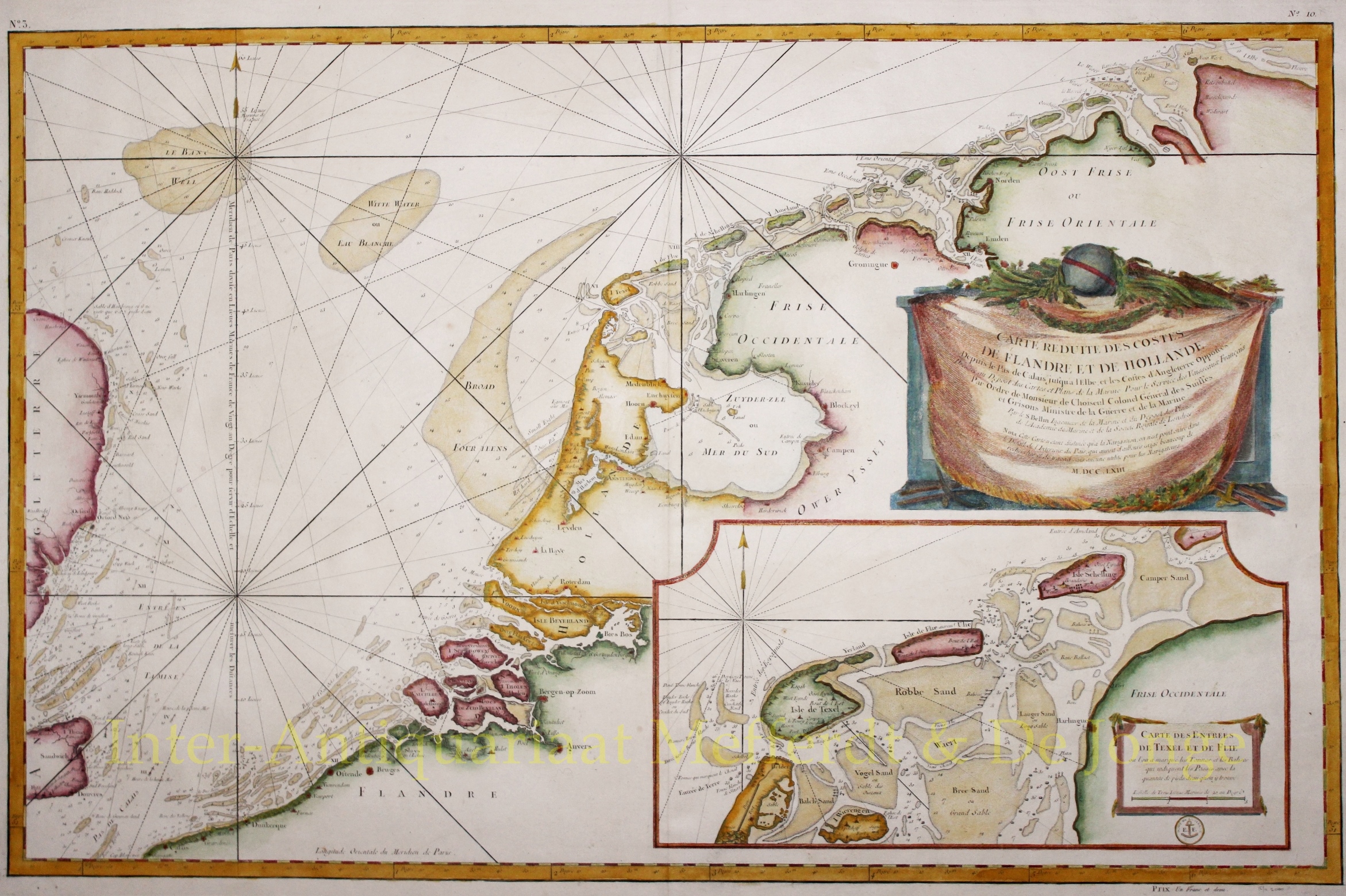

Netherlands, North Sea – Nicolas Bellin, 1763
NAUTICAL CHART OF THE NETHERLANDS “CARTE RÉDUITE DES COSTES DE FLANDRE ET DE HOLLANDE Depuis le Pas de Calais jusqu’a…
Read more
NAUTICAL CHART OF THE NETHERLANDS
“CARTE RÉDUITE DES COSTES DE FLANDRE ET DE HOLLANDE Depuis le Pas de Calais jusqu’a l’Elbe, et les Costes d’Angleterre Opposées” [reduced map of the coasts of Flanders and Holland from the Pas-de-Calais to the Elbe, and the opposite coasts of England], engraving printed from two copper plates made by Nicolas Bellin in 1763. Coloured by a later hand. Size: 55 x 86 cm. Verso: blank.
Sea chart of the Dutch and Flemish coast and on the left part of the English coast, with inset map of the Wadden Islands. Large, fine rococo cartouche in the form of a drapery crowned with a globe and bearing various attributes including an anchor, indicating title, commission, maker and date.
The map was made using documents from the French Dépôt des Cartes et Plans de la Marine, where Bellin worked for more than 50 years. Bellin had been appointed ‘Hidrographe du Roy‘ and later became a member of the Royal Society in London.
The publishing of the map was financed by the Duc de Choisseul, an energetic officer, diplomat and protégé of Madame de Pompadour (mistress of Louis XV).
The map could be bought separately in 1763 for “Un Franc et demi” [a franc and a half].
SOLD