
Cape Colony, South Africa – Henry Hall + Edward Stanford, 1875
IMPORTANT EARLY MAP OF SOUTH AFRICA “South Africa”, engraving originally compiled in 1856 by Henry Hall, published at the Geographical…
Read more
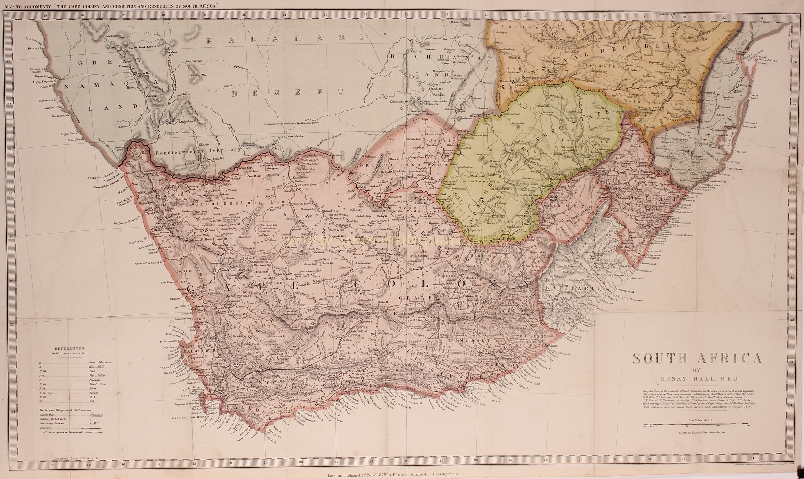
IMPORTANT EARLY MAP OF SOUTH AFRICA
“South Africa”, engraving originally compiled in 1856 by Henry Hall, published at the Geographical Establishment of Edward Stanford of London on 1 February 1875 as part of the “Cape Colony and condition and resources of South Africa” by John Noble. With original hand colouring. Size: 40 x 69 cm.
The map represents all the districts into which the British Cape Colony was divided at the time, and shows the lines of the proposed new railways. It also embraces the territories and states adjoining South Africa , to nearly the 25th parallel, and gives the territorial limits of each, “as recognized by Her Majesty’s Government”.
Henry Hall (1815-1882) was born in Dublin in 1815 and moved to Cape Colony in 1842, in the employ of the British Government Service, a Foreman of Works in the Royal Engineer Department. Hall served on the Eastern Frontier during the Frontier Wars of 1846 and 1851-52. In 1852 he returned to England briefly, but returned to the Cape Colony until 1860. Henry Hall’s is considered as South Africa’s foremost pioneer cartographer.
In 1856 Stanford’s Geographical Establishment in London published Henry Hall’s comprehensive Map of the Eastern Frontier of the Colony of the Cape Good Hope. Compiled from local authoritative information only, this map not only surpassed its predecessors in scale and completeness, but also achieved a marked degree of accuracy. The present map is an update of Hall’s map of 1856, revised and corrected until August 1874.
Hall’s contribution to the cartographic history of South Africa was described by Elri Liebenberg in 2006.
Price: SOLD