
Lake Geneva, Switserland – Mercator-Hondius, 1606
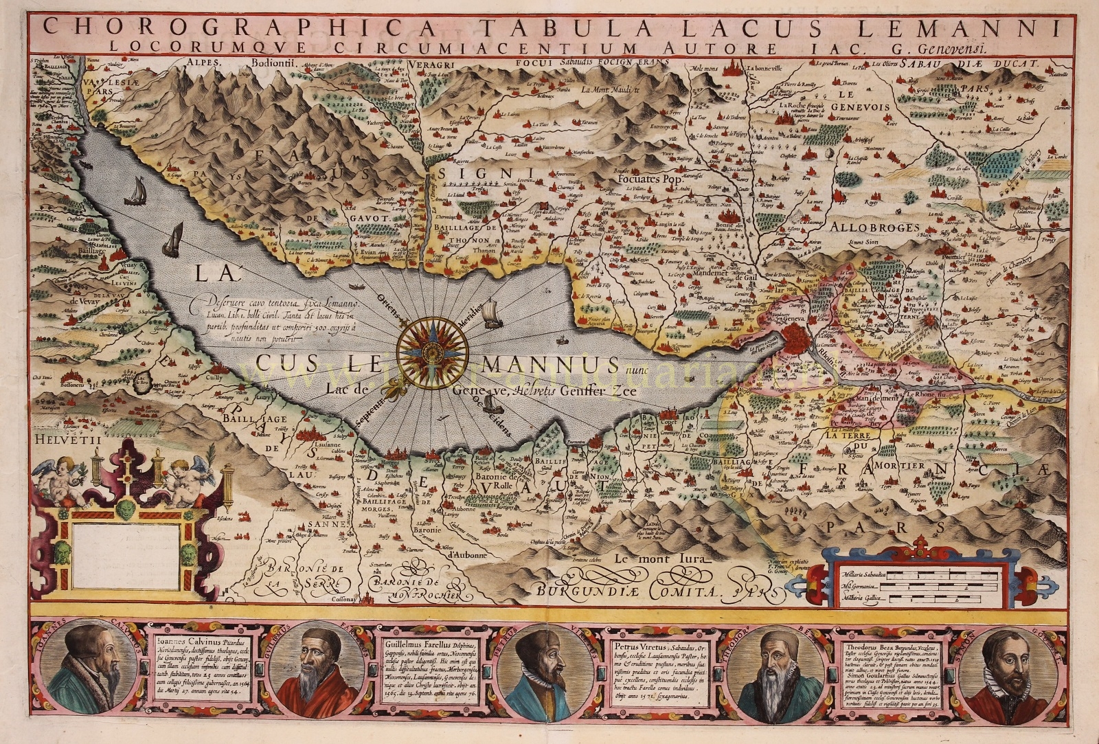
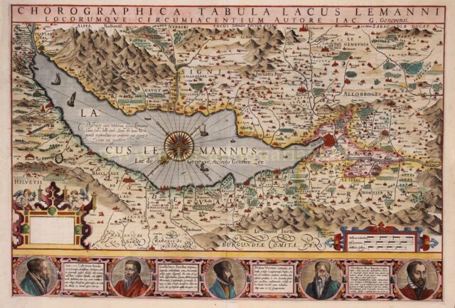
“Chorographica Tabula Lacus Lemanni Locorumque Circumiacentium Auctore Iac. G. Genevensi” [chorographic map of Lake Geneva and surrounding places made by…
Read more
“Chorographica Tabula Lacus Lemanni Locorumque Circumiacentium Auctore Iac. G. Genevensi” [chorographic map of Lake Geneva and surrounding places made by Jacques Goulard of Geneva], copper engraving made by Gerard Mercator and published by Jodocus Hondius in 1606. Coloured by a later hand. Verso: Latin text. Size (plate): 36,9 x 54,3 cm.
This decorative map covers all of Lake Geneva from the Rhone River in the northeast to Geneva, inclusive of the full Canton of Geneva. The map mentions towns and fortresses, but there is also information on castles, towers and wineries, some of which are labeled. At the top left on the narrow side of the lake, for example, there is the “Chateau Chillon”, later made famous by authors such as Rousseau and Byron.
The map includes numerous decorative elements including sailing ships in Lake Geneva and the stunningly rendered Alps. A large and appealing compass rose sits in the center of the Lake. A blank title cartouche appears in the lower right, suggesting that Hondius planned to add his own impression, but never completed the job.
Below the map there are five portraits of important reformers of the time, with fact sheets of their lives: John Calvin, William Farel, Pierre Viret, Theodore Beza and Simon Goulart. In editions of the Mercator-Hondius atlas published after 1609, the portraits fell victim to censorship and this part of the engraving was masked off. The Protestant Reformation had led to a split in Christianity, and tensions between Protestants and Catholics led to the Thirty Years’ War in 1618. The Amsterdam based publishing house of Hondius must have thought to lay low and include a neutral map in their atlases without glorifying the Protestant reformers.
Price: SOLD