
Mediterranean Sea – Johannes van Keulen, 1680-1700
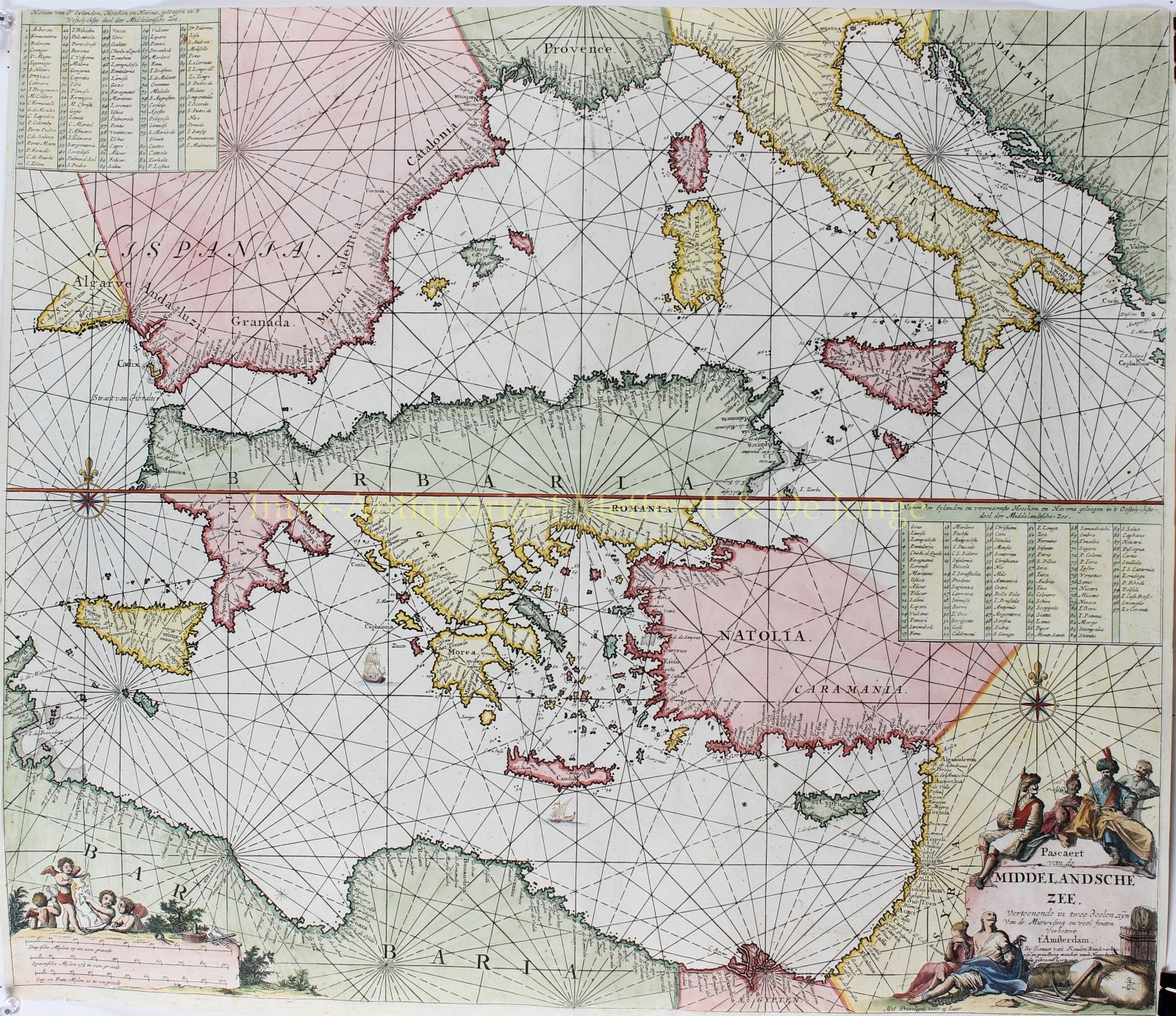
“Pascaert van de Middelandsche Zee, vertoonende in twee deelen, zijn van de miswysing en veel fouten verbetert t’Amsterdam” [Chart of…
Read more
“Pascaert van de Middelandsche Zee, vertoonende in twee deelen, zijn van de miswysing en veel fouten verbetert t’Amsterdam” [Chart of the Mediterranean Sea, shown in two parts, many mistakes now corrected in Amsterdam.] Copper engraving published by Johannes van Keulen around 1680-1700. Colored later by hand. Size: 52 x 60 cm.
The map shows us the west- and east Mediterranean separated on one sheet. At the bottom two allegorical cartouches with on the left the scale of the map, various navigation instruments and a number of putti that read the map, on the right the title and imprint of the map. On top of the cartouche on the right are Ottomans (who have been a formidable force in the region until the very end of the 17th century), below a chained European and a crying woman besides merchandise. The main islands, corners and harbors are listed in the upper corners of both parts of the map.
Johannes van Keulen was the founder of the well-known publishing house that, during more than two centuries of its existence, focused on publishing sea atlases and sea rutters. Van Keulen was not a cartographer himself, but he struck a deal with cartographer Claes Jansz. Vooght, who made of most of the maps that Johannes van Keulen published. Van Keulen’s atlases, the “Nieuwe Lichtende Zee-Fackel” [New lighting sea-torch] and the “Groote Nieuwe Vermeerderde Zee-Atlas ofte Water-wereld” [large extended sea atlas of the water world] “were very useful and helpful to skippers, helmsmen, and lovers of ocean shipping.
Price: SOLD