
North Sea – Jacques-Nicolas Bellin, ca. 1770
LARGE CHART OF THE NORTH SEA “Carte De La Mer D’Allemagne Contenant Les Bancs Isles Et Costes Comprises Depuis Bergen…
Read more€850
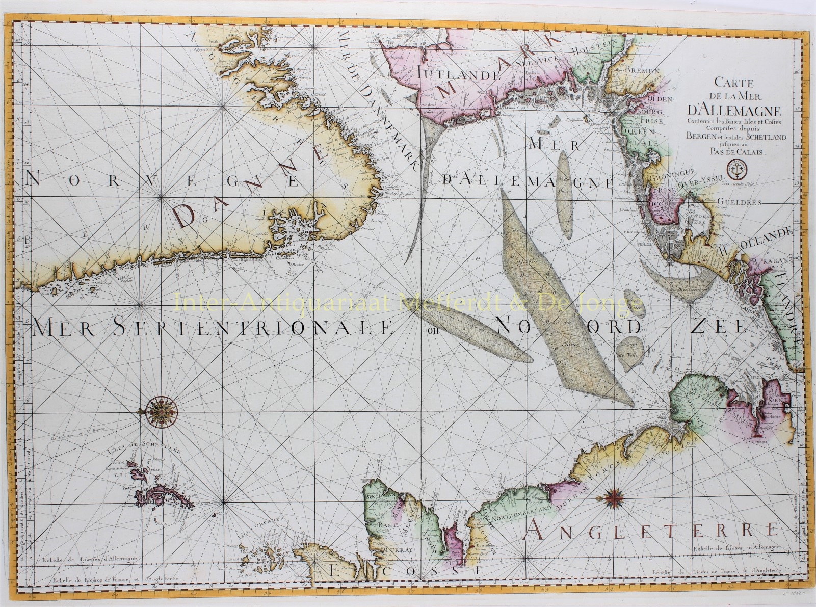
LARGE CHART OF THE NORTH SEA
“Carte De La Mer D’Allemagne Contenant Les Bancs Isles Et Costes Comprises Depuis Bergen Et Les Isles Schetland Jusques Au Pas De Calais” [Map of the German sea containing the shoals, isles and coasts, from Bergen and the Shetland Islands to the Calais passage]. Engraving made from two copper plates for Pieter Mortier‘s sea atlas in 1693, here published around 1770 by Jacques-Nicolas Bellin for the “Dépôt des Cartes et Plans de la Marine“. Coloured by a later hand. Size: 61 x 86 cm.
Nautical chart of the entire North Sea with the adjacent coasts. The topography is limited to the places along the coastline and shows the depths and shallows (dotted sandbanks) in the sea, as well as the various tidal inlets. Compass lines run all over the map. The scales in German, English and French miles are explained in the border at the bottom. In the hinterland, the political boundaries between the different countries and regions are indicated by dots (and colours).
This map was available at the end of the 18th century for “Trente Sols”.
Prijs: Euro 850,-