
Suriname – Alexandre de Lavaux, 1758
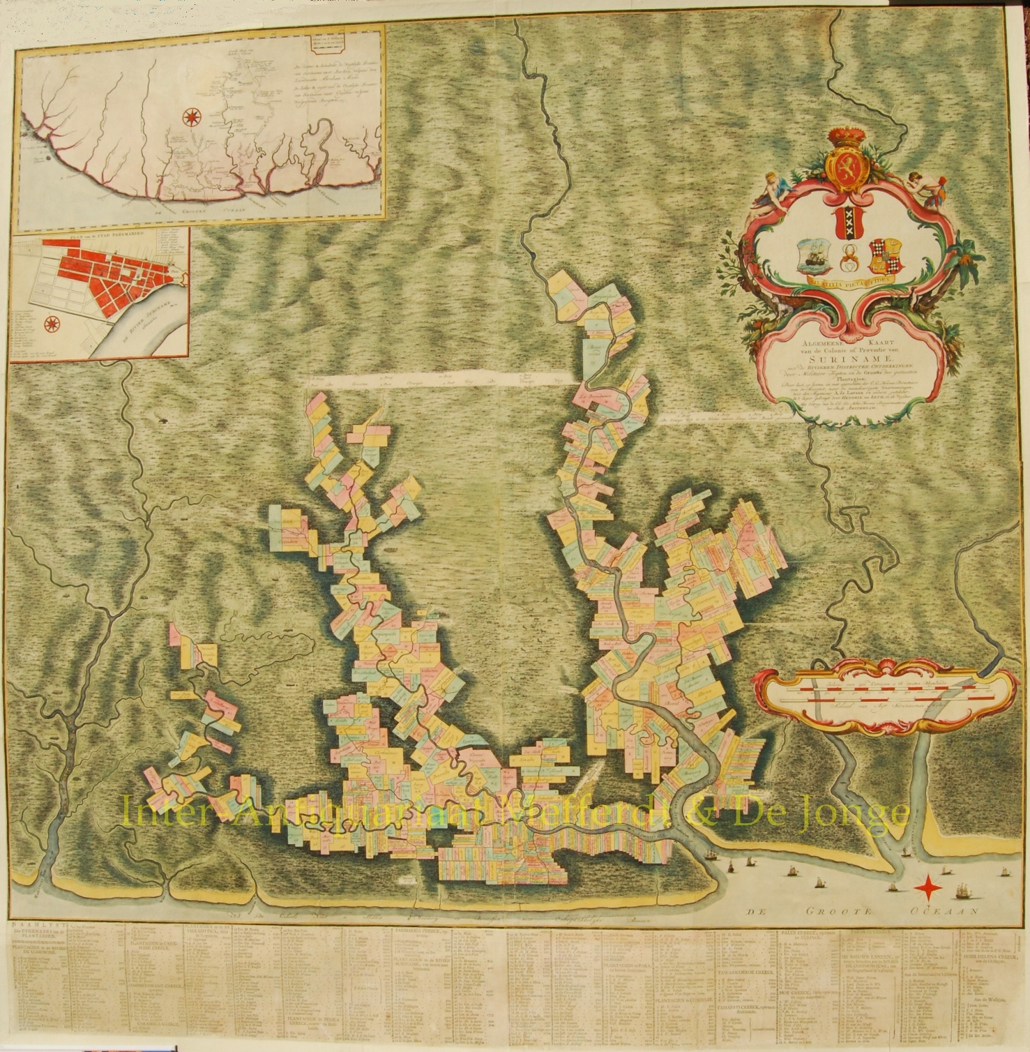
“Algemeene Kaart van de Colonie of Provintie van Suriname met de Rivieren, Districten, Ontdekkingen door Militaire Togten, en de Grootte…
Read more
“Algemeene Kaart van de Colonie of Provintie van Suriname met de Rivieren, Districten, Ontdekkingen door Militaire Togten, en de Grootte der gemeeten Plantagien “. Copper engraving after Alexandre de Lavaux, engraved by Hendrick de Leth, printed on 4 sheets mounted on linen together with letterpress “Naamlyst” below, 3 cartouches, inset map of the Guyanas and inset plan of Paramaribo, together 109 x109 cm., published in Amsterdam c. 1758. Colured by a later hand.
Impressive and very rare map showing all the plantations on the Cottica, Commewijne and Suriname rivers. It is the large, completely new engraved edition of this map, and the largest of the Lavaux maps, with added the “Oranje weg” which was constructed in 1752. The map was to replace older maps that gave insufficient information on the plantations and their situation. Depicted are also several “wegloopersdorpen” in the outbacks on fire, villages in which runaway slaves, the so-called Marrons, of African origin, lived and many of which were burned down by the colonial troops.
Price: SOLD