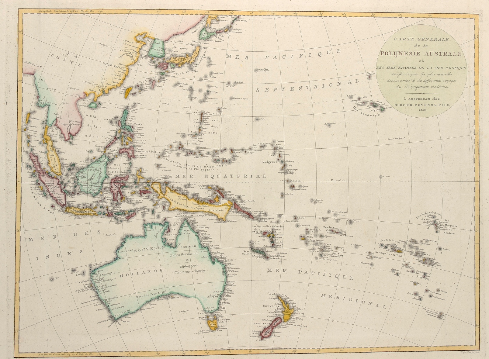
RARE CHART OF THE WESTERN PACIFIC OCEAN
“Carte Generale de la Polijnesie Australe ou des Iles Eparses de la Mer Pacifique… “. Copper engraving published in Amsterdam by Mortier, Covens & Zn. in 1808. Original hand colouring. Size: 44,5 x 60 cm.
This map shows most of East Asia, Southeast Asia, Australia, and the south Pacific islands. Based on Johann Matthias Christoph Reinecke`s 1801 map of the region, which was the first German map to depict Tasmania as a separate island. There are few changes with the Mortier, Covens & sons edition, with the exception of the translation of many place names into French and Dutch.
Australia is divided with the western portion named Nouvelle Hollande (New Holland) and the eastern portion named Nouveau Galles Meridionale ou Sijdnij Cove (New South Wales or Sydney Cove). Numerous place names fill the coasts of Australia, which is depicted with a hypothetical coastline stretching from Western Port to St. Peters Island. Dozens of tiny islands in the Pacific are named, including Hawaii (Iles Sandwich), which appears adjacent to the title cartouche. Several areas still show very early cartography, including Korea shown in a trapezoidal shape, and New Guinea with an elongated shape and a hypothetical northeastern coastline. Engraved by Willem Cornelius van Baarsel, who was only 17 at the time of publication.
Price: SOLD


