

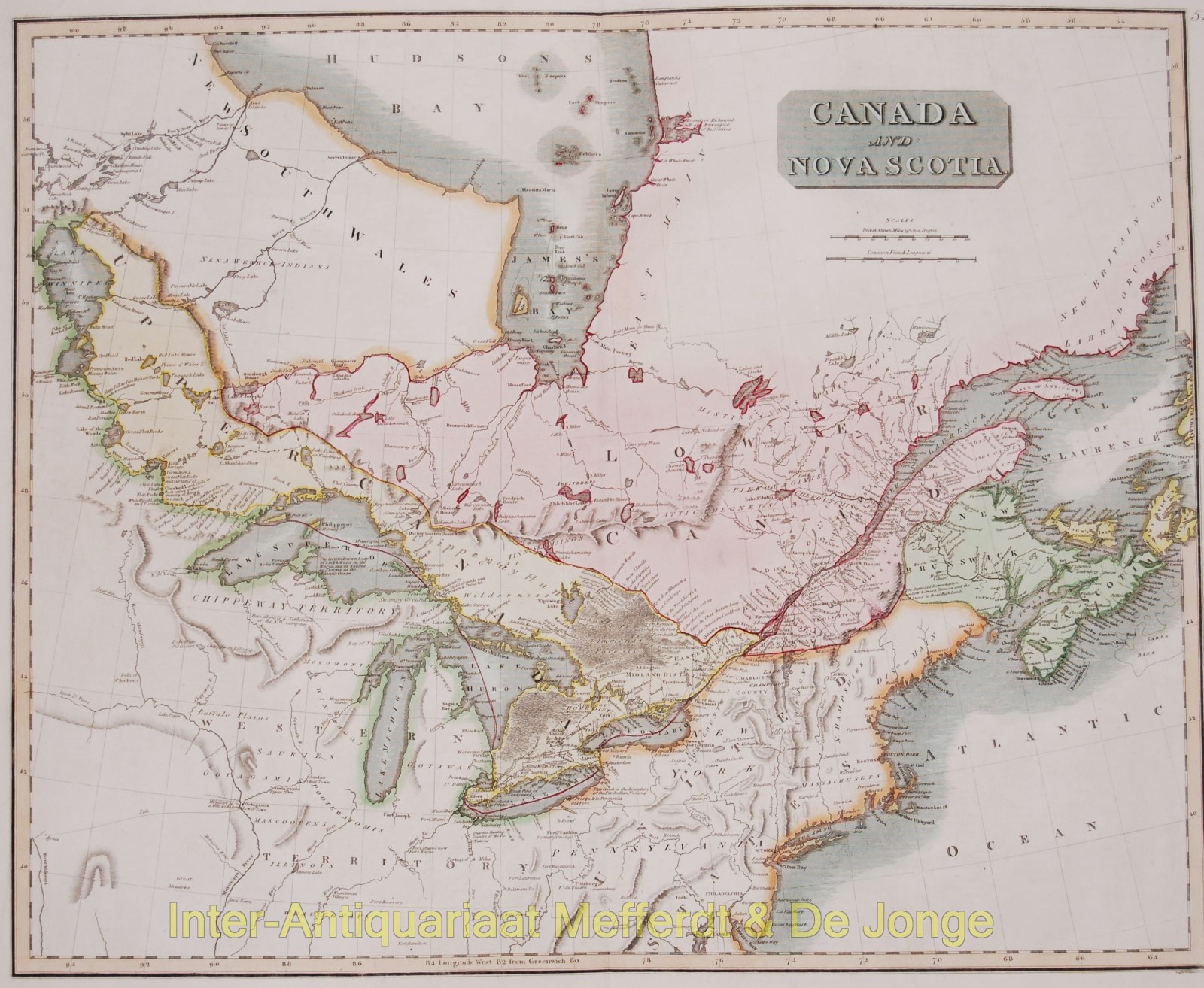
“Canada and Nova Scotia“, engraving published in 1814 in Edinburgh as part of John Thomson’s “New General Atlas”. Original hand colouring. Size: 48,4 x 59,5 cm.
A wonderful map of Canada and Nova Scotia, with countless place names and details not normally encountered on maps of this region. Splendid detail on the Canadian side of the Great lakes, the entire map containing scattered historical and natural history notes and observations. Includes Long Island, Cape Cod, the Great Lakes and Quebec. Toronto is still named York. Various portages are named along the lakes and the St. Lawrence River.
Price: SOLD