

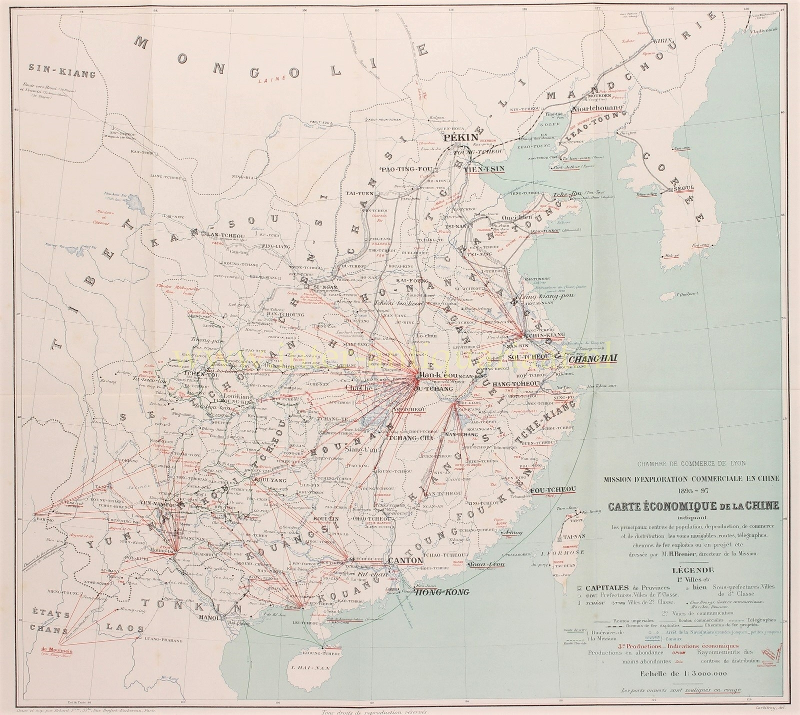
“Carte économique commerciale en Chine 1895-1897.” Lithograph made in 1897 by the Erhard Frères in Paris for the economic exploration mission in China by the Chamber of Commerce of Lyon. Size: 43,5 x 48,5 cm.
China’s economy during end of the 19th century was at a crossroads. The country primarily relied on rice cultivation and silk production. Traditional agricultural practices however, were no longer sufficient to meet the needs of a growing population, and the country was grappling with foreign influence and economic decline. The Qing Dynasty’s attempts at modernization faced numerous challenges, and the unequal treaties and foreign concessions further undermined China’s economic sovereignty. This period foreshadowed the larger economic and political changes that would continue to shape China in the 20th century, eventually leading to the end of the imperial system and the emergence of a modern Chinese state.
The map shows the principal centres of population, production, commerce and distribution, waterways, roads, telegraph lines and railroads. It indicates also the type of production: coal, iron, tin, gold and silver, opium (lots of it), tea, rice, sugar, peanuts, cinnamon, wool, medicinal plants, leather, etc.
Price: SOLD