
Iceland – Willem and Joan Blaeu
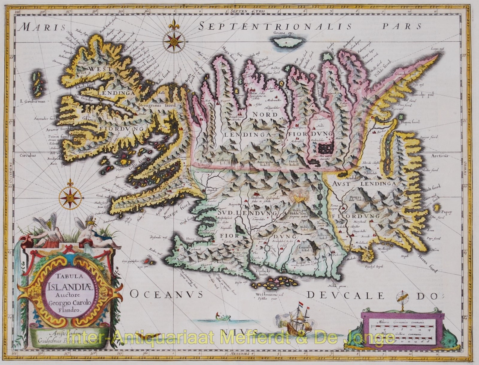
Tabula Islandia Georgeous map, including an erupting volcano, sea monsters, sailing ships, decorative cartouches, compass rose and the spectacular landscape…
Lees verder
Tabula Islandia
Georgeous map, including an erupting volcano, sea monsters, sailing ships, decorative cartouches, compass rose and the spectacular landscape of Iceland.
Published by Blaeu approx. 1645. Willem Janszoon Blaeu based his map on the work of Juris Carolus, a Dutch traveler who probably drew his map in the 1620s. Carolus based his rendering on Iceland Bishop Gudbrandur Thorlaksson’s map, drawn originally in the late sixteenth century. Carolus updated his map and it remained the standard map of Iceland for much of the seventeenth century.
Size 38,5 x 50,5 cm. Verso: French text. Coloured by a later hand.
Price: SOLD