

South Africa, Cape of Good Hope – Jacques-Nicholas Bellin, c. 1750
SOUTH AFRICA AND THE CAPE OF GOOD HOPE
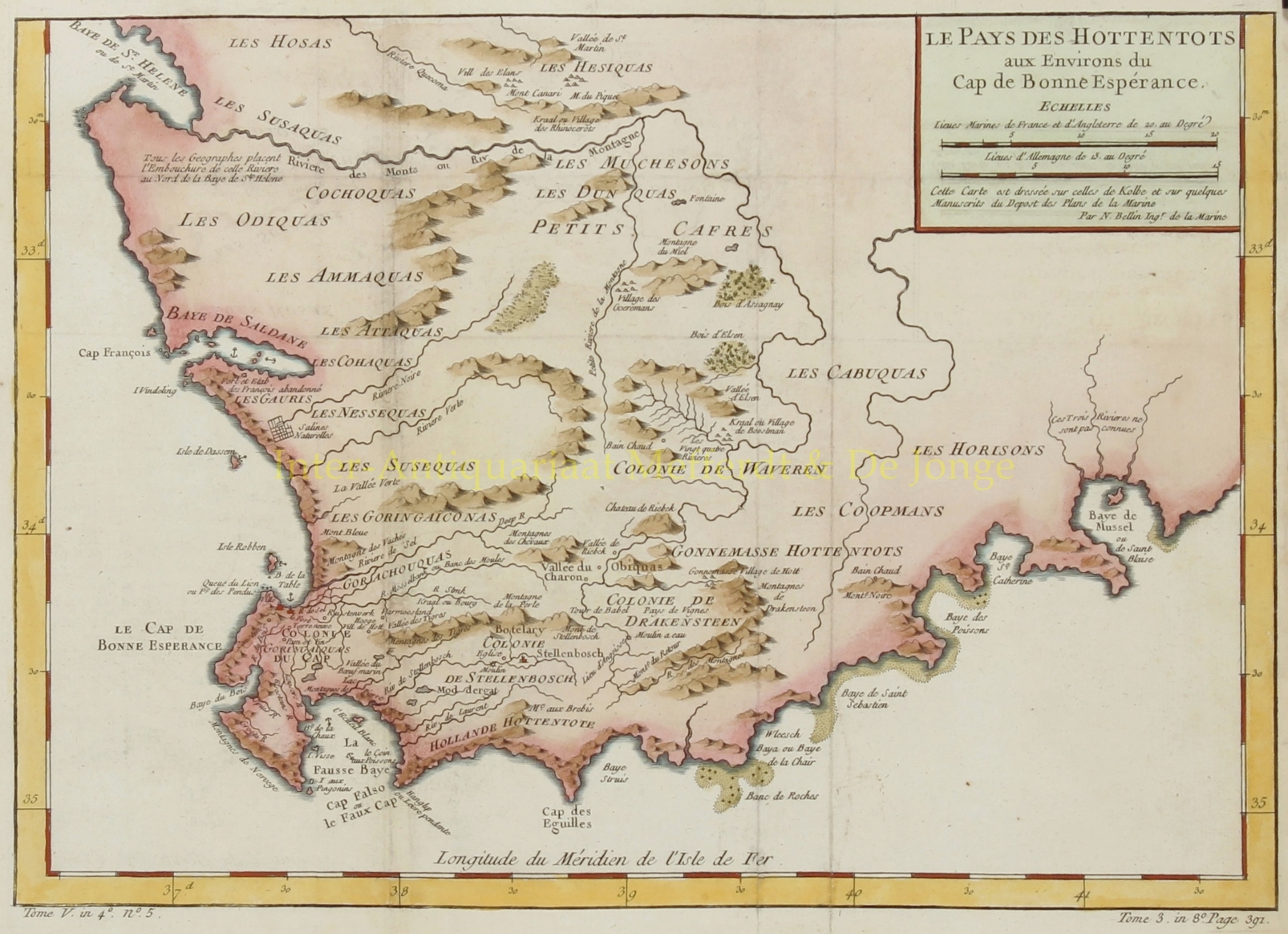
“Le Pays De Hottentots aux Environs du Cap de Bonne Esperance “. Copper engraving made c. 1750 by Jacques-Nicholas Bellin for the “Abrege de l’Histoire generale des voyages“, a small sized atlas that depicts many parts of the known world. Coloured by a later hand. Size: approx. 25 x 35 cm.
Detailed map of South Africa and Cape of Good Hape, from St. Helens Bay and Saldanha Bay in the west to Musssel Bay in the East, centered on the Dutch Hottentot regions and the land of the Kaffirs.
In the late 16th century, Portuguese, French, Danish, Dutch and English ships regularly stopped over in Table Bay en route to the Indies. They traded tobacco, copper and iron with the local Khoikhoi (Hottentots) in exchange for fresh meat. In 1652, Jan van Riebeeck and others of the Dutch East India Company (VOC) were sent to the Cape to establish a way-station for ships travelling to the Dutch East Indies, and the Fort de Goede Hoop (later replaced by the Castle of Good Hope).
Jacques-Nicolas Bellin (1703 – 1772) was one of the most important cartographers of the 18th century. With a career spanning some 50 years, Bellin is best understood as Geographe de Cabinet and transitional mapmaker spanning the gap between 18th and early 19th century cartographic styles. His long career as Hydrographer and Ingénieur Hydrographe at the French Dépôt des cartes et plans de la Marine resulted in hundreds of high quality nautical charts of practically everywhere in the world. A true child of the Enlightenment Era, Bellin’s work focuses on function and accuracy tending in the process to be less decorative than the earlier 17th and 18th century cartographic work. Unlike many of his contemporaries, Bellin was always careful to cite his references and his scholarly corpus consists of over 1400 articles on geography prepared for Diderot’s Encyclopedie. Bellin, despite his extraordinary success, may not have enjoyed his work, which is described as “long, unpleasant, and hard.” In addition to numerous maps and charts published during his lifetime, many of Bellin’s maps were updated (or not) and published posthumously. He was succeeded as Ingénieur Hydrographe by his student, also a prolific and influential cartographer, Rigobert Bonne.
Price: SOLD