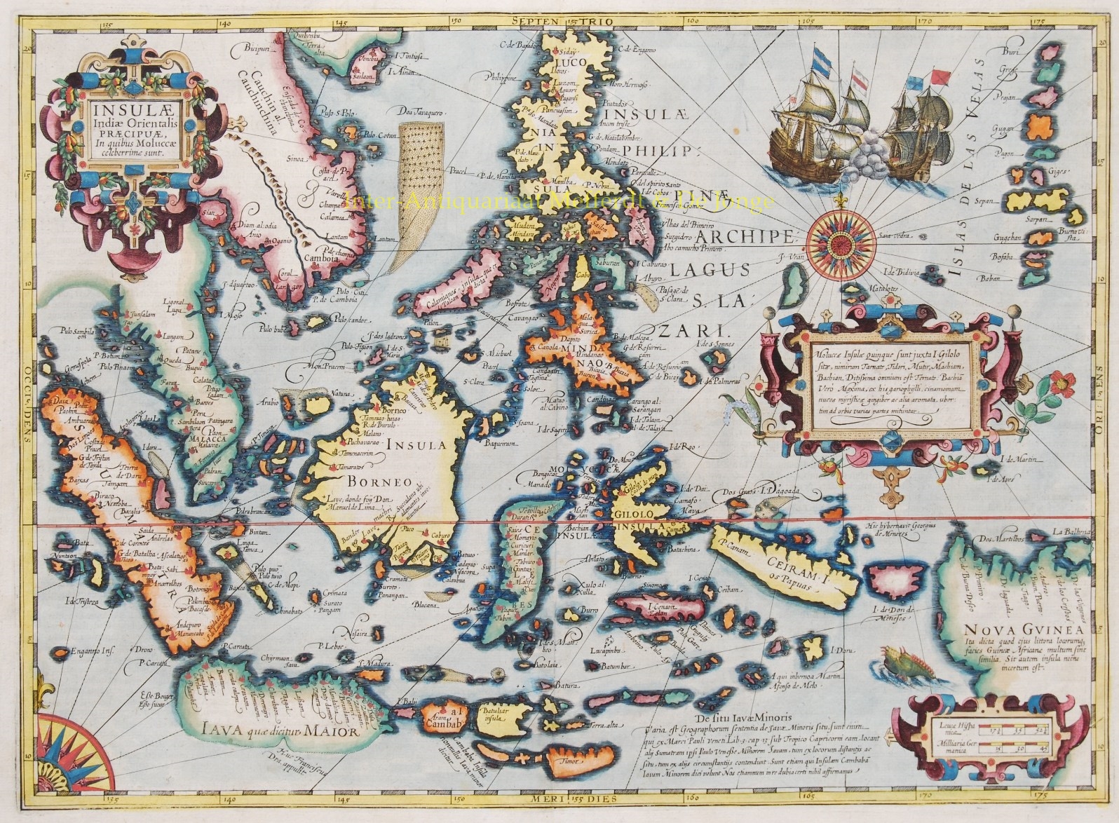
South-East Asia – Gerard Mercator, 1630
DECORATIVE MAP OF THE EAST INDIES “Insulae Indiae Orientalis Praecipuae, In quibus Moluccae celeberrime sunt.” Copper engraving made by Gerard…
Lees verder
DECORATIVE MAP OF THE EAST INDIES
“Insulae Indiae Orientalis Praecipuae, In quibus Moluccae celeberrime sunt.” Copper engraving made by Gerard Mercator published in Amsterdam in 1630 by Jodocus Hondius. Coloured by a later hand. Size: 34,5 x 47,6 cm. Verso: Latin text.
Striking and highly decorative map of the East Indies from the Mercator-Hondius Atlas.
Extends from the Philippines to Timor and Sumatra to New Guinea, detailing the Spice Islands, a region of great importance to seventeenth century Europe, but one about which little was known at the time. Hondius based his map on 16th century portolan charts by Portuguese cartographer Bartolomeu Lasso. Of particular note is the comment Huc Franciscus Dra. Appulit, which appears by the unknown southern coast of Java, representing Drake’s landing during his circumnavigation of the globe in 1577-80.
This map follows very shortly the extension of Dutch control over the islands. In 1602 the Dutch East India Company was formed, and within a couple decades the company came to control the region. Includes three strapwork cartouches, and European ships shown in the midst of battle. Other decorative features include two compass roses, rhumb lines and sea monster.
Hondius was a religious refugee in London from 1583, so it is likely that he became familiar with Drake’s accounts during this time. On his return to Amsterdam he published an enlarged edition of Mercator’s atlas in 1606, in which this map first appeared.
Jodocus Hondius (1563-1612) was the founder of the famous 17th century Dutch map publishing family. Hondius, along with sons Jodocus II and Henricus and son-in-law Jan Jansson, was prominent in Dutch cartography and competed with the emerging Blaeu family map business.
When Jodocus Hondius acquired the copperplates of the Mercator atlas, he prepared this map for inclusion in his Atlas sive Cosmographicae… This map is dated 1630.
Price: SOLD

