

Spice Islands (Moluccas) – Blaeu, c. 1640
THE FIRST LARGE-SCALE, DETAILED MAP OF THE DUTCH-CONTROLLED SPICE ISLANDS
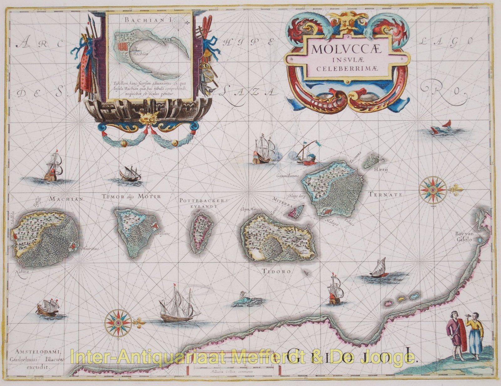
“Moluccae Insulae Celeberrimae” Copper engraving published by Willem Blaeu in Amsterdam c. 1640. With original hand colouring. Size: 49,1 x 37,6 cm.
Superb map of the Spice Islands based on the islands described by Jan Huyghen van Linschoten. This map was the first large-scale map of the region and depicts the islands that provided, first the Portuguese and then the Dutch with a monopoly on the lucrative spice trade. Each of the islands (Makian, Moti, Mare -in Dutch times called “Pottebackers Eyland“, potters’ island, Tidore, Ternate and Hiri) is shown with groves of the prized clove and nutmeg trees and the location of their protective fortresses. Along the bottom of the map we see the coastline of Halmahera (in Dutch times known as Gilolo Island).
Originally by Jodocus Hondius, the plate was purchased by Blaeu in 1629. One of the very decorative cartouches encloses an inset map of Bacan Island. Rhumb lines, calligraphy, two compass roses, various types of sailing ships, and sea monsters further enrich this engaging sheet.
There is a sea battle near Ternate where the Dutch defeated the Portuguese. After the Sultan of Ternate granted the spice concession to the Dutch in 1607 they established a settlement on Bacan in 1609 and rapidly gained control of the Moluccas.
Price: SOLD