BLAEU’S FAMOUS WORLD MAP
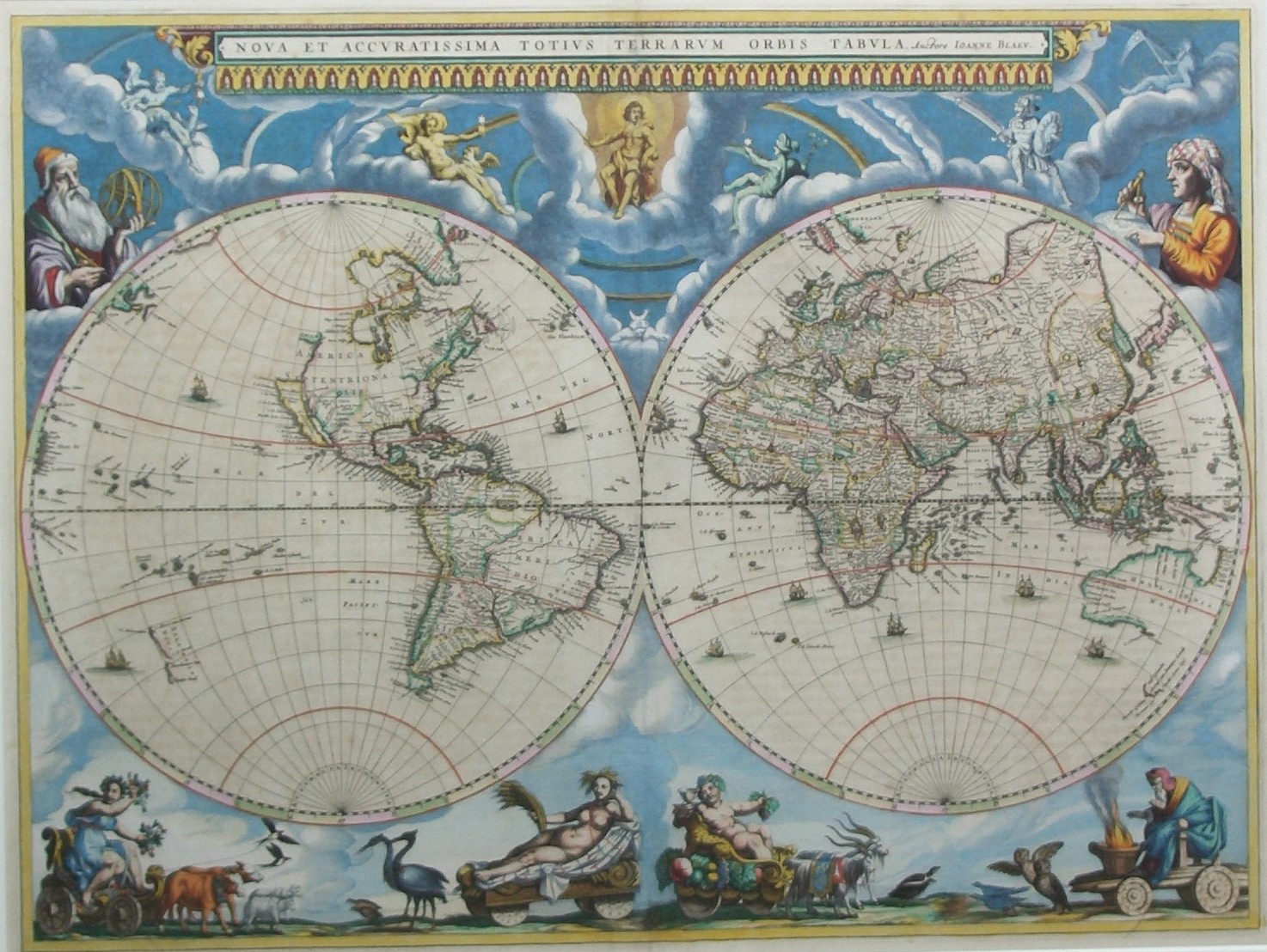
“Nova Et Accuratissima Totius Terrarum Orbis Tabula.” Copper engraving with original hand colouring from the “Atlas Maior” published by Joan Blaeu in Amsterdam, 1662. Size: 40,0 x 54,0 cm (plus margins). Very nice copy.
The last world map to be published under the Blaeu imprint. This map is the spectacular fronticepiece of the great cartographic work of the 17th century, Joan Bleau’s Grand Atlas. Galileo overlooks the Western Hemisphere, Tycho Brahe, the teacher of Joan Bleau’s father, is depicted on the right. On the west of North America is the mysterious ‘Island’ of California.
“This new world map prepared by Joan Blaeu for his eleven-volume Atlas Maior in 1662 is, unlike its predecessor with its marginal city views and native peoples, in two hemispheres. As with all productions by the firm of Blaeu, the engraving and layout and elegance of decoration are of the highest standard.
Outside the twin hemispheres at the top we see the classical gods that personify each planet and Apollo, the Sun. Each planetary deity is portrayed with his astrological attributes: Mercury with flying cap and caduceus; Venus with cupid at her side; Mars armed for battle; Jupiter with thunderbolts; and Saturn brooding and holding a flag of a six pointed star. At the base are four allegorical personifications of the seasons, each on a chariot. All of which place Earth in a larger context and make the map a celebration of the Western European scientific and exploratory achievements.
The fire of 1672 ravaging the Blaeu publishing house, put an end of Blaeu’s production of their Atlas Maior with this particular world map. It is therefore much rarer than Blaeu´s earlier world map in Mercator projection.
Reference: The Mapping of the World, Early Printed World Maps – Rodney Shirley (1984) no. 428, plate 315.
Framed in a tasteful and high quality wooden frame, using protective museum glass.
Price: SOLD


