

Duitsland – Johannes Janssonius, 1626
€3.750
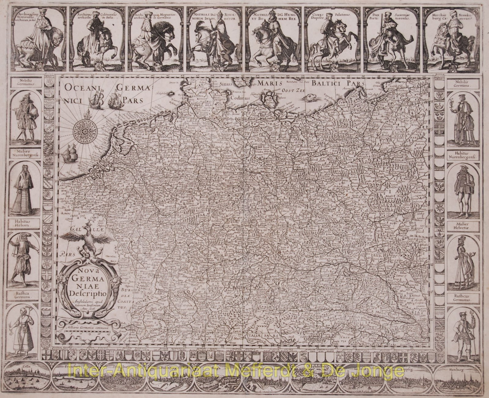
BEAUTIFUL MAP OF GREATER GERMANY
“Nova Germaniae Descriptio” Copper engraving, 2nd state (out of 5) published in 1626 by Johannes Janssonius, originally published by Petrus Kaerius in 1615. Verso: blank. Size: 47 x 57,2 cm.
The map is framed on all sides with decorative borders. The top border contains portaits of Emperor Matthias with the seven Electors, all on horseback. Matthias is shown twice: as emperor and as king of Bohemia and Hungary.
On three sides the map image is framed by shields with coats of arms. Along the bottom border there’s a strip with ten town views in oval frames: Cologne, Frankfurt, Strassbourg, Nurenberg, Prague, Augsburg, Heidellberg, Lübeck and Hamburg. Willem Janszn.’s (Blaeu) map of 1609 served as a model for the town views. Costumed figures flank the coats of arms along the side borders.The coats of arms along the side borders are flanked by costumed figures.
When Petrus Kaerius had to sell his company inventory for family reasons in 1623, the present plate got to his colleague and nephew Joannes Janssonius by marriage. He continued to publish the map as a single-sheet print. In this condition, it also appears as a overview map of Germania in the first editions of the Atlantis Maioris Appendix (1630) and the Theatrum Imperii Germanici (1632).
Literature: Günther Schilder, Monumenta Cartographica VI, 33.2
Price: Euro 3.750,-