ONE OF THE EARLIEST SEA CHARTS OF THE NEW WORLD AND CARIBBEAN
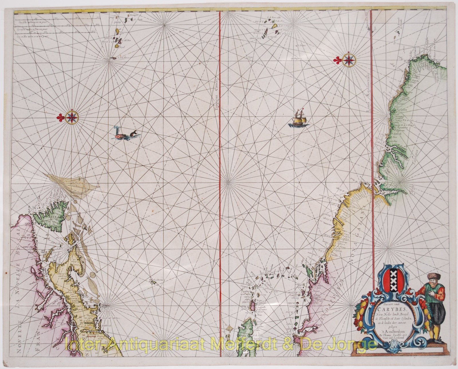
“Pascaert vande Carybes, Nieu Nederlandt, Brazil, de Flaemsche en Soute Eylanden ende landen daer omtrent gelegen.” Copper engraving, seperately published by Theunis Jacobsz Lootsman in Amsterdam around 1650.
This attractive sea chart assumes the perspective of the westward direction facing upwards and embraces the Western Atlantic Ocean from the Canaries and Azores, in the east, to the eastern reaches of the American continents. It features North America from Delaware up to and including Newfoundland, the West Indies from Hispaniola through to the Barbados, and South America from eastern Colombia through to Pernambuco, Brazil.
Cartographically, the depiction of the Mid-Atlantic region, New England and eastern Canada is novel and distinct. The depiction of the American coasts running from the Delaware River to Cape Cod departs from the portrayal commonly used on contemporary Dutch charts that were largely derived from Adriaen Block’s maps of 1614. On the present chart, Long Island is more correctly shown to have an elongated (as opposed to bulbous) form, while Narragansett Bay is shown to correctly open to the south (whereas the Block maps show the mouth of the bay to be sheltered by an island). The Hudson and the Connecticut Rivers are shown to be of exaggerated width, likely as a point of visual emphasis on their utility for inland travel, as opposed to being an accurate depiction of their breadth. Lootsman likely had access to a variety of Dutch sources emanating from the activities of the Dutch West India Company (WIC). As a result of its control of the colony of New Netherlands, the WIC controlled the region extending roughly from modern Delaware to Connecticut, holdings which they would maintain until the English conquest of New Amsterdam (New York) in 1664.
The depiction of the eastern Caribbean is relatively conventional for the time, and shows the WIC’s direct experience in the region, having recently settled a number of islands, including Curaçao and Saint Martin. The coasts of South America prominently feature the mouths of the Amazon and Orinoco rivers. The mapping of Northeastern Brazil is derived from WIC maps disseminated by Caspar Barlaeus during the recent Dutch hegemony over the region.
Theunisz’s chart was published in response to the commercial success of Willem Blaeu’s West Indischen Pasckaert, as a means of offering the same map in sheets, which could also be bound into an atlas. Theunisz’ map was the progenitor of an entire series of maps which covered the same region.
Price: Euro 1.450,- (excl VAT/BTW)


