

INDONESIA NAUTICAL CHART
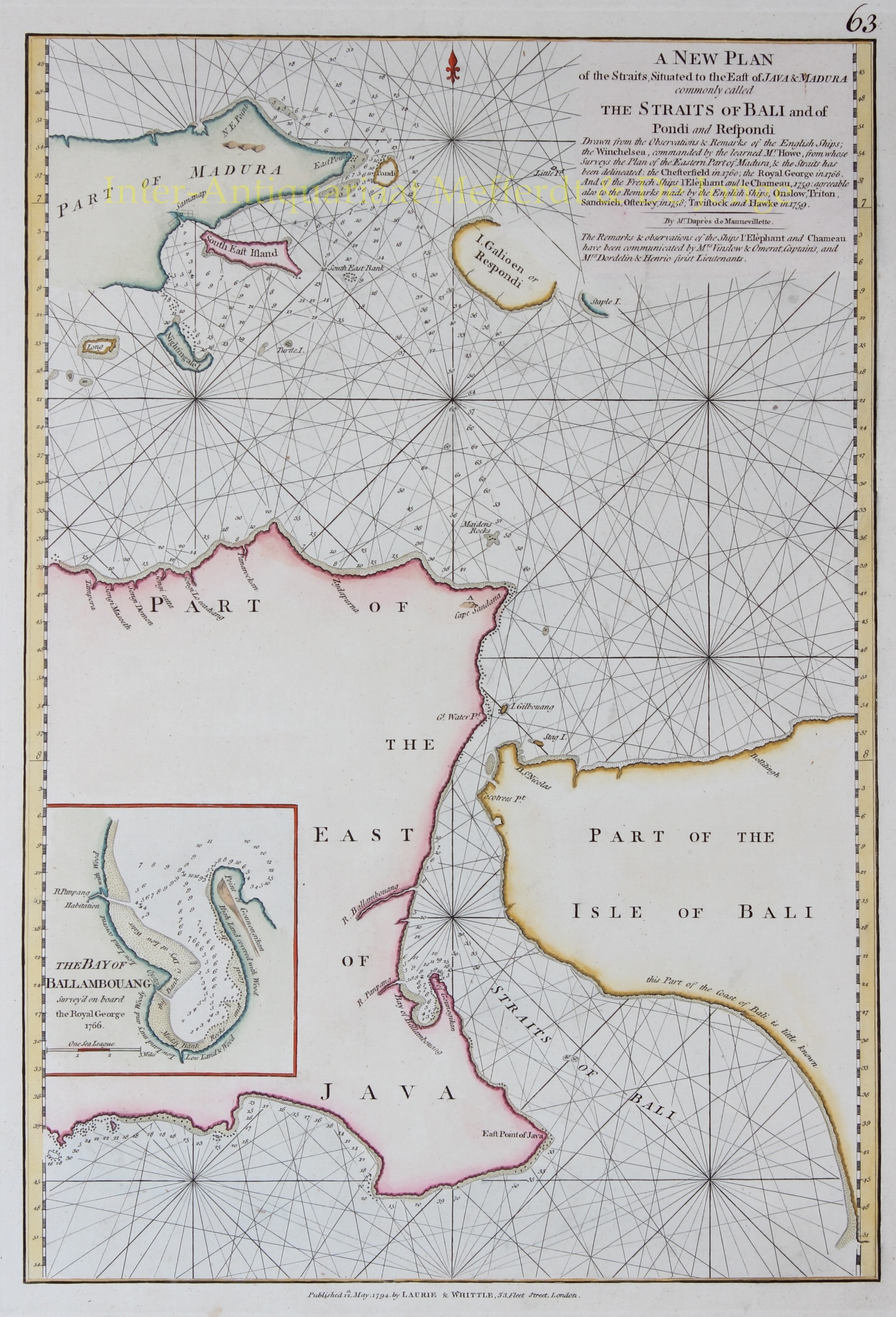
“A New Plan of the Straits Situated to the East of Java & Madura commonly called The Straits of Bali and of Pondi and Respondi.” Copper engraving from “The East-India Pilot, or Oriental Navigator” published in London by Robert Laurie and James Whittle in 1794. Coloured by a later hand. Size approx. 35, 6 x 50,8 cm.
Nautical chart of the Strait of Bali, Indonesia, from Java’s eastern extension to include the western half of Bali and the islands of Madura and Respondi (Sapudi). An inset near the left border details Java’s Bay of Ballambouang. Java was a major producer of rice during the colonial era. Madura and most of Java was under the influence of the Dutch during this period.
The map offers rich detail including countless depth soundings, notes on the sea floor, commentary on reefs, rhumb lines, shoals, coastal features, place names and a wealth of other practical information for the mariner. Cartographically this chart is derived from earlier maps prepared for Jean-Baptiste d’Apres de Mannevillette’s 1745 Neptune Oriental. De Manevillette based his chart, as noted under the title, on “observations and remarks of the English Ships; the Winchelsea, commanded by the learned Mr. Howe, from whose surveys the Plan of the Eastern Part of Madura, and the Straits has been delineated; the Chesterfield in 1760; the Royal George in 1766; and of the French Ships, l’Elephant, and le Chameau, 1759: agreeable also with the remarks made by the English Ships, Onslow, Triton, Sandwich, Osterley, in 1758; Tavistock and Hawke in 1759”.
Price: Euro975,- (excl. VAT/BTW)