

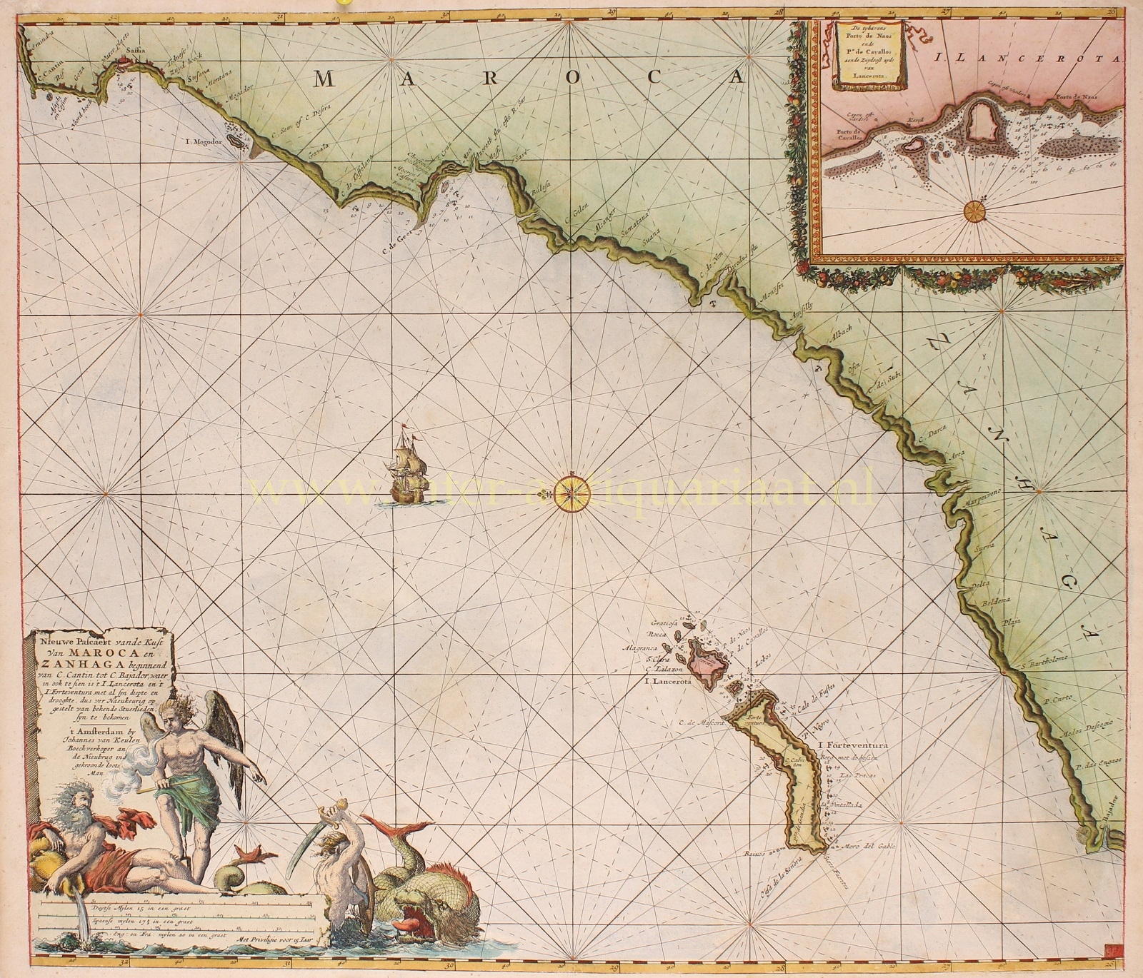

OFF THE NORTHWESTERN AFRICAN COAST, LANZAROTE AND FUERTEVENTURA
“Nieuwe Pascaert vande Kust van Maroca en Zanhaga…”. Copper plate engraving published by Johannes van Keulen in 1682. Coloured by a later hand. Size (plate): 51,2 x 58,7 cm.
Beautifully rendered sea chart with north oriented to the left. Showing the African northwestern coast from Cape Cantin (today’s Cape Beddouza) in Morocco to Cape Bojador in Western Sahara, including the Canary Islands of Lanzarote and Fuerteventura. With an inset plan of the harbours of Naos and Cavallos on Lanzarote.
The discovery of a passable route around Cape Bojador by the Portuguese, was considered a major breakthrough for European explorers and traders en route to Africa and later to India. The disappearance of numerous European vessels that had made prior attempts to round the Cape despite its violent seas, led to suggest the presence of sea monsters.
The main concern lies in the changes in winds that occur at about the point at which Cape Bojador is passed in sailing down the coast. It is here that the winds start to blow strongly from the northeast at all seasons. Together with the half-knot set of current down the coast, these conditions would naturally alarm a 16th/17th century mariner used to sailing close to the land and having no knowledge of what lay ahead.
In the end it was discovered that by sailing well out to sea—far out of sight of land—a more favorable wind could be picked up.
This nautical map with its rhumb lines, a compass rose, depths and nicely detailed banks was intended to help sailors survive what is dramatically depicted in the cartouche: Neptune (god of the sea), Boreas (god of the north wind) and a battle with a sea monster…
Price: SOLD