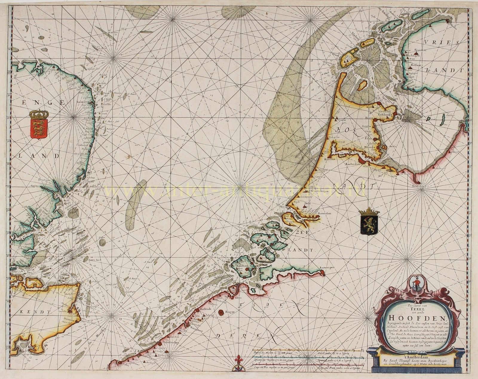
North Sea – Jacob Theunis Lootsman, 1681
€1.250
17TH CENTURY CHART OF THE NORTH SEA
“Pas Caerte van Texel tot aende Hoofden…” Copper engraving published in 1681 by Jacob Theunis Lootsman II “bookseller and nautical instrument maker”. The map was part of the “Nieuwe Water-Werelt ofte Zee-Atlas”. Coloured by a later (?) hand. Size: 42.5 x 53.5 cm.
Charts like this were used for sea navigation in the 17th century. They allowed sailors to determine their course and measure distances traveled. The charts showed a topographical representation of coastlines, rivers, and islands and were equipped with a network of compass lines or rhumb lines. They also indicated anchorages, shallows, sandbanks, buoys, and sailing instructions, aiding sailors on their way.
Here we see the North Sea from island Texel to the Hoofden (Strait of Dover), including the coasts of Friesland, Holland, Zeeland, Flanders, and the east coast of England. One can read how to navigate from all ports and passages, such as the Vlie, the Marsdiep near Texel, the Meuse, the sea inlet of Goeree, the Veerse Gat, and all Zeeland passages, to the mouth of the Thames, and how to easily enter these passages from the sea.
The Lootsman firm (founded by Jacob Theunis Lootsman I) was a thriving business in maritime cartography in 17th century Amsterdam. They specialized in pilot books of European coastal waters but also published a sea atlas of the world.
Literature: C. Koeman “Atlantes Neerlandici” IV, Jac 6
Price: Euro 1.250,-


