

Scotland – Nicolaes Visscher, c. 1680
€750


THE KINGDOM OF SCOTLAND
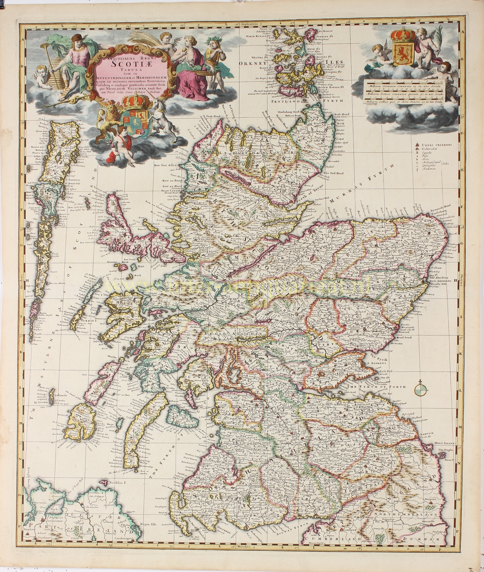
“Exactissima Regni Scotiae Tabula tam in Septentrionalem et Meridionalem quam in Minores Earumdem Provincias…” [Most accurate map of the Kingdom of Scotland, both of its northern and southern parts, as well as of its smaller provinces.] Copper engraving published by Nicolaes Visscher around 1680. With beautiful original hand colouring, heightened with gold. Size: 57.2 × 48.0 cm.
This finely executed map depicts the Kingdom of Scotland in its entirety, divided into northern and southern provinces, richly detailed with cities, towns, rivers, lakes, and coastlines. The islands of the Hebrides (here called the “Westerne Iles of Scotland”), Orkney, and Shetland are also clearly shown. In the upper left corner a baroque cartouche appears with the royal arms of Scotland, surrounded by allegorical figures such as Mercury, god of commerce, and Ceres, goddess of the harvest, while in the upper right the crowned shield of the arms of Scotland is displayed.
The map was issued by the Amsterdam publisher Nicolaes Visscher II (1649–1702), heir to an important dynasty of mapmakers. Amsterdam was at this time the center of European cartography, supplying the entire continent with accurate, richly decorated maps.
Around 1680 Scotland was still in a politically and religiously turbulent period. Since 1603 it had been in personal union with England under a single monarch (the so-called Union of the Crowns), but it retained its own parliament and church structure. The decade was marked by tensions between Presbyterians and Anglicans, with violent repression of conventicle attendance during the so-called Killing Times. Economically, Scotland lagged behind England and the Dutch Republic, yet ports such as Edinburgh, Glasgow, and Aberdeen maintained lively trade contacts with the Low Countries.
Maps like this served above all as prestige objects for the elite and as instruments of knowledge and power. Visscher’s Exactissima Regni Scotiae Tabula reflects both the political independence of seventeenth-century Scotland and the international role of Amsterdam cartography.
Price: Euro 750,-