

Terschelling – Van der Burgt + Ydo, ca. 1949
€475
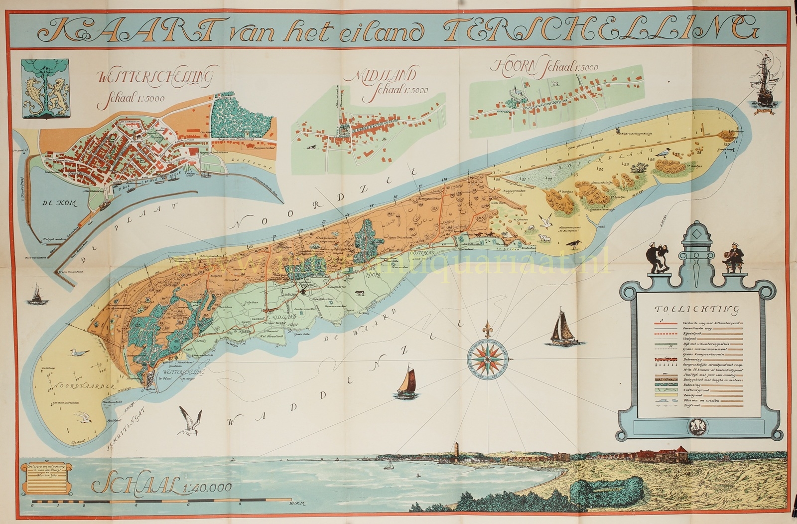


“Kaart van het eiland Terschelling” [Map of the Island of Terschelling], with inset maps of West-Terschelling, Midsland and Hoorn. Colour lithograph made by C. van der Burgt and Wouter Ydo and published around 1949 by Jeen de Vos and J. Cupido. Size: 45 × 74 cm.
The map offers a detailed yet narrative portrayal of the island in the first years after the Second World War.
The line of dunes along the northern side of the island forms a protective belt along the North Sea coast, while to the south the salt marshes and accreted tidal flats, with a few embanked areas along the Wadden Sea, are shown. Below the island appears the bay of West Terschelling, with the Brandaris lighthouse prominently depicted.
The map incorporates both decorative and educational elements. A finely executed compass rose, sailing vessels at sea, birds above beach and tidal flats, and small illustrations of dune landscapes reinforce the image of Terschelling as a maritime, nature-driven island.
The clear colours and the use of decorative lettering reflect post-war optimism and a growing interest in regional identity, recreation and landscape, in which islands such as Terschelling were increasingly regarded as destinations for nature appreciation and tourism.
Price: Euro 475,-