

‘s-Hertogenbosch – Willem en Joan Blaeu, 1634-1635
€1.250
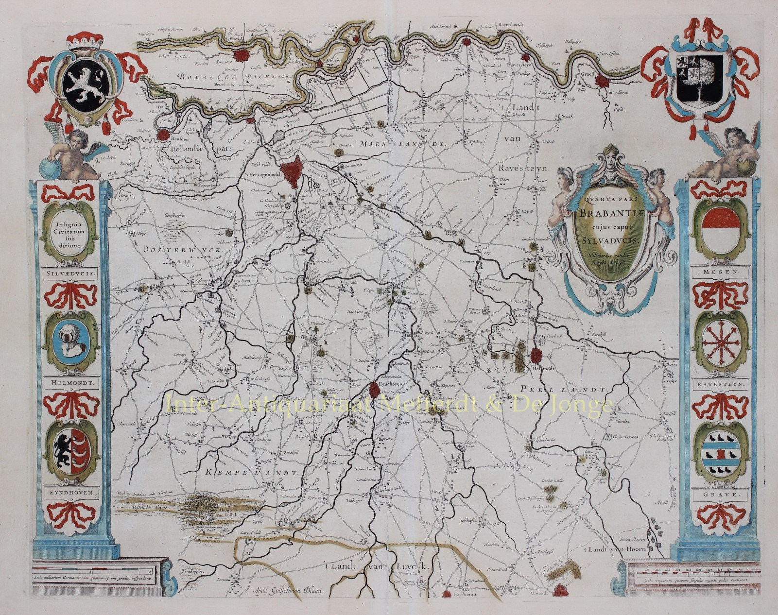

FAMOUS ARMORIAL MAP OF THE MEIERIJ OF ’S-HERTOGENBOSCH
“Quarta Pars Brabantiae cujus caput Sylvaducis” [The fourth part of Brabant, whose capital is ’s-Hertogenbosch], copper engraving of the eastern part of North Brabant, centered on Den Bosch and Eindhoven, published in Amsterdam by Willem and Joan Blaeu as part of “Le Theatre du Monde ou Nouvel Atlas“, 1634–1635. With original hand colouring. Size: 41.5 × 52 cm.
This so-called “armorial map” of the Meierij of ’s-Hertogenbosch, created by Willebordus van der Burght, is one of the most admired maps in the Blaeu atlases for its decorative coats of arms and accurate topographical detail.
In addition to the coats of arms of Brabant and ’s-Hertogenbosch (featuring two Brabant and two Limburg lions) at the top, the map also displays the arms of Helmond, Eindhoven, the County of Megen, the Land of Ravenstein, and Grave.
Price: Euro 1.250,- (incl. frame)