

Brabant – Willem Blaeu, ca. 1650
€375
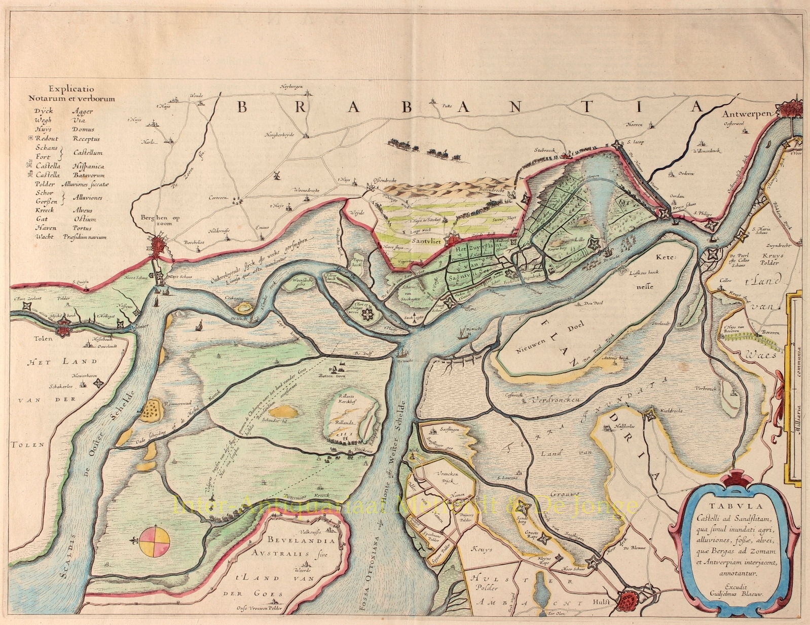
BLOCKADE OF THE SCHELDT
“Tabula Castelli ad Sandflitam qua simul inundati, agri, alluviones, fosse, alvei, quae Bergas ad Zomam et Antverpiam interjacent annotantur.” [Map of the Fort near Zandvliet, showing at the same time the inundated lands, floodplains, ditches, and channels lying between Bergen op Zoom and Antwerp.] Copper engraving published ca. 1650 by Willem Blaeu. Original hand colouring. Size approx. 38 × 50 cm.
Detailed map of the inundated areas and fortifications constructed to control toll collection on the Scheldt River leading to Antwerp (after the Twelve Years’ Truce, 1609–1621), covering the stretch from Zandvliet to the mainland of eastern South Beveland near Waarde.
All redoubts and forts held by the Spanish are marked with flags bearing a cross (Zantvliet, Ossendrecht, etc.), while Dutch flags fly over the others. Dutch guard ships are shown stationed in both the Eastern and Western Scheldt. The Spanish escape route over land is indicated by a dotted line.
The east is oriented at the top. At the upper edge, a blank panel spans the full width of the map. The title and publisher’s imprint appear within a simple Baroque cartouche. A legend is placed in the upper left corner, and a compass rose is shown west of Reimerswaal.
Price: Euro 375,-