

Friesland and Groningen – Abraham Ortelius, 1603
€650


16TH CENTURY FRIESLAND AND THE WAY THEY IMAGINED IT MUST HAVE LOOKED IN ROMAN TIMES
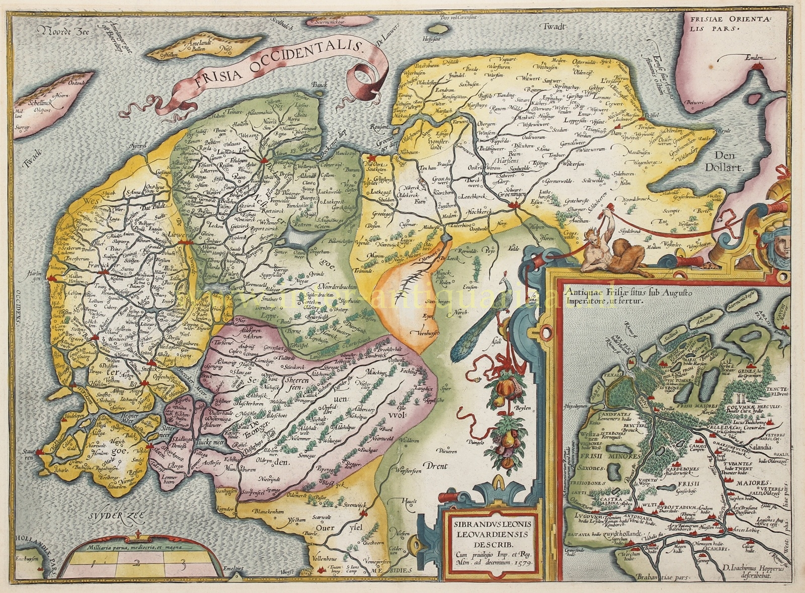
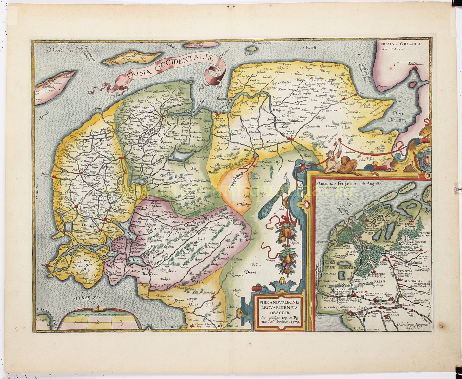
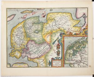
“Frisia Occidentalis”, copper engraving made after the design by Sibrandus Leo of Leeuwarden, first published by Abraham Ortelius in Antwerp in 1579, here in a 1603 edition. Hand-coloured at the time. Size: 36.8 × 50 cm. Verso: Latin text.
We see Friesland and Groningen, with an inset map of “ancient Friesland as it would have looked under Emperor Augustus.” In those days, the territory of the Frisii stretched between the Old Rhine at Katwijk and the River Ems, surrounding large lakes. These were the Flevo lakes, which lay where today the IJsselmeer polders are, and northwest of that, between Stavoren and Enkhuizen.
Between Katwijk aan Zee and Noordwijk aan Zee stood the Huis te Britten, a Roman fortress. It is very likely the site of the westernmost fort of the Roman limes (frontier line). It is named on the inset map. We also see the ‘Pillars of Hercules’, a dolmen with stones so large they could not have been brought there by human hands.
In Ortelius’ time, atlases as we know them today did not yet exist. There were loose nautical charts and custom-assembled atlases made to order. These were usually composed of maps of varying sizes and scales.
Ortelius probably got the suggestion from the cartographer Gerard Mercator to collect and spread geographic knowledge and maps of the entire world from various sources to a broad audience. This gave rise to the idea of a ‘modern’ atlas: a collection of maps bound together in a book, all of uniform size and scale, specially engraved (or re-engraved) on copper plates for the publication. The publisher would issue the book in multiple copies, which was also something new.
Producing the atlas was a major undertaking. For the first edition, Ortelius gathered the best materials he knew. He redrew all 53 maps himself to a standard format and added descriptions of the countries and places. Finally, he included references to the original sources of each map — something quite unusual in the sixteenth century. Every mapmaker reused copperplates from predecessors, but they rarely acknowledged their sources.
Once the maps were drawn, Ortelius had them engraved onto copper plates by Frans Hogenberg and his assistants Ambrosius and Ferdinand Aertsen. Gillis Coppens van Diets handled the printing. The atlas was named “Theatrum Orbis Terrarum”, or Theatre of the World. The first edition appeared in 1570, in Latin.
In 1571, the first Dutch edition was published. Notably, the texts were not directly translated from the Latin but were specially written for a general, non-scholarly audience. For example, Ortelius writes that The Hague is the best village in Europe, and that its residents prefer to live in the best village rather than turn it into a city like so many others, with walls and fortifications.
Ortelius’ atlas was an immediate success. Although such an atlas was quite an investment for a buyer — especially with hand-coloured maps — there were plenty of wealthy citizens eager to expand their knowledge of the world. The first edition quickly sold out. Ortelius decided to produce new editions with more maps. Translations soon appeared in German, French, Spanish, and later in English and Italian. These later editions, from 1579 onward, were produced by the famous Antwerp printer Christoffel Plantin.
Literature: Marcel van den Broecke (2011), “Ortelius Atlas Maps – An illustrated Guide”, nr. Ort81
Price: Euro 650,-