

Groningen – Theodorus Beckeringh, 1849 (1784)
€11.000
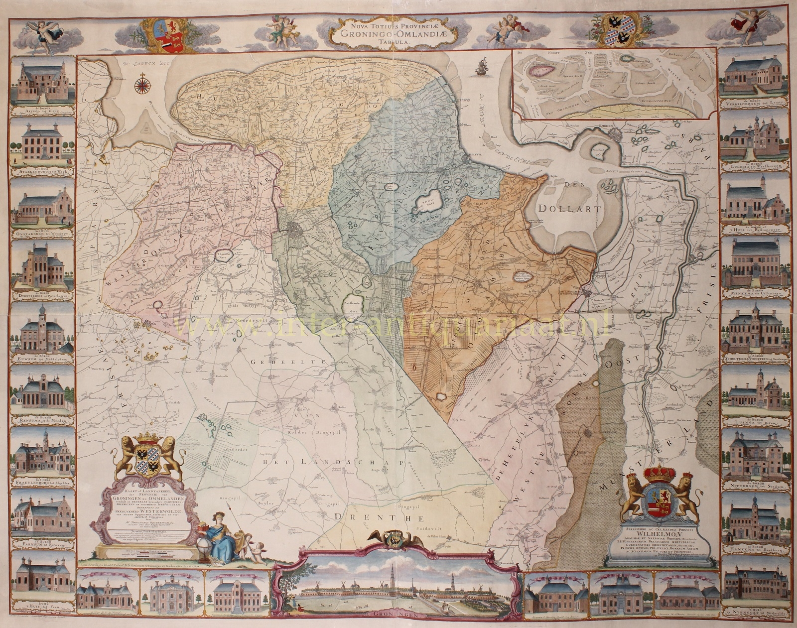

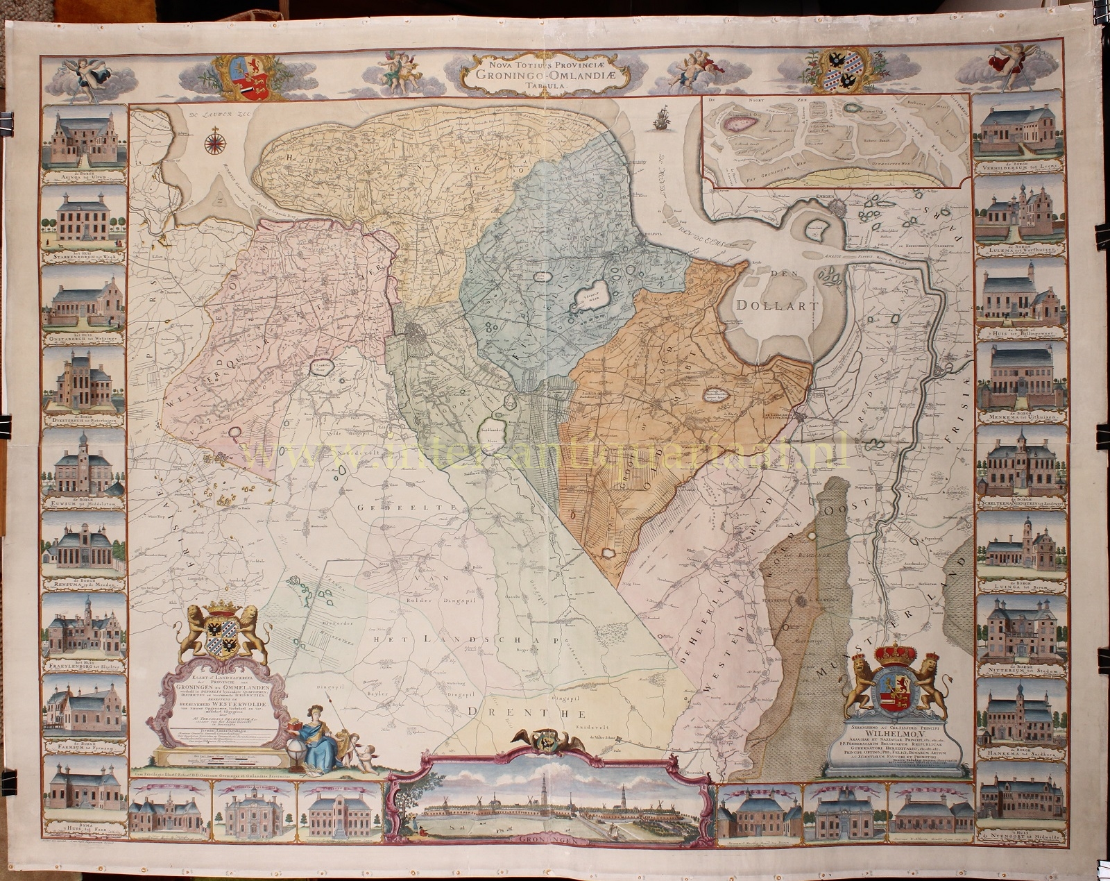
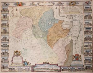
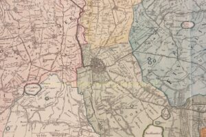

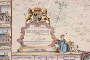
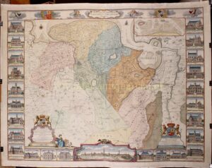
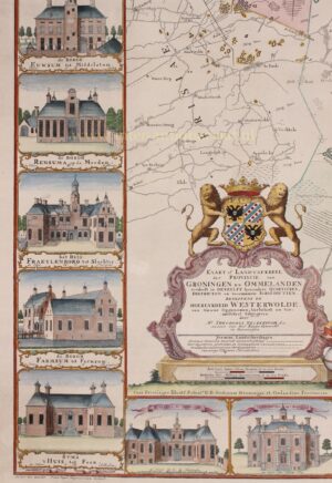
BECKERINGH MAP OF GRONINGEN – The most extensive and detailed map of the province of Groningen in the 18th century. The so-called “Groninger Borgenkaart.”
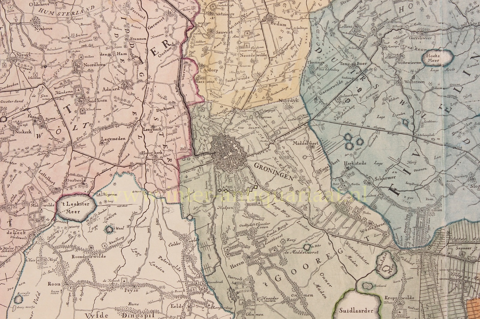
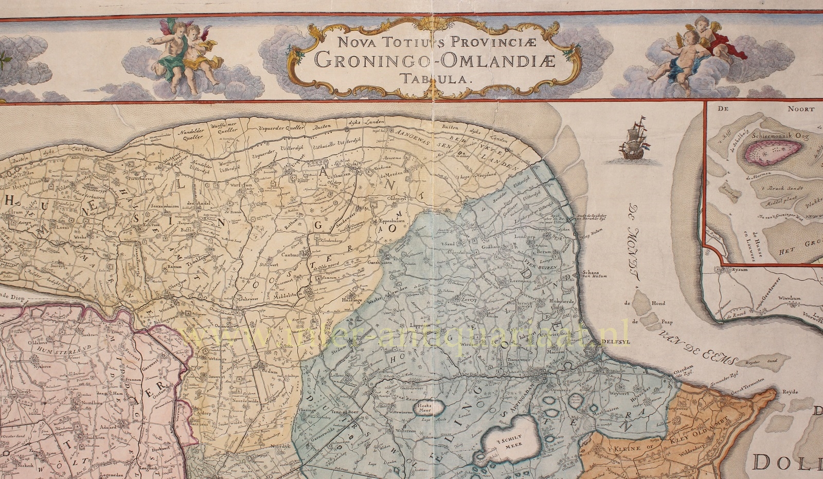
“Nova Totius Provinciae Groningo-Omlandiae Tabula“, “Map or Land Tableau of the Province of Groningen and the Ommelanden, divided into its particular quarters, districts, and principal jurisdictions, together with the Lordship of Westerwolde. Newly surveyed, improved, and enlarged. Published by Theodorus Beckeringh, Assessor of the Court Martial in Groningen.” Engraving printed from four copper plates, made in 1777 and first published in 1784. The present example is probably a second (unchanged) edition printed by Jan Oomkens III in 1849. Coloured by a later hand. Size approx. 104 × 135 cm.
On 8 November 1777, the States of the City and Ommelanden of Groningen discussed a petition submitted by Theodorus Beckeringh (1712–1790). In it, the petitioner asked for financial support for the printing and publication of the map he had created. Theodorus was not, by training, a cartographer but a jurist, yet he requested from the deputies a 25-year privilege (copyright) and a subsidy to help defray the high costs. The Gentlemen Deputies were receptive to this private initiative and requested advice from the Chamber of Accounts. It took two years before the matter progressed.
Eventually, the Deputies received the recommendation to grant Beckeringh a subsidy of 7,000 Carolus guilders and a 15-year privilege. They found this sum somewhat excessive and instead awarded him 1,000 gold ducats — equivalent to 5,000 Carolus guilders — and a 15-year privilege. He would receive this amount once a sufficient number of copies had been printed and were available for sale, and after the Deputies had each received a fine “coloured” copy of the map.
Archival evidence shows that Beckeringh carried out the surveying of the province himself. The practice of amateur land surveying was not uncommon in the 18th century. One could acquire the necessary skills by apprenticing with a master or by consulting manuals on land surveying. In its lettering and style, Beckeringh’s map still has a 17th-century character. To produce the map, Beckeringh travelled throughout the province of Groningen, though his measurements and observations were not always accurate. He also relied on various old sketch maps. This becomes especially clear when his map is compared with contemporary maps by professional surveyors. It is quite possible that Beckeringh used an outdated textbook. His measurements were not very precise—on average, he was about 2.5 km off. The strength of the map therefore lies not in its accuracy, but in its faithful representation of the provincial boundaries with Friesland, Drenthe, and Germany.
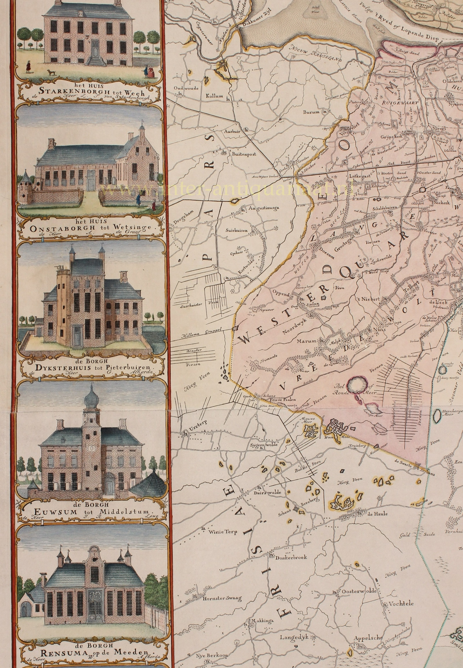
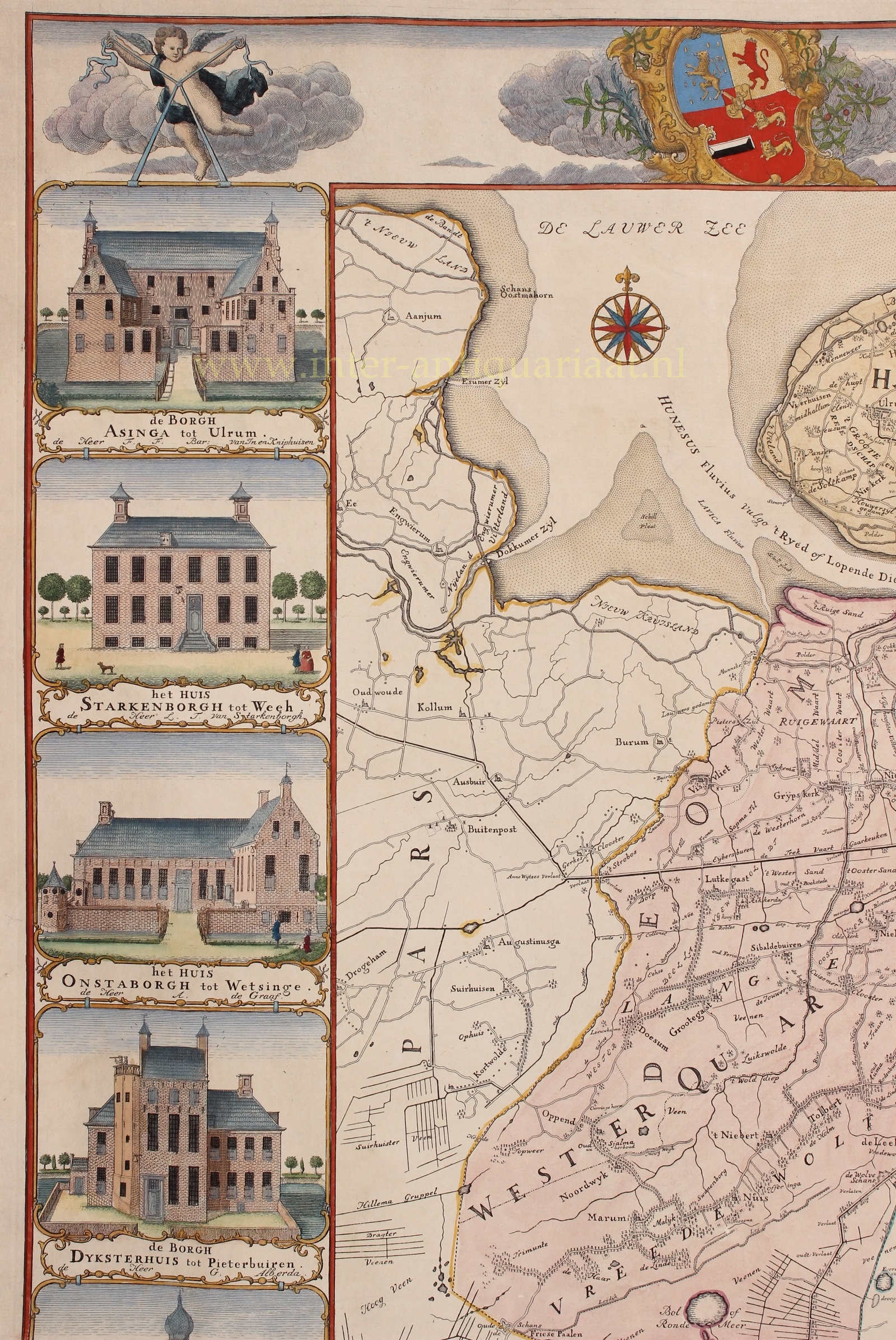
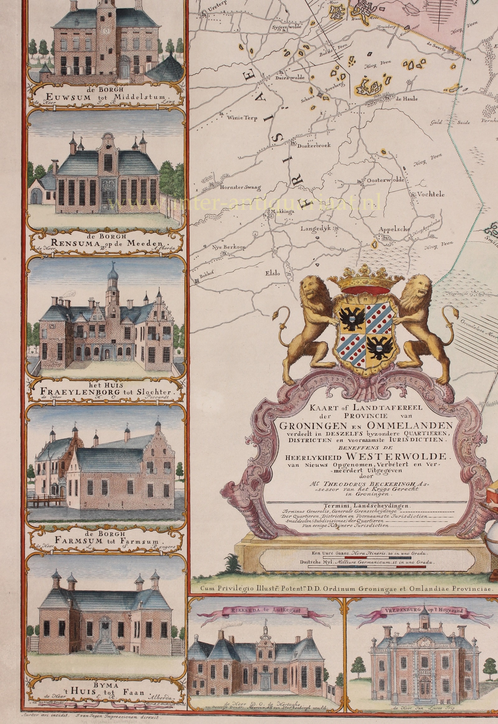
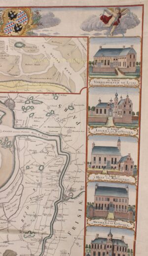
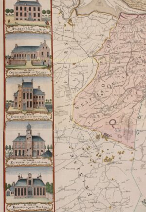
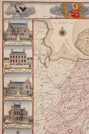
A large number of preparatory drawings and proofs for Beckeringh’s map have survived, particularly his studies of the borgen (manor houses), which form an especially interesting group. The idea of adorning a provincial map with such a decorative border was borrowed from the map by the brothers Coenders van Helpen, circa 1678 (see our website). The project sparked some debate in the Provincial States. From the preparatory sketches, it is clear that Beckeringh was not a gifted draftsman—the quality of his sketches is rather modest—but he reworked them at home at his drawing table, using a straightedge to create neat pen drawings. Archival sources indicate that Beckeringh engraved the map himself. This is also stated on the map: “Auctor aeri incidit, J. van Jagen impressionem drext” (“The author engraved the plate, J. van Jagen printed the impression”).
Beckeringh completed his work in 1777; seven years later, in 1784, the map was published. It was printed on four separate sheets forming one large whole, intended as a wall map.
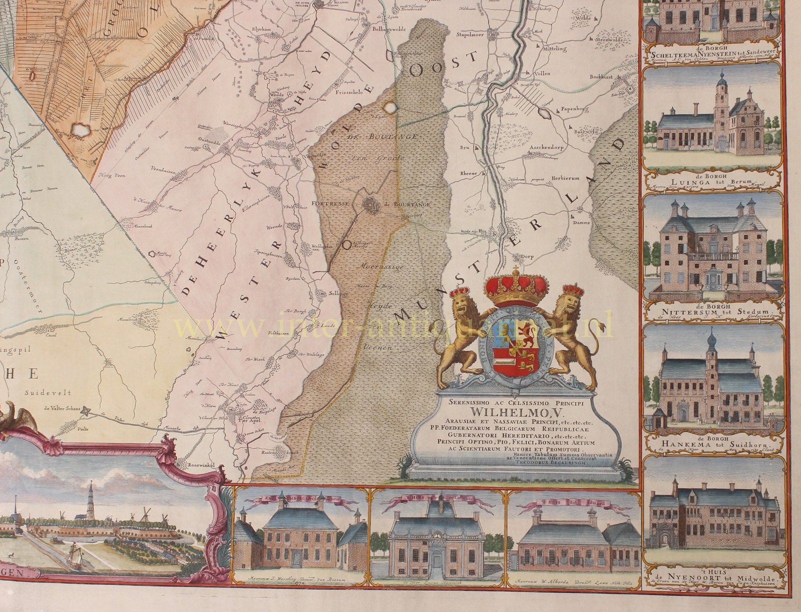
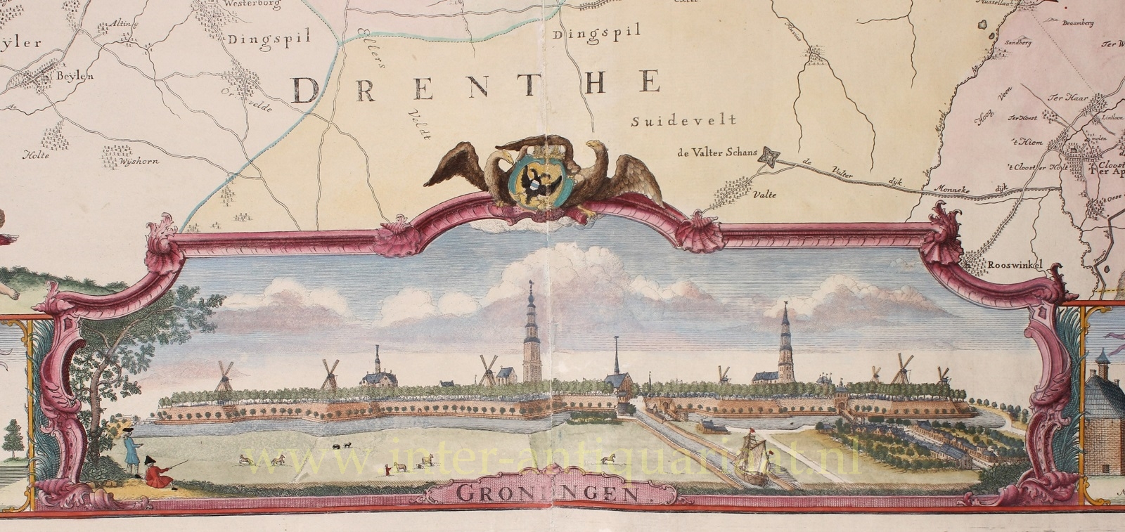
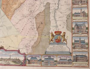
The work is dedicated to Stadtholder William V. His coat of arms appears twice on the map: at the lower right and on the upper border at left. On the upper border at right appears the coat of arms of the City and Province (Stad en Lande). The cartouche at lower left is adorned with the arms of the City of Groningen and the Ommelanden.
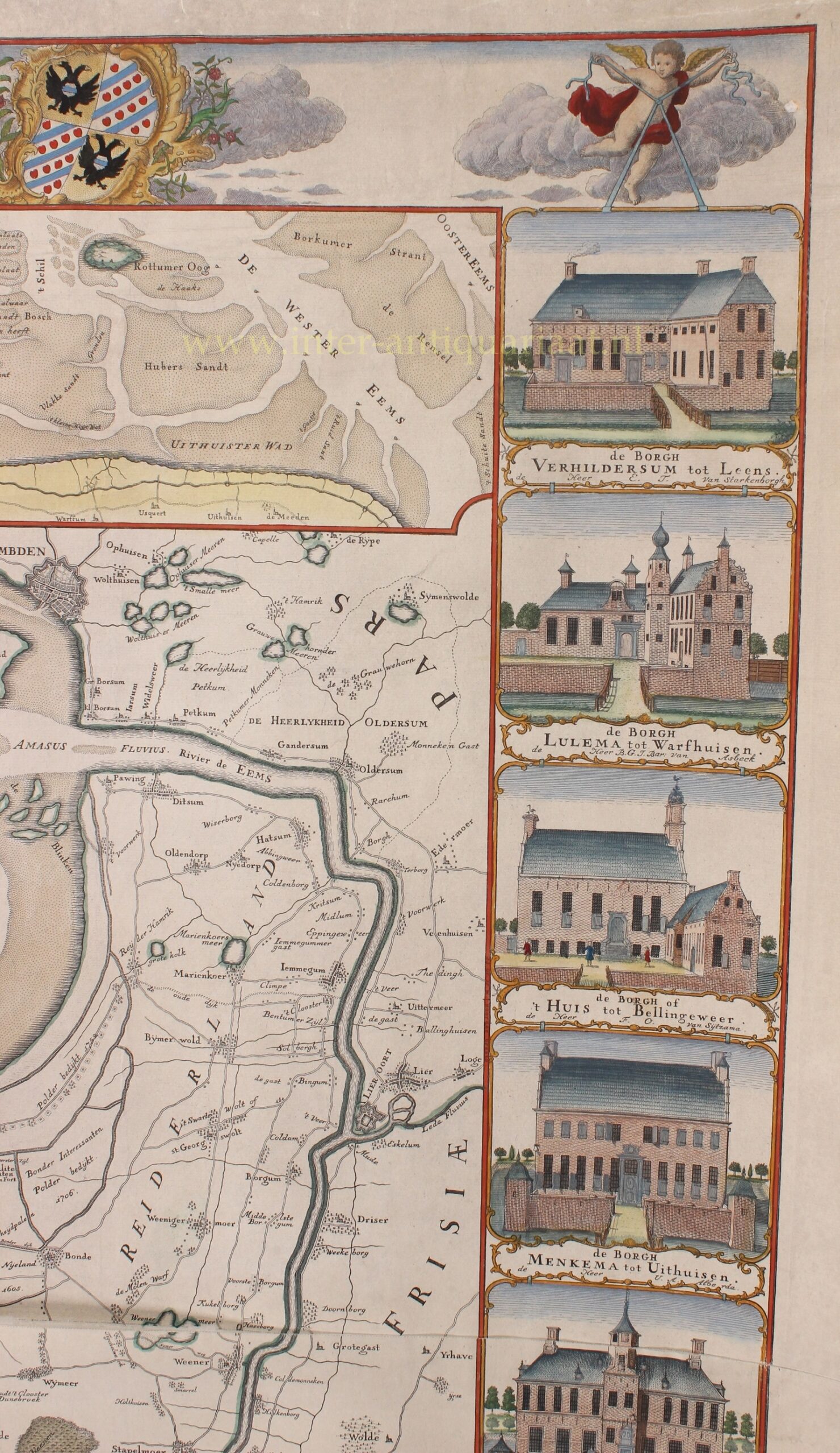
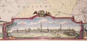
At lower left, two scale bars are depicted: one indicating German miles, the other showing how long a pedestrian would take to cover a given distance. At the bottom centre, there is a view of the city of Groningen, while the inset at upper right shows part of the Wadden Sea with the islands of Schiermonnikoog and Rottumeroog.
In the left and right borders are depictions of 24 Groninger borgen—manor houses of the local nobility.
We may assume that Beckeringh worked on the engraving between 1774 and 1777. Shortly before addressing the Provincial States in 1777, he made a few final adjustments to bring the map up to date. By 1781, the work was ready: enough copies had been printed for commercial release. On 9 February of that year, the following advertisement appeared in the Groningsche Courant:
“Lubbartus Huisingh in Groningen, and Covens & Mortier and Covens junior in Amsterdam, map and book dealers, intend—once the waterways are open at the beginning of March 1781—to publish and distribute to the principal art and map dealers in the Dutch provinces, a new, accurate, and very detailed geographical map of the Province of Groningen and the Ommelanden, together with the Lordship of Westerwolde, newly surveyed and improved according to the present state of the land and considerably enlarged, with an elegant border of noble estates in the Ommelanden and several others within the jurisdiction of the city, and a splendid prospect of the city of Groningen, printed on four large Elephant sheets of the finest writing paper; with privilege granted to the author, Mr. Theodorus Beckeringh, Assessor.”
The copper plates of the map, together with 95 impressions, were sold publicly on 1 October 1828. In the auction notice, the map was advertised as “much in demand and highly accurate.” The buyer was the bookseller Jan Oomkens II, a member of a prominent family of printers. His son, Jan Oomkens III, produced a reprint from the original copper plates in 1849 in an edition of 100 copies. After that, the plates were destroyed.
Literature:
- De Groninger provincie-wandkaart van Theodorus Beckeringh in Caert Thresoor, tijdschrift voor de geschiedenis van de kartografie,2005
- In 2016, the Groninger Museum dedicated an exhibition to the map. On this occasion, a splendid book by Martin Hillenga was published: “De atlas van Beckeringh I Het Groninger landschap in de 18e eeuw.”
Price: Euro 11.000,- (incl. frame)