

Haarlemmermeer, Leidsemeer – Schenk
€375
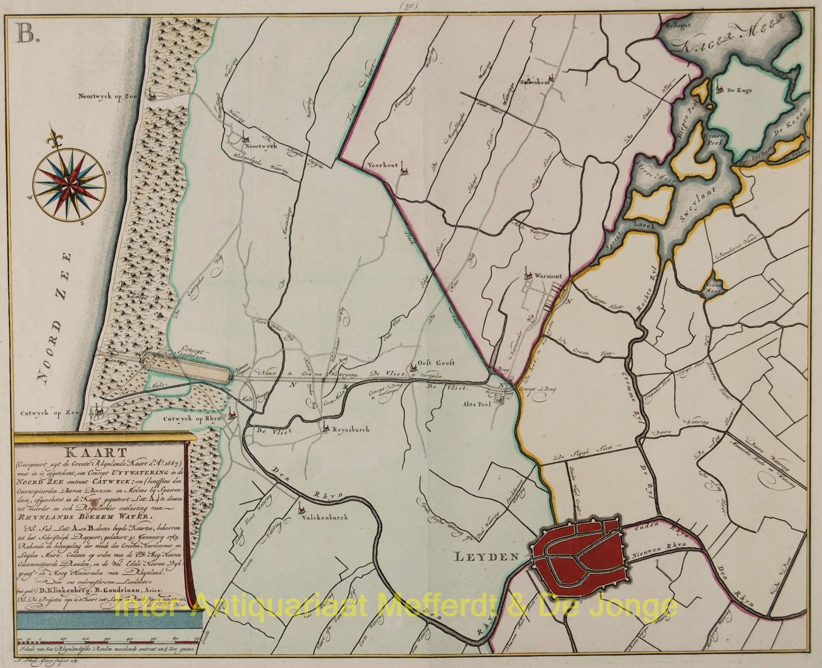
TO TAME THE FURY OF THE HAARLEM AND LEIDEN LAKES
“Kaart waar in is aftekent, een Concept Uytwatering in de Noord Zee omtrent Catwijk”ter ontlasting van Rijnlands boezem water.” [Map showing a proposed drainage into the North Sea near Katwijk… for the relief of Rijnland’s polder waters.] Copper engraving published by Leonardus Schenk in 1769. With original hand colouring. Plate size: 21.6 × 31.7 cm.
Although large-scale lake reclamation projects had already been carried out in North Holland during the seventeenth century, the plan to drain the ever-expanding Haarlemmermeer was postponed for many decades. Rivalry between Haarlem and Leiden — the latter reluctant to lose the lucrative fishing rights to the vast inland sea — prevented the execution of earlier proposals.
In 1769, Dirk Klinkenberg and Barend Ariesz. Goudriaan presented a plan to drain the lake by means of an outfall at Katwijk. According to this scheme, 112 windmills would pump the lake dry, after which 50 additional mills would discharge the water from Rijnland’s drainage basin into the sea. The costs for reclaiming the 19,000 bunders (c. 19,000 hectares) were estimated at approximately ƒ9,000,000.
The cartouche of the map states that it was issued as an appendix to the proposal concerning “the taming of the fury of the Haarlem and Leiden lakes.”
After a violent storm in 1836 drove the waters as far as Amsterdam and Leiden, it was finally decided to drain the Haarlemmermeer — a task completed between 1848 and 1852.
Price 375,-