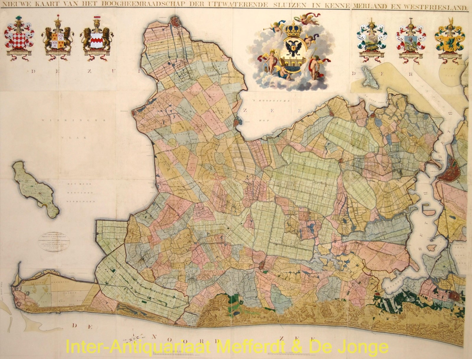
North Holland – Daniel Veelwaard after Johannes Dou, 1825
€8.500
“Nieuw Kaart van het Hoogheemraadschap der Uitwaterende Sluizen in Kennemerland en Westfriesland“ [New Map of the Hoogheemraadschap der Uitwaterende Sluizen in Kennemerland and Westfriesland”. Engraving on 16 copper plates engraved by Daniël Veelwaard & Zn. in 1825 after the design of C.W.M. Klijne. Coloured by a later hand. Size (print) 172 x 224 cm. Mounted on linen between wooden sticks.
The water board of the “Uitwaterende Sluizen in Kennemerland and West-Friesland” is a former water board in the Dutch province of North Holland. The water board was responsible for the drainage of the Schermerboezem [a body of water] from the Noorderkwartier into the Zuiderzee and the IJ.
In 1660, the Dijkgraaf [chairman] and Hoogheemraden [officials] of the Uitwaterende Sluizen water board, commissioned their territory to be mapped . After twenty years of preparatory work, land surveyor Johannes Dou completed his assignment and presented a huge map on sixteen sheets. The map was used for more than one and a half century and was reprinted with changing coats of arms of its officials. In 1825, finally a new improved edition was published, of which this is a beautiful example.
Literature: Donkersloot – de Vrij, no. 751
Price: Euro 8.500,-


