

Zandvoort and surroundings – K.H. Schnirneck and J.P. van der Sande, 1909
€475


ZANDVOORT AS A FASHIONABLE SEASIDE RESORT IN 1909
“Wandelkaart van Zandvoort en Omstreken” [Walking Map of Zandvoort and Surroundings]. Colour lithograph made by K.H. Schnirneck and J.P. van der Sande, published by Saaf’s Boekhandel in Zandvoort, 1909. Size: approx. 90 × 63 cm.
Folding walking map of Zandvoort and its surroundings, showing the village, the beach, the dunes, Overveen, Haarlem, Heemstede and the area extending towards Bloemendaal. The map includes a key indicating footpaths, dunes, dykes, municipal boundaries, railways, tramways and metalled roads. Its scale of 1:25,000 makes clear that the map was intended not merely to show the village centre, but above all to guide the seaside visitor into the surrounding landscape: towards the dune valleys, country estates, parks, walking routes and connections in the direction of Haarlem and Bloemendaal.
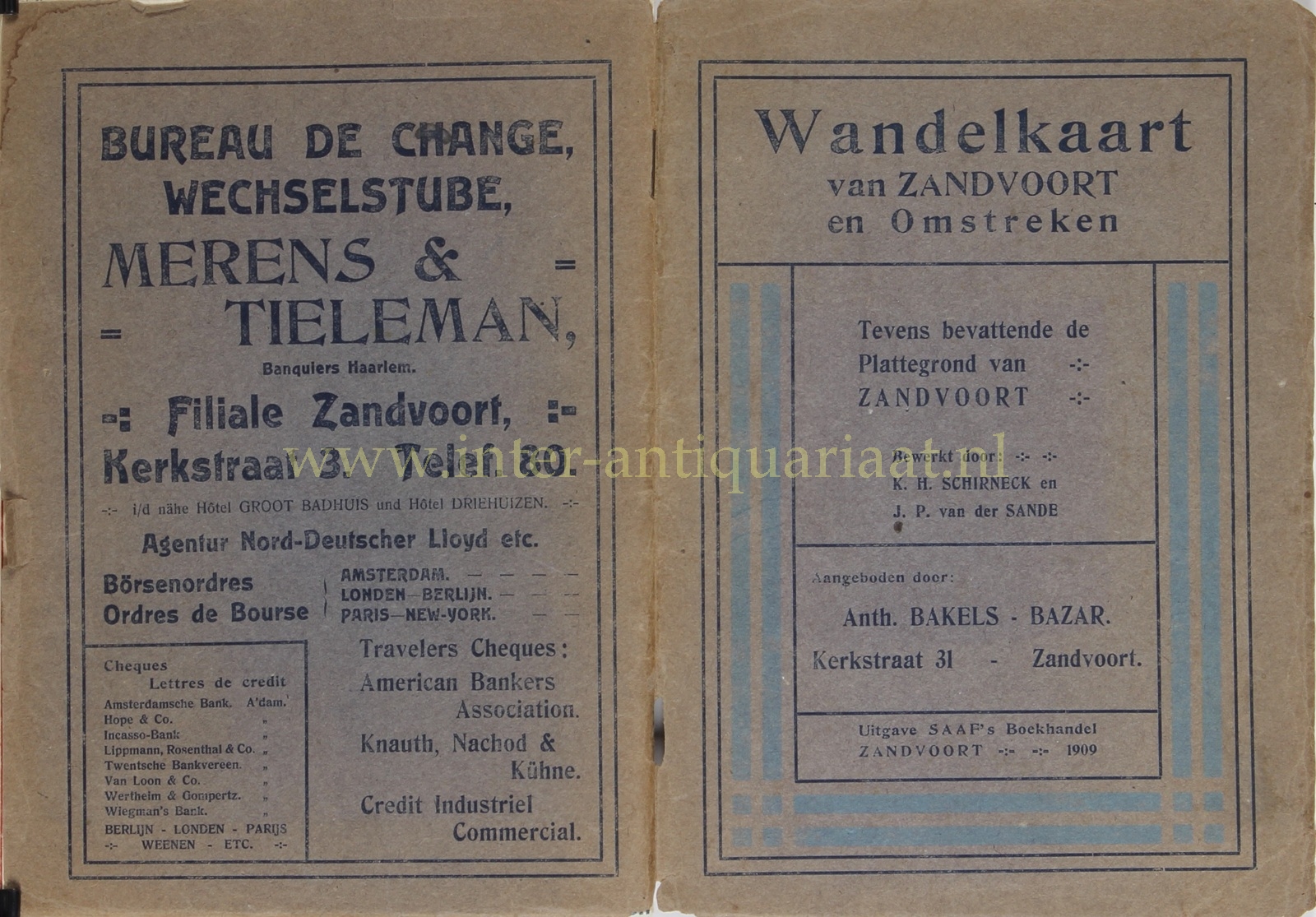
The reverse brings the map vividly to life. Here, the plan of Zandvoort is surrounded by dozens of advertisements for hotels, boarding houses, restaurants, shops and service providers. Together, they form a striking period image of Zandvoort as a seaside resort in the first decade of the twentieth century.
By around 1909, Zandvoort was no longer an isolated fishing village, but a readily accessible resort for urban visitors from Haarlem and Amsterdam. The Haarlem–Zandvoort railway had opened in 1881 and gave an important impulse to seaside tourism; in 1899 it was followed by the electric tramway between Haarlem and Zandvoort, later part of the well-known Amsterdam–Haarlem–Zandvoort connection. This modern transport infrastructure is prominently present on the map. The advertisement of the “Electrische Spoorweg-Maatschappy” promotes the convenient connection with Amsterdam, Haarlem, Bloemendaal, Aerdenhout and Bentveld, with trains “every 10 minutes in both directions”, booklets of ten tickets and inexpensive subscriptions for periods from one to twelve months. Zandvoort thus became not only a destination for long-stay summer visitors, but also for day-trippers.
The advertisements show a seaside resort aimed at comfort, health and fashionable leisure. Names such as Hotel de l’Océan, Grand Hotel Wüst, Hotel Groot Badhuis, Hotel Trier, Hotel Beau Site, Villa Groot Kijkduin and various pensions emphasise location, sea views, tranquillity, first-class accommodation and modern comfort. Grand Hotel Wüst even describes itself as a “Maison tout premier ordre” and advertises its restaurant with a view of the sea. Such wording firmly places Zandvoort within the international bathing culture at the end of the Belle Époque, in which the sea, fresh air, walking, lodging and restaurant visits together formed a refined mode of recreation.
The shops advertised on the reverse also say much about the public for whom the map was intended. There are fashion houses and haberdashers, such as Gebr. Gerzon’s Mode-Magazijn and Anth. Bakels’ Bazar, as well as cigar shops, perfumeries, chocolatiers, tea merchants, banking and exchange offices, opticians, photographers and suppliers of luxury and beach articles. The seaside visitor in Zandvoort could do more than bathe and walk: one could drink tea, smoke, buy postcards, have one’s photograph taken, hire beach chairs, and purchase clothing or toiletries. The presence of a “Bureau de Change” also points to a public that was broader than merely local or regional.
Price: 475,-