

Indian subcontinent and Southeast Asia – Guillaume Delahaye + Robert de Vaugondy, 1751
€395

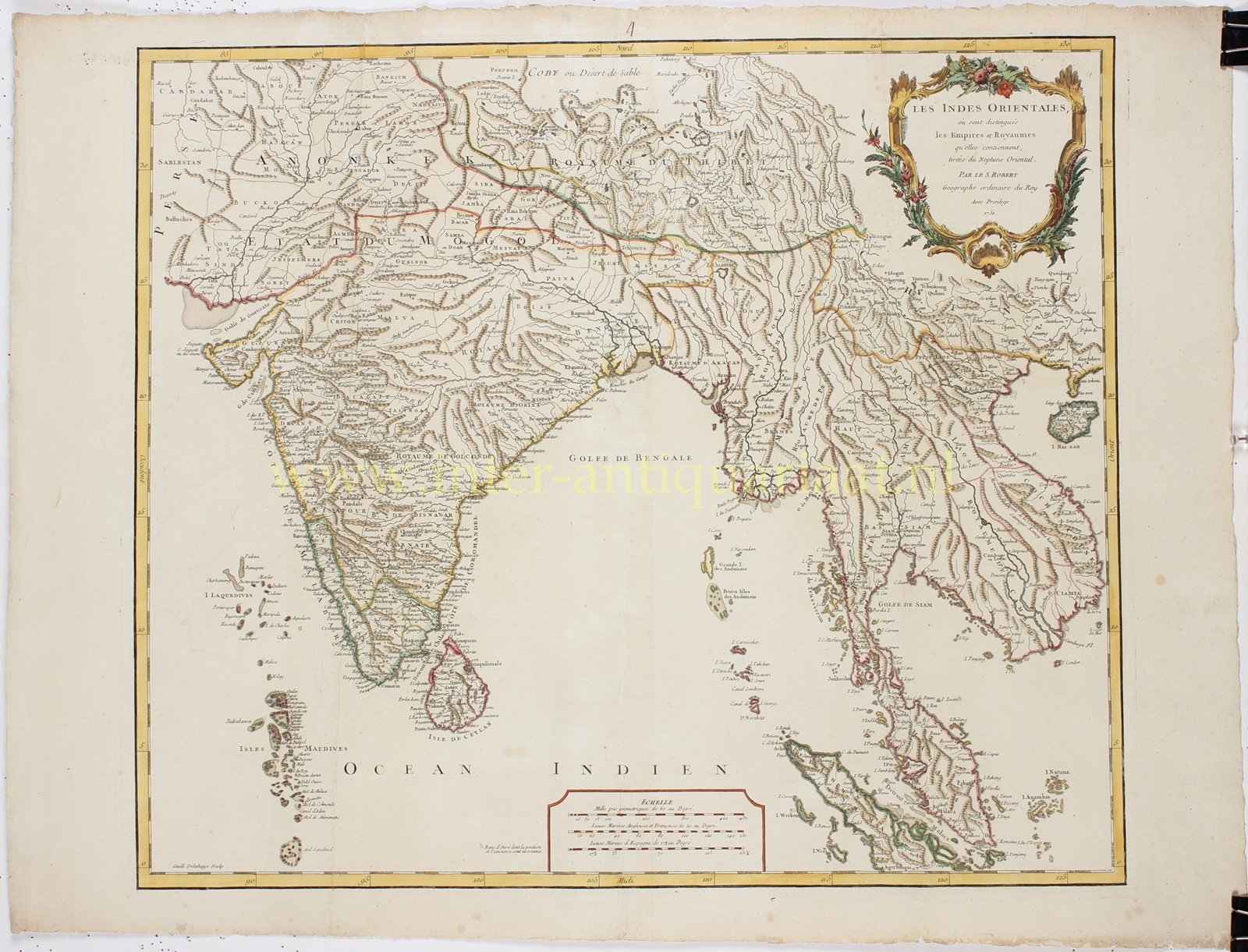


“Les Indes Orientales où sont distingués les Empires et Royaumes qu’elles contiennent, tirées du Neptune Oriental” [The East Indies, showing the empires and kingdoms they contain, taken from the Neptune Oriental sea atlas.] Copper engraving by Guillaume Delahaye after the 1751 design by Robert de Vaugondy, published in the Atlas Universel. Coloured by a later hand. Size: 48 × 56 cm.
This elegant map depicts the vast region of the Indian subcontinent and Southeast Asia, from the Persian Gulf and the Himalayas to Sumatra and Singapore. It includes India, Sri Lanka, Tibet, Burma (Myanmar), Siam (Thailand), Laos, Cambodia, Vietnam and the Malay Peninsula. Singapore is explicitly named. The Maldives and Andaman Islands are also carefully engraved, while the coastlines of Bengal and southern India reflect the most up-to-date French maritime knowledge of the period.
Of particular note is the depiction of the mythical “Lac Chiamay”, situated in present-day Assam. This legendary lake was long believed, since the 16th century, to be the source of four major Southeast Asian river systems — the Irrawaddy, the Chao Phraya, the Dharla and the Brahmaputra — and continued to appear on maps well into the 18th century.
At the time this map was created, India was undergoing a period of profound political transformation. The Mughal Empire, which had dominated the subcontinent for centuries, was in decline. In the resulting power vacuum, European powers — particularly the British and French East India Companies — competed for influence. Their interests clashed above all in Bengal, along the Coromandel Coast, and around Pondicherry and Madras, leading soon after to the Seven Years’ War (1756–1763) and paving the way for British dominance in India.
The ornate title cartouche in the upper right corner, surrounded by flowers and trophies, underlines the prestige of French cartography during the Age of Enlightenment. Robert de Vaugondy’s Atlas Universel was among the first atlases based on actual surveys, making this map remarkably accurate for its time, with most place names rendered correctly.
Price: Euro 395,-