Switserland – Henri Abraham Chatelain, 1720
€425
SWISS CONFEDERATION OF THE XIII CANTONS
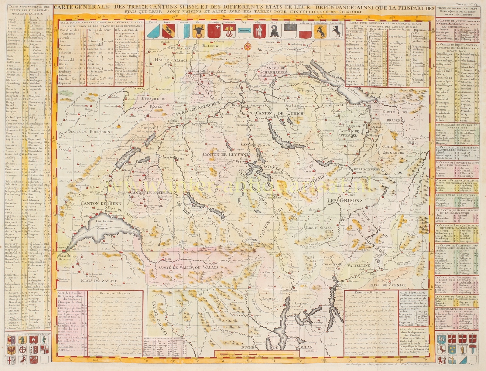
“Carte Geneneral de Treize Cantons Suisse et des Differents Etats de leur Dependance; ainsi que le pluspart des etats qui leur sont Voisins et Aliez”, [general map of the thirteen Swiss cantons and the different states dependent on them; as well as most of the states that are their neighbors and allies.] Copper engraving made by Henri Abraham Châtelain published in Amsterdam 1705-1720, as part of the “Atlas Historique“. Coloured by a later hand. Size ca. 47 x 61 cm.
At the top of this detailed map are the coats of arms of the 13 cantons of the Swiss Confederation, with the cities and allies depicted in the lower left and right corners. The tables surrounding the map show the ranking of the cantons, the year in which they formed their union, and the various states that are dependent on them.
Bovenaan deze gedetailleerde kaart staan de wapens van de 13 kantons van de Zwitserse Confederatie, de steden en bondgenoten staan in de hoeken links- en rechtsonder. De tabellen rondom de kaart tonen de rangorde van de kantons, het jaar waarin zij hun unie hebben gevormd en de verschillende staten die ervan afhankelijk zijn.
While Europe was torn apart by the Thirty Years’ War, Switzerland experienced the 17th century as a period of peace and rising prosperity. Neutrality was beneficial for the economy, allowing the confederation to supply other countries with goods. There was also an influx of refugees, particularly French Huguenots after their expulsion in 1685, who greatly contributed to the revival of old crafts and the establishment of new enterprises.
With the pensions from the mercenary system and commercial activity, capital was accumulated, which was loaned to neighbouring countries constantly at war, particularly France. The bankers in Geneva thus became the center of an extensive European financial network.
There was also enough capital available to finance national industrial expansion. Natural resources were not available in sufficient quantities for easy exploitation, and agricultural output was not enough for the growing population. As a result, the Swiss Confederation had ample access to labour. And since landlocked Switzerland had no shipping enterprises or colonial possessions, the industrial sector became the driving force behind economic development.
Châtelain’s Atlas Historique was an ambitious work, covering a range of subjects including genealogy, cosmography, topography, heraldry and chronology. It was first published in Amsterdam in 1705-20. The text was compiled by Nicholas Gueudeville and Garillon with a supplement by H. P. de Limiers and the maps were engraved by Chatelain, primarily after maps by Guillaume de l’Isle. it was one of the most expansive Dutch encyclopedias of the age.
Prijs: Euro 425,-


