SWISS CONFEDERATION OF THE XIII CANTONS
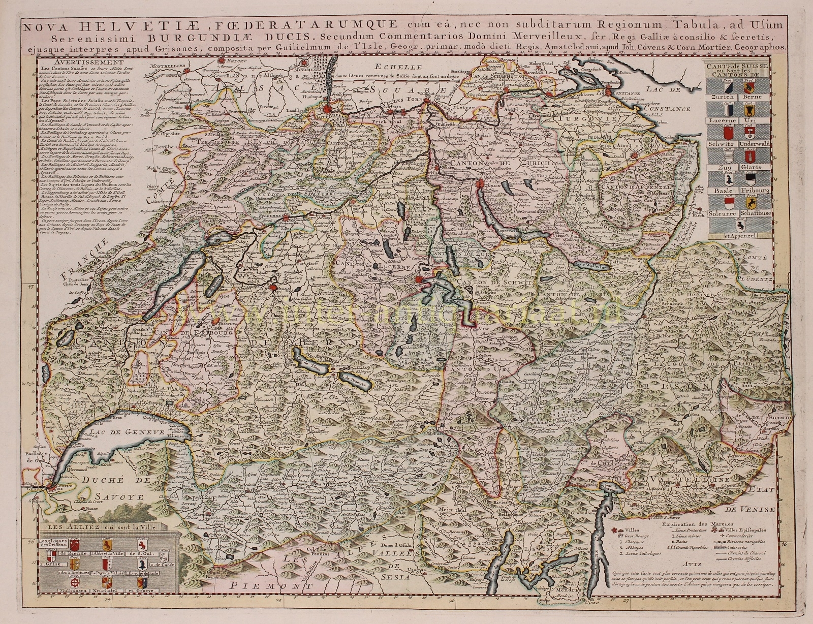
“Nova Helvetiae foederatarumque nec non subditarum Regionum Tabula ad Usum Serenissimi Burgundiae Ducis” [Map of the new Swiss federated as well as subordinate regions, for the use of the most serene Duke of Burgundy,” copper engraving made by Guillaume De l’Isle and published around 1758 by Johan Covens & Cornelis Mortier. Original hand colouring with later additions. Size: approx. 47 x 61 cm.
While Europe was torn apart by the Thirty Years’ War, Switzerland experienced the 17th century as a period of peace and rising prosperity. Neutrality was beneficial for the economy, allowing the confederation to supply other countries with goods. There was also an influx of refugees, particularly French Huguenots after their expulsion in 1685, who greatly contributed to the revival of old crafts and the establishment of new enterprises.
With the pensions from the mercenary system and commercial activity, capital was accumulated, which was loaned to neighbouring countries constantly at war, particularly France. The bankers in Geneva thus became the center of an extensive European financial network.
There was also enough capital available to finance national industrial expansion. Natural resources were not available in sufficient quantities for easy exploitation, and agricultural output was not enough for the growing population. As a result, the Swiss Confederation had ample access to labour. And since landlocked Switzerland had no shipping enterprises or colonial possessions, the industrial sector became the driving force behind economic development.
The towns and villages on the map are marked with a symbol indicating whether they were Catholic or Protestant (or both), which was important at the time. Also shown are the baths and major vineyards.
The cartouche in the upper right shows us the coats of arms of the 13 cantons of the Swiss Confederation, while the coats of arms of 11 allied cities are shown in the lower left.
The house of Covens & Mortier (1721-1866), the largest cartographic publishing house of the 18th century, was founded by Johannes Covens I (1697-1774) and Cornelis Mortier (1699-1783), located on the Vijgendam in Amsterdam. The partnership arose after the death of Pieter Mortier (1661-1711), the son of a French political refugee, who in 1690 had obtained the privilege to distribute maps and atlases from French publishers in Holland. His widow continued the business until her death in 1719. Her son Cornelis then took charge for a few years, under his father’s name. In 1721, a partnership was established by Cornelis Mortier and Johannes Covens I. That same year, Covens married Cornelis’ sister. Their firm would experience significant expansion over the next 140 years. Until 1732 their company was located next to the Amsterdam stock exchange. Their main competitors were Reinier & Josua Ottens and the firm of Gerard Valck and Petrus Schenck.
Price: Euro 475,-


