

Dutch Brazil, Paraiba and Rio Grande – Joan Blaeu, c. 1662
€2.150
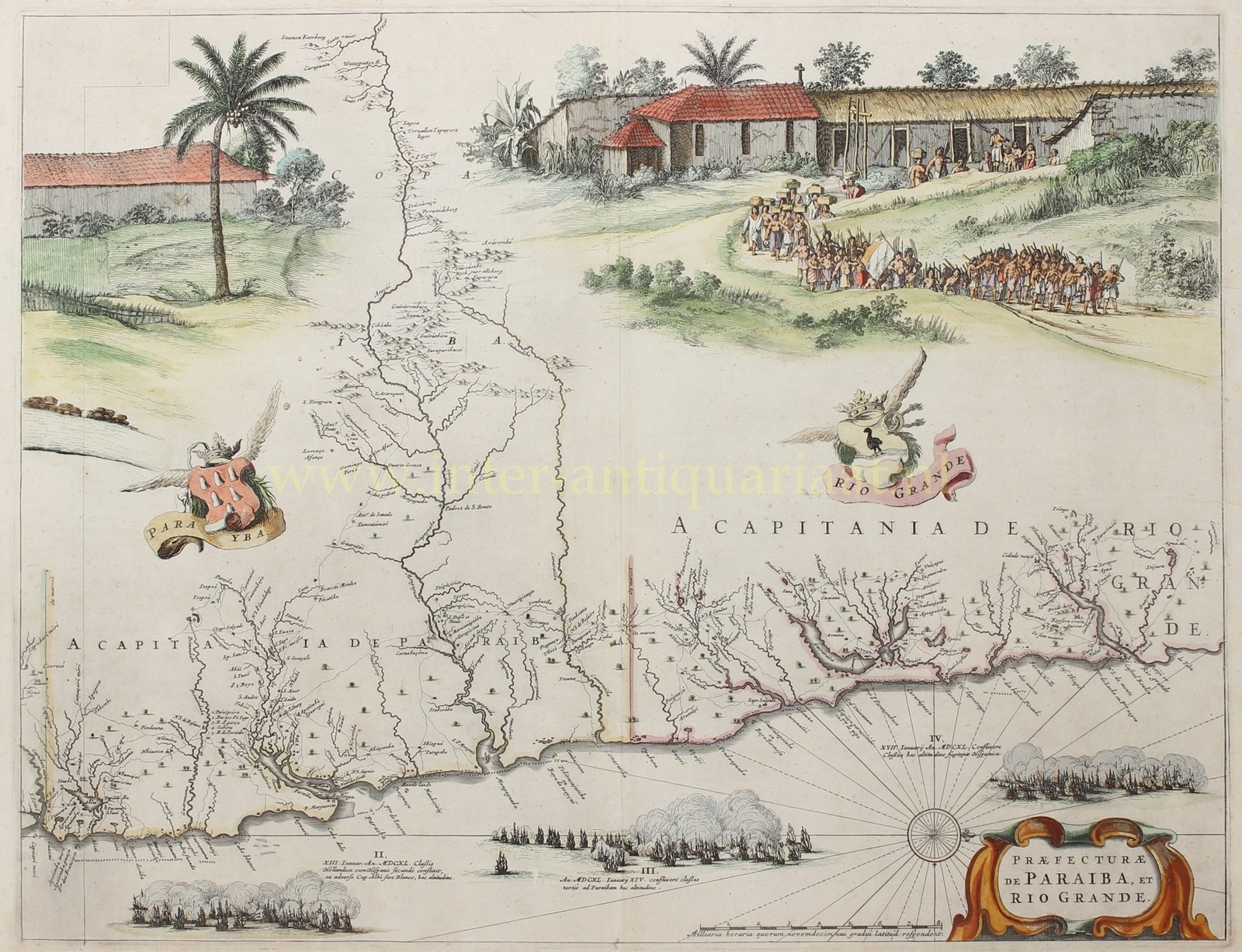


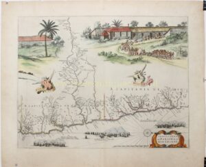
“Praefecturae de Paraiba, et Rio Grande” — copper engraving after a design by Georg Marcgrave, published by Joan Blaeu around 1662 as part of his Atlas Maior. With original hand colouring. Size: 41.5 x 53.4 cm.
Between 1630 and 1654, part of the northeastern coast of Brazil was under the control of the Dutch West India Company (WIC). For a significant part of this period (1636–1644), Johan Maurits van Nassau-Siegen served as Governor-General of Dutch Brazil. He sought to make the region the centrepiece of the WIC’s operations, which earned him the nickname ‘the Brazilian’. (His legacy is now the subject of considerable debate, given his role in the trade in enslaved people and sugar production in Brazil.) The Mauritshuis, which he had built after his return to the Netherlands, was sometimes called the Sugar Palace on account of his involvement in sugar production and trade.
To gain a thorough understanding of the geography and culture — but above all the economic potential — of the region, Johan Maurits brought an extensive company of scientists and artists to Dutch Brazil to study, explore, draw, and describe the land. The German astronomer, natural historian, and cartographer Georg Marcgrave (1610–1644) was one of them. In 1643 he produced an entirely new map of Dutch Brazil based on expeditions undertaken between 1640 and 1643. The map was first printed in 1647, in four sheets, by publisher Joan Blaeu.
Marggraf consistently depicted only a narrow strip of land along the coast — which is not particularly surprising, since Dutch authority did not extend far into the interior. This engraving shows the so-called capitanias (captaincies) of Paraíba and Rio Grande, on the northeastern coast of Brazil. The division of Brazil into capitanias was devised by the Portuguese to improve the governability of the territory; the Portuguese crown granted these captaincies to private individuals to administer.
Joan Blaeu incorporated Marggraf’s maps into his atlas but also made his own additions. To enliven the cartographic material and fill in the blank spaces of the interior, Blaeu copied Brazilian scenes from the landscape painter Frans Post. On this sheet we see a depiction of a village with a church, and Brazilian Indians working for the Dutch. In the upper left is the reverse side of the sugar mill from Blaeu’s map of Pernambuco and Itamaracá. Below the map image, the further course of the naval battle between the Dutch and the Spanish in 1640, on 13, 14 and 17 January, is depicted.
The map shows the captaincies of Paraíba and Rio Grande, two northern coastal territories that, following their conquest by the WIC, formed part of Dutch Brazil.
The Captaincy of Paraíba came into being after the expulsion of the French in 1584. The Portuguese built a city there, laid out sugarcane fields, and developed sugar production. According to Blaeu, there were eighteen or nineteen sugar mills, which processed and exported approximately 150,000 arrobas (around 2,250 tonnes) of sugar annually.
The city of Paraíba lay a few miles inland along the river, but remained accessible to ships. Earlier it had been home to around five hundred Portuguese, but by the time the map appeared the population had grown considerably, alongside numerous “Savages” and “Blacks”. The city was initially open, but was later surrounded by a simple earthwork rampart as the threat from the Dutch increased. An earlier Dutch attack on the fort at Cabedelo failed, but in 1635 they captured both the city and the fort. These possessions were later lost, along with the other Dutch conquests in Brazil.
Along the river lay mills, warehouses, houses, and small villages. The area was considered fertile, producing among other things brazilwood, which was used by dyers.
The Captaincy of Rio Grande (later Rio Grande do Norte) takes its name from the great river that the indigenous population called the Potengi. Here too the French initially came ashore, in alliance with local groups. To push back their presence, the governor of Paraíba was ordered to drive them out. Following conflicts with the French and their indigenous allies, a fortified fort was constructed on the bank of the Rio Grande.
Blaeu first published this map as part of Caspar Barlaeus‘s Rerum per octennium in Brasilia in 1647. By the time the Atlas Maior came to market in 1662, Dutch sovereignty over Brazil had already come to an end.
Price: Euro 2.150,-