

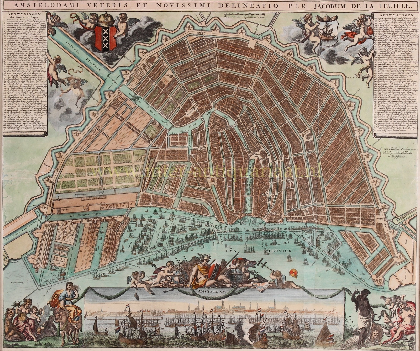
“Amstelodami veteris et novissimi delineatio per Jacobum de la Feuille” [latest depiction of old Amsterdam by Jacob de la Feuille]. Copper engraving first published in 1678 by Johannes de Ram, here in an edition by Gerard van Keulen from around 1725. Coloured by a later hand. Size: 48 x 56 cm.
Engraver and publisher Johannes de Ram (1648-1693) regularly copied work by others. For the map image, he took a 15-year-old map by Nicolaes Visscher as an example. He copied the city panorama, the decorations in the bottom left and right corners and the idea of the imperial crown (on the city coat of arms) and city seal from a map by rival Frederik de Wit. De Ram added a pair of putti himself.
After the first edition, the map image was updated. Among other things, the garden behind the Besjeshuis on the Amstel [today’s Hermitage Amsterdam] was added. That building was completed in 1683 and the garden was laid out afterwards. Weesperstraat appears to have been built on both sides and the Plantage has its garden structure. The islands of Uilenburg and Marken are also fully built. The area outside the Singelgracht around the northernmost bastions of Zeeburg and Leeuwenburg was engraved in more detail. Changes were also made to the rows of pilings in the IJ, and were given names. Between Rapenburgergracht and Nieuwe Vaart, houses and shipyards were added.
After the death of Johannes de Ram in 1693, Jacob de la Feuille, who himself continued the business until his death in 1719, married De Ram’s widow. He reissued the map, replacing De Ram’s name in the title strip for his own. Finally, the map came into the hands of yet another publisher, Gerard van Keulen, who marketed it again around 1725.
Literature: Marc Hameleers “Kaarten van Amsterdam 1538-1865”, no. 79-4.
Price: SOLD