


Rotterdam – Soviet map, 1981
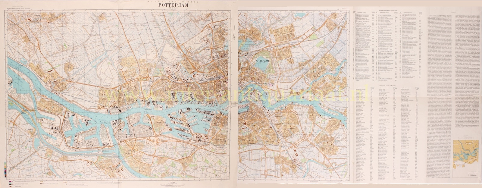
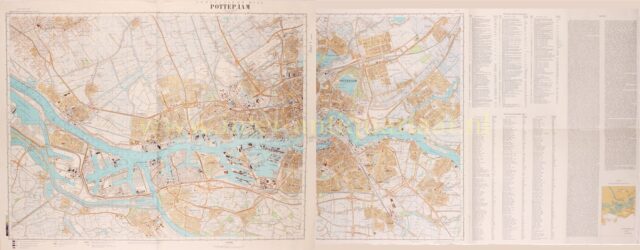
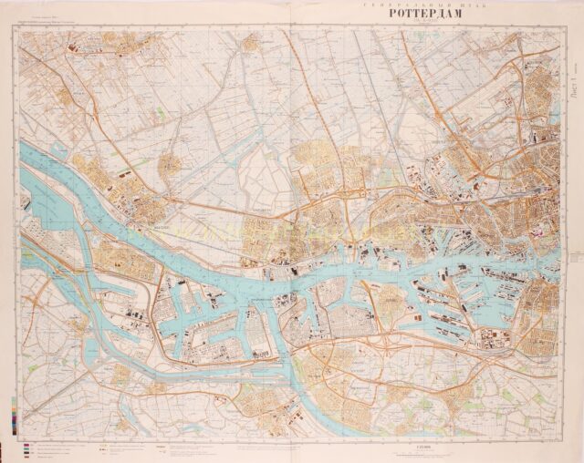
SECRET SOVIET MAP OF ROTTERDAM “Роттердам” [Rotterdam] offset colour print on two sheets made in 1981. Size (paper) 70 x…
Read more€475
SECRET SOVIET MAP OF ROTTERDAM
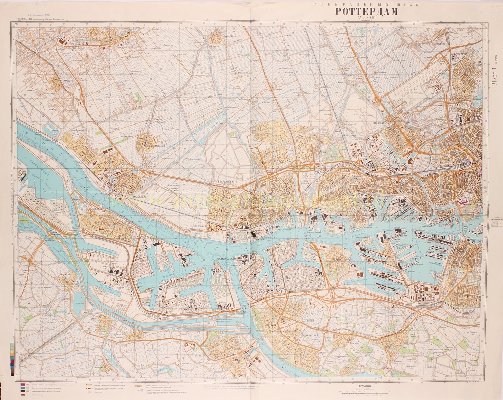
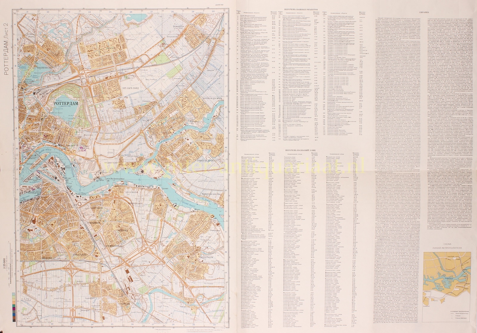
“Роттердам” [Rotterdam] offset colour print on two sheets made in 1981. Size (paper) 70 x 88.5 and 70 x 94.5 cm.
With the fall of the Soviet Union in 1991, the Cold War came to an end. A time of ideological struggle and constant threat of war was over. In hindsight, it turns out that the Soviet Union had better maps of the Netherlands (and many other Western countries) than we ourselves did. These Russian maps from the early 1980s show disturbingly detailed information!
Since the 1940s, the Soviet Union had begun mapping the world. They created maps of cities with unprecedented detail, including bus stops and government buildings. Several dozen maps of the Netherlands were made.
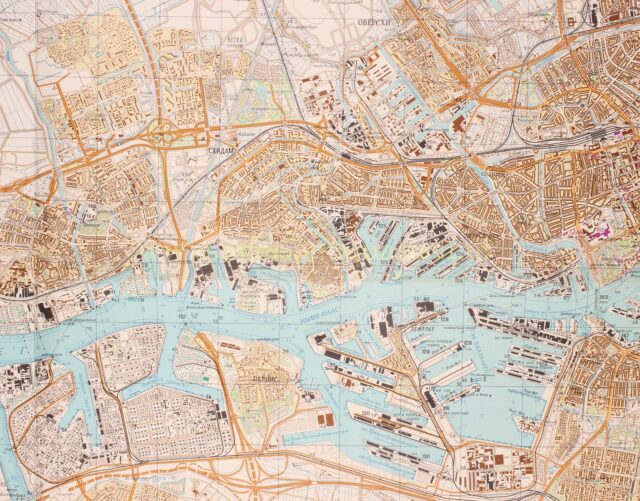
On maps like this one of Rotterdam, you can see at a glance how the city is laid out. Government agencies, post offices, factories, barracks, airports, they are all neatly marked in Cyrillic script. The size and strength of many bridges are indicated, along with information on navigability and the width of the rivers and canals. The height of dams and dikes, types of crops, and the paving of roads can also be found. The map is marked “секретно” [secret].
In addition to the fact that many Western countries made topographic maps freely available – communist spies would have eagerly used them – the Soviet Union had access to information via its satellites since the 1960s. Other information was gathered through extensive espionage activities. It’s highly likely that there were spies from the Soviet Union active through the embassy in the Netherlands. But not only that. In the 1950s, all truck drivers from Eastern Europe were screened by the Dutch secret service. This policy was later abandoned, but in the 1980s, there were warnings again about truckers from Ukraine hanging around military locations. Also, passenger planes from the Soviet Union sometimes disappeared from Dutch radar for a while. It later turned out that these planes had descended to take photos of locations of interest to them.
The fact that truckers from Ukraine suspiciously often took their breaks next to Dutch military locations seems to have a logical purpose; gathering information in preparation for a possible war. At the bottom of the map, it mentions: “the area shown on the map can be completely flooded by the water of the sea and rivers as a result of the destruction of coastal and river dikes and dams on a broad front.”
But presumably, the maps were not only made for war. Specific information was also noted about crops, vegetation next to roads, and the location of, for example, post offices. Seemingly useless information if you were only planning a military offensive or even a devastating nuclear attack. Presumably, this is because the communist leadership in Moscow believed until the end of the Cold War that the West would also succumb to communism.
With these maps, they could already better understand the world beyond their current borders. After all, it would only be a matter of time before the Soviet Union would also take control there. When that moment arrived, these maps would come in handy.
It only became clear after the fall of the communist superpower in 1991 how extensively the Soviet Union had mapped the world. Despite orders from Moscow to destroy the maps, many ended up in the West. Through Russian officers, the maps came into the possession of universities, collectors, companies, and even armies.
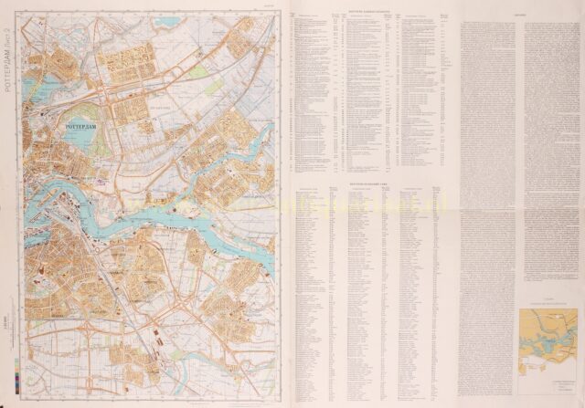
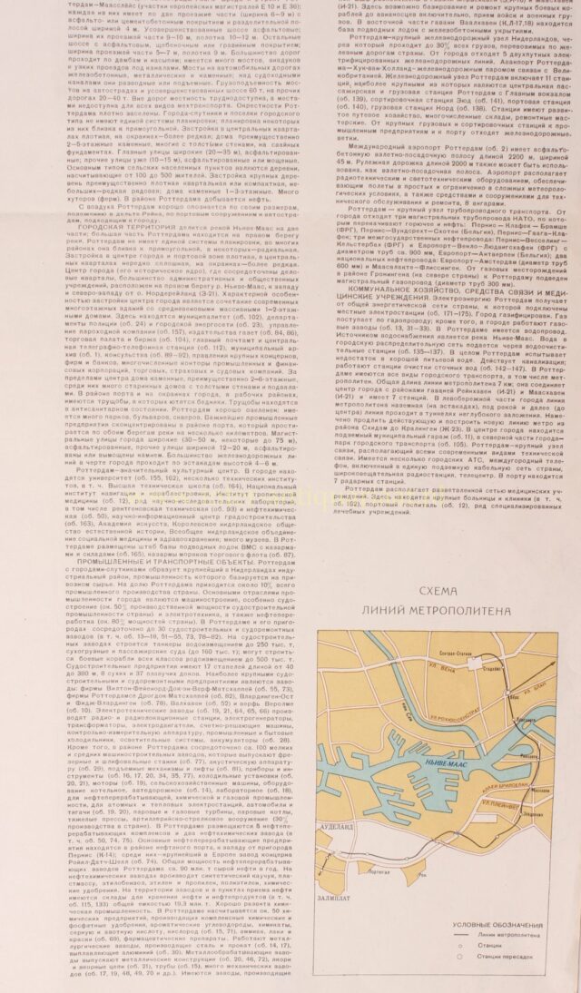
In addition to a street register, the Rotterdam map has two columns with very detailed background and topographic information. Interesting to read. (With Google Translate! 😊 )
Price: Euro 475,-