

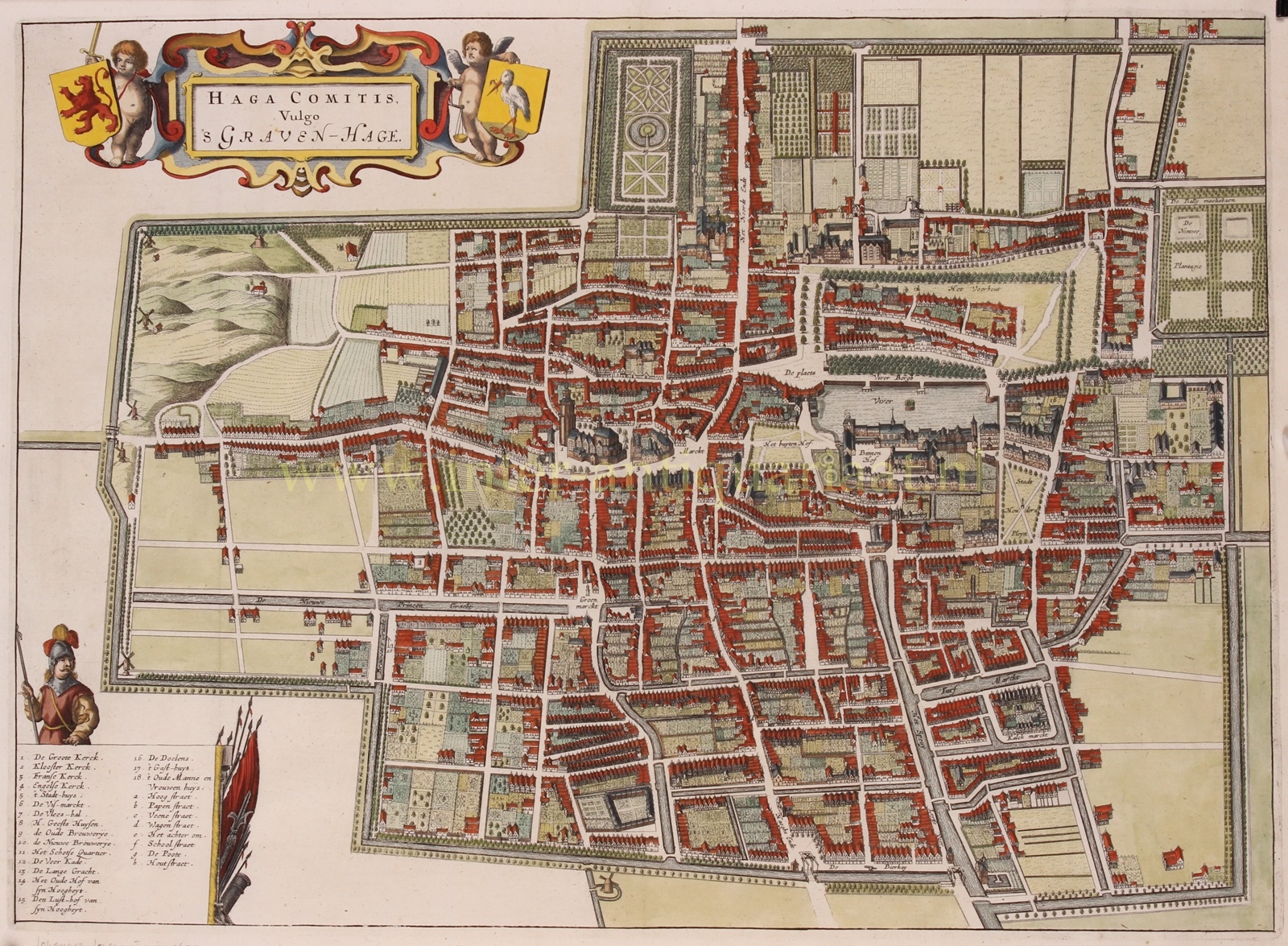
THE CITY COMMONLY REFERRED TO AS THE HAGUE
“Hage Comitis, Vulgo ’s Graven-Hage,” copper engraving published by Jan Jansson (in Dutch known as Johannes Janssonius) in Amsterdam in 1657 as part of his townbook “Urbium Totius Belgii Seu Germaniae Inferioris.” Coloured by a later hand. Size: 38.2 x 52.8 cm.
During the first half of the 17th century, there was significant construction in The Hague due to a growing population. In 1585, there were an estimated 7,000 to 8,000 inhabitants, barely more than in 1500. However, by 1600, the population had increased to 12,000, and by 1625, it had reached 18,000. This growth was attributed in part to the arrival of immigrants from the Southern Netherlands and rural inhabitants seeking a new life in the city.
This map by Janssonius depicts The Hague with its completed system of canals. The Veerkaden, the canals between Spui and Wagenstraat, were the last to be dug. The Amsterdamse Veerkade canal was created in 1630, while the Stille Veerkade, an extension of it, was established later. Only then city development was sufficient. The growth in the western direction was slow, and the planned streets near the end of the Prinsegracht were barely realized, remaining open spaces until the 19th century.
Price: Euro 1.450,-