

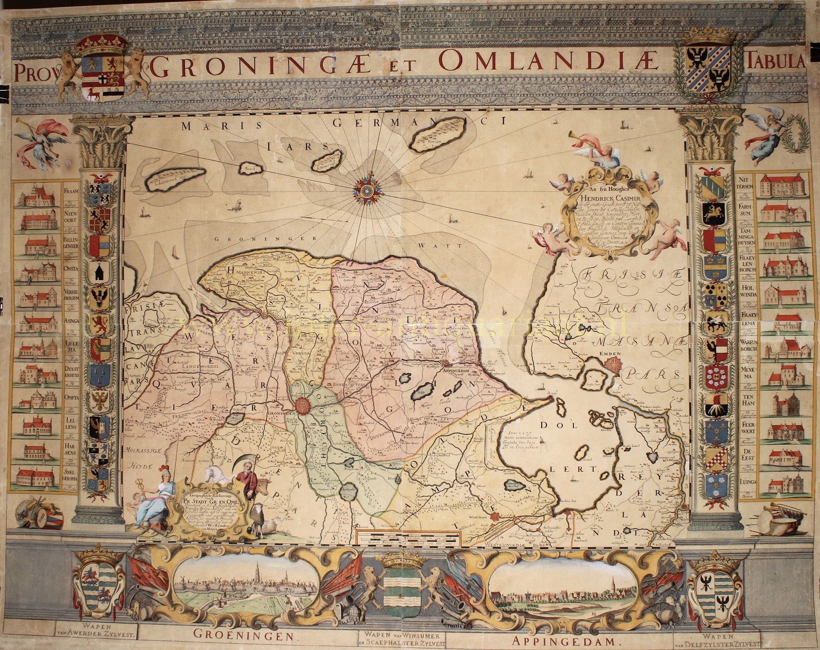
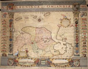


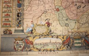
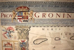
THE SO-CALLED “COENDERS MAP” – THE OLDEST WALL MAP OF THE PROVINCE OF GRONINGEN
“Prov: Groningae et Omlandiae Tabula.“, copper engraving on four mounted sheets made around 1678 by Cornelis Appeus after the design by Wilhelm and Frederik Coenders van Helpen. Coloured by a later hand. Size: 105 x 135 cm.
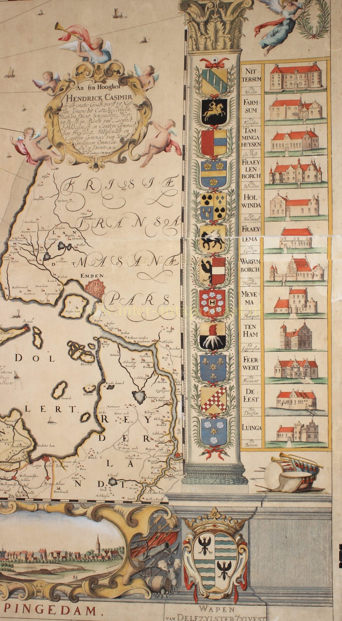
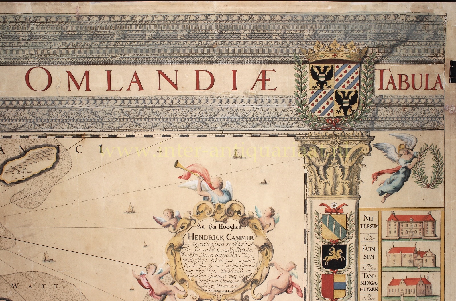
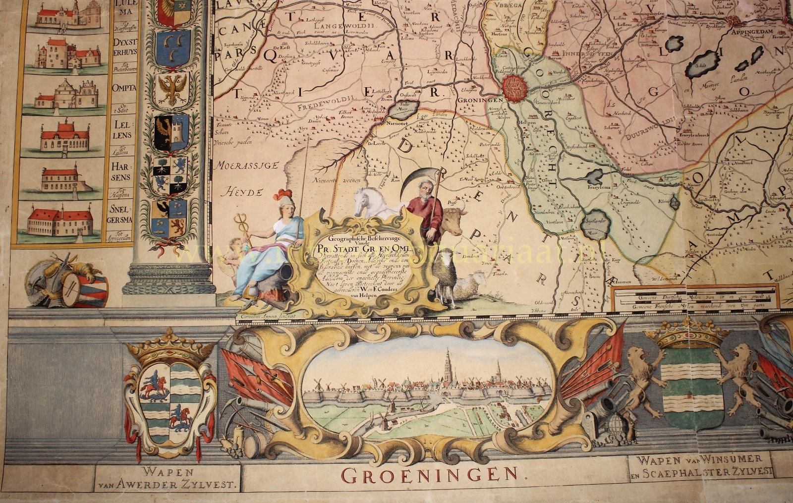
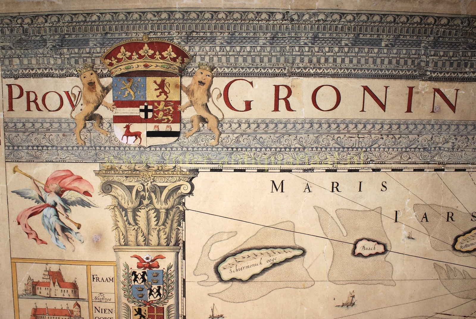
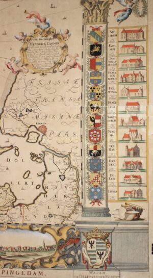
The map is dedicated to Hendrik Casimir II, the stadtholder of Friesland, Groningen, and Drenthe from 1664 to 1696. At the top it features the coats of arms of the stadtholder and the province, at the bottom those of the major water boards in the region. Below the map there are views of the cities of Groningen and Appingedam.
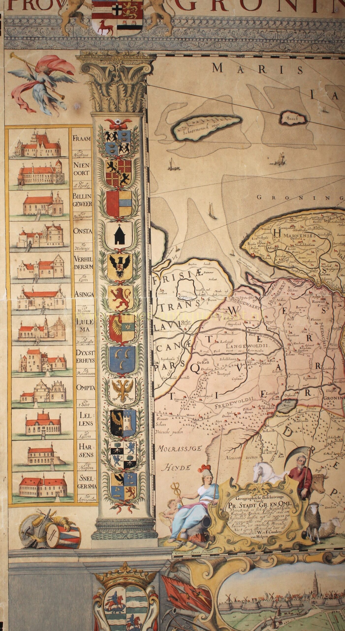
On both sides of the map, there are depictions of “adelijcke ende considerable huysen” (noble and considerable houses), including the coats of arms of the families residing in these prominent “borgen” (fortified houses or castles) of the time. All of the borgen have meanwhile (mostly in the 19th century) been demolished, except the Fraeylemaborg in Slochteren.
The Coenders brothers used cartographic work by Frederik de Wit as a basis for their map and added various elements to it. The Coenders map is the first wall map ever made of the province of Groningen. Only about a dozen examples have survived.
Price: Euro 18.500,- (incl. frame)