

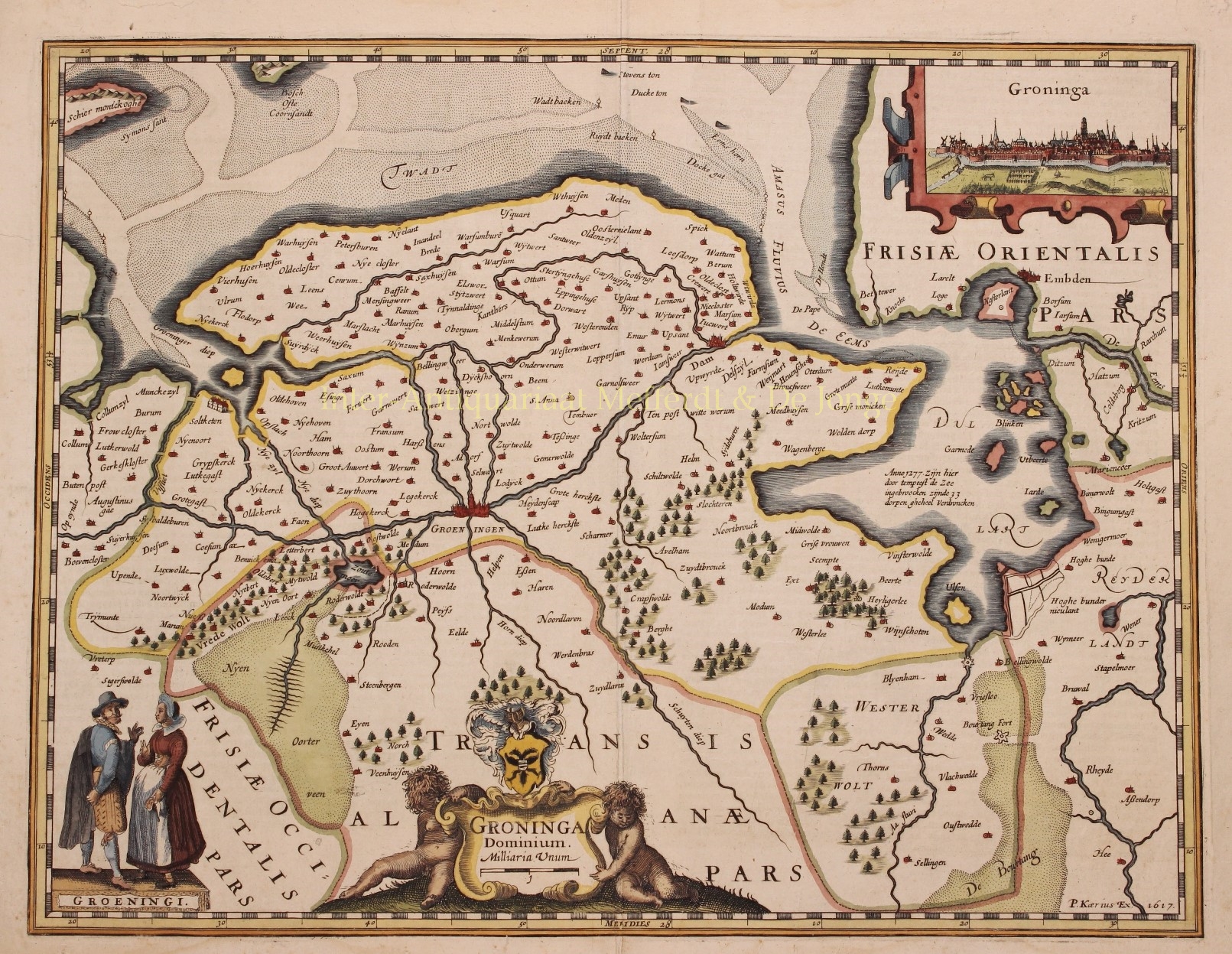

“Groninga Dominium”, copper engraving by Petrus Kaerius (Peter van der Keere) first published in 1617 in Amsterdam as part of Germaniae Inferior id est, XVII Provinciarum ejus novae et exactae Tabulae Geographicae, the first separately published atlas of the Seventeen Provinces Here in a second edition with French text on the verso side, published in 1622. Coloured by a later hand, Size: 37 x 48 cm.
This fine early map of the Groningen region includes a view of the city of Groningen (copied from Lodovico Guicciardini) and two “Groningi” in their typical regional dress.
Kaerius’ atlas “Germania Inferior” was published in only three editions: two in Latin in 1617 and one in French in 1622. After the death of his wife in 1623, Kaerius ran into financial difficulties and had to sell his copper plates. The new owner was Claes Jansz. Visscher, who reused them and brought the maps on the market under his own name.
Price: Euro 1.350,-