

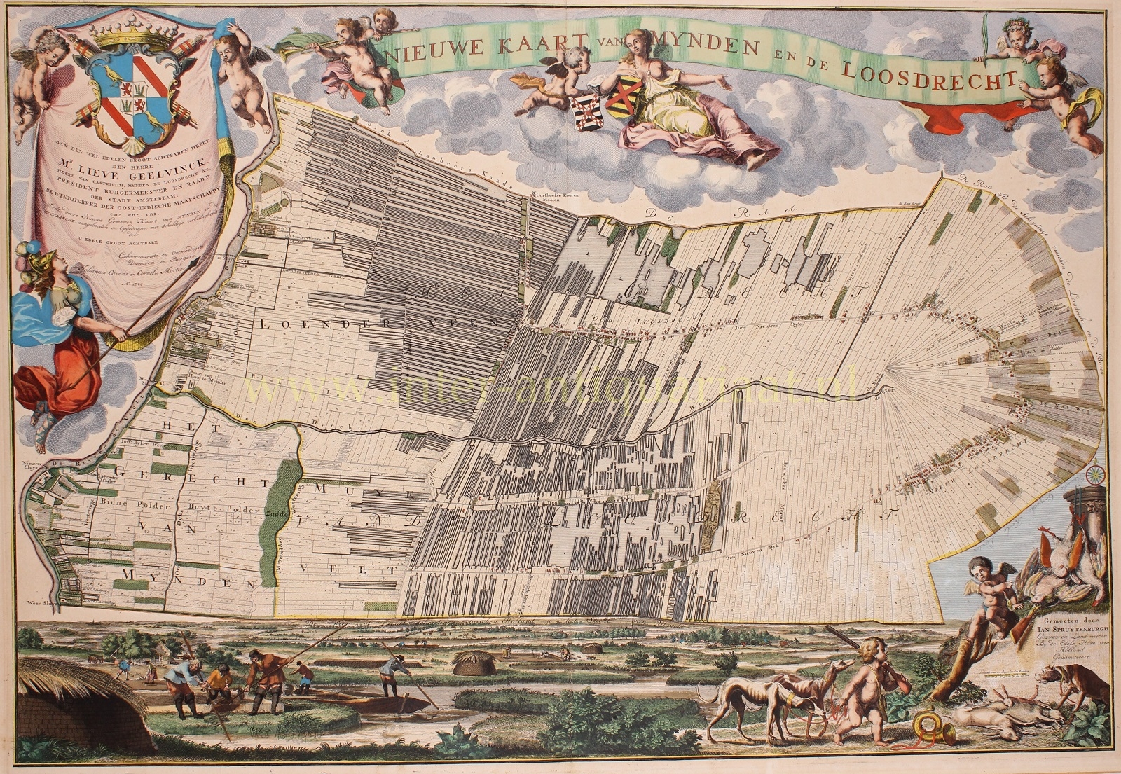
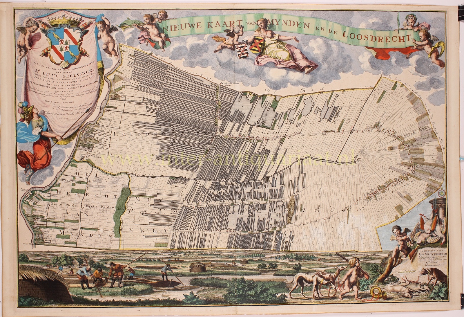

LOOSDRECHT DURING THE ERA OF PEAT EXTRACTION
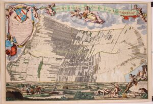
“Nieuwe kaart van Mynden en de Loosdrecht”, copper engraving made by Adolf van der Laan based on the design by surveyor Jan Spruytenburgh and published by Johannes Covens & Cornelis Mortier in 1734. With beautiful original hand colouring. Size: 61 × 89 cm.
The map is dedicated “with dutiful respect” by the “most obedient and humble servants and citizens” Johannes Covens and Cornelis Mortier to Mr. Lieve Geelvinck. This manner of expression may seem excessively deferential to us today but was apparently quite common back then. Lieve Geelvinck (1676-1743) was immensely wealthy and influential, not only as Lord of Mijnden and Loosdrecht but also of Castricum, Backum, and Kroonenburg. He held significant administrative positions in Amsterdam, including serving as the city’s mayor for several years, residing in an elegant building on Herengracht.
Three years after this map was published, Covens & Mortier published an equally splendid map of the ‘Heerlijkheid‘ of Castricum, also dedicated to him. This suggests Geelvinck, who likely generously supported the cartographic work financially, was pleased with their efforts. And it’s no surprise, given that the map is both informative and decorative. There’s a slight overlap with a earlier map of Loenen, indicating that Geelvinck might have inspired Covens & Mortier to create a similar map of Mijnden and Loosdrecht.
The surveying work for the map were conducted by a certain Jan Spruytenburgh, who was admitted as a surveyor in Holland in 1727. He wasn’t a well-known surveyor-cartographer – only few maps are attributed to him – but as the map demonstrates, he was skilled in what he did.
The engraver and etcher Adolf van der Laan, also known for just a few maps, excelled in his decorations. While there wasn’t a local historian suggesting ideas for the border embellishments as with the Loenen map, the peat extraction in the area provided good subjects. Additionally, customary decorative motifs such as angels, hunting scenes, the family coat of arms of Lieve Geelvinck, and the arms of Mijnden and Loosdrecht are prominently featured.
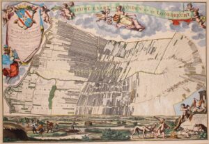
The depiction of peat extraction at the bottom of the map illustrates the sequential tasks involved in wet peat extraction. It shows the peat being dredged from the water, transferred onto a barge, spread on the land, compacted by workers (often women), and stacked for drying, covered with reeds. The processed peat was stored in sheds before being transported by turf barges to markets, especially those in cities, before winter.
The map itself offers a highly detailed view of the Loosdrecht area in 1734. The current recognizable form of the Loosdrechtse Plassen is not yet evident. Large expanses of open water were scarce, mainly existing north of Oud-Loosdrecht and slightly to the north of Boomhoek. However, the area of trenches and drying acres was substantial. The Drecht, as a river, remained entirely intact from its origin to its mouth at the Vecht, as did the now-vanished Oudendijk. Peat sheds were visible in various locations along the Oudendijk, Nieuwendijk, and Veendijk.
The map’s release was announced in the Amsterdamse Courant on April 24, 1734, and an edition from June 1, 1737, indicates its price was two guilders and ten stuivers (the same as the Loenen map).
Literatuur: Marijke Donkersloot-de Vrij (1985), “De Vechtstreek – Oude kaarten en de geschiedenis van het landschap”, nr. 26.
Price: Euro 6.950,- (incl. lijst)