

COUNTRY ESTATES IN THE VECHT REGION
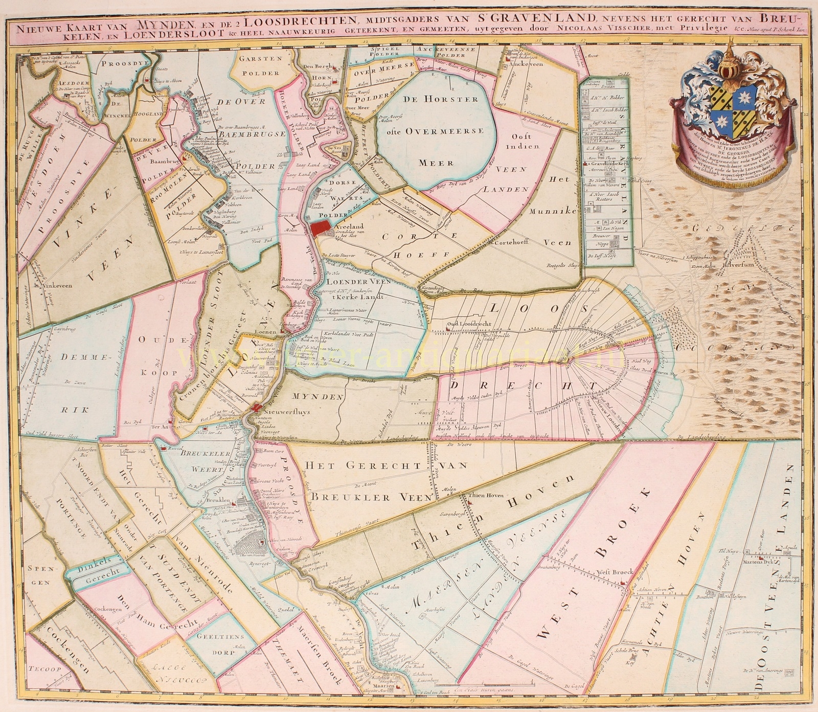
“Nieuwe kaart van Mynden en de 2 Loosdrechten, mitsgaders van ‘s-Graveland nevens het gerecht van Breukelen en Loenersloot“. copper engraving first published around 1677 and revised after 1702. This particular map was reissued by Petrus Schenk around 1720. Coloured by a later hand. Size: 48 x 56 cm.
This rare overview map of the central part of the Vecht region (between Nederhorst den Berg and Maarssen) was likely a bestseller among estate owners at the time. Approximately 155 country estates along the rivers Angstel and Vecht, and in ‘s-Graveland are mentioned.
These estates (NL: buitenplaatsen) emerged during a period of tremendous growth in trade and industry in Dutch cities, particularly Amsterdam. A new social upper class had become wealthy in a short time through trade with overseas territories and could afford a splendid second home in a scenic area. During the winter, they resided in the city, but in the summer, they enjoyed a pleasant life in their country house with their numerous staff. The Vecht region was popular due to its easy accessibility by trekschuit (public tug boats) and private yachts.
The revision of the map was partially financed by Jeronimus de Haze, an important regent from Amsterdam who owned a country estate in Loosdrecht. For his support, his coat of arms was included on the map.
Literature: Donkersloot-de Vrij “De Vechtstreek”, no. 20b
Price: Euro 1.950,-