

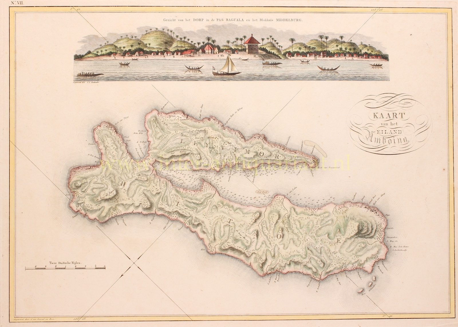
“Kaart van het Eiland Amboina”, engraving made by Cornelis van Baarsel & Son from the “Atlas of the Overseas Possessions of His Majesty the King of the Netherlands,” compiled by Johannes van den Bosch in 1818. Coloured by a later hand. Size: 33.5 x 51.5 cm.
Ambon was a governorate of the Dutch East India Company (VOC), consisting of Ambon Island and ten neighbouring islands from 1605 to 1796.
Ambon was a important trading post for the VOC, where the majority of cloves in the entire East Indies archipelago were grown. For the VOC, it was of utmost importance to maintain control over the clove trade. Ambon lost its position as the center of the clove trade only in the late 18th century. Despite the death penalty for trading in live cloves, clove seedlings were smuggled to Mauritius and other French islands around 1770.
In 1796, the island was occupied by British troops. In 1800, the Dutch state took over the possessions and debts of the VOC, and after a turbulent period, Ambon returned to Dutch control in 1814. Shortly after, in 1817, a bloody uprising against Dutch rule led to the transfer of the island to the New Government of the Moluccas.
Above the map of the island, we see a view of the village of Pas Baguala (Passo), where the Dutch had built Fort Middelburg for strategic reasons. The village is located in the narrowest part of the island, connecting the northern and southern peninsulas.
Most buildings from the VOC era on Ambon were destroyed during World War II, including Fort Middelburg.
Johannes van den Bosch (1780-1744) was appointed as the director of the Dutch topographical bureau in Batavia in 1802, where he gathered the infoarmation for compiling the Atlas of the Overseas Possessions.
Price: 625,-