

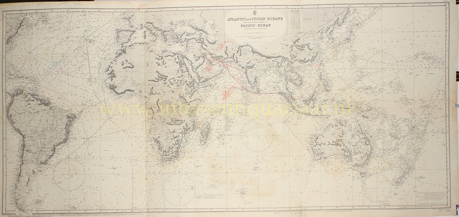
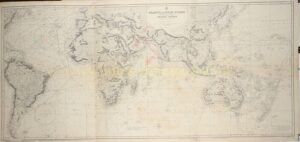

Admirality Chart 2483 of the “Atlantic and Indian Oceans with the western portion of Pacific Ocean : compiled from the latest government surveys”. Copper engraving first published in 1886, here in a reissue with corrections until 1956. Size: 64,2 x 143 cm.
Admiralty charts have been produced by the United Kingdom Hydrographic Office for over 200 years, with the primary aim of saving and protecting lives at sea. The core market for these charts have been (and still are) defense and merchant ships globally. Today, their products are used by over 90% of ships trading internationally.
Charts were printed from copper plates, which allowed very fine detail, but was slow. When corrections or alterations were needed to a chart, the copper was hammered from behind, the raised section scraped and smoothed, and the new information engraved on the smoothed area. This allowed plates to continue in use for long periods, in some cases for over a hundred years.
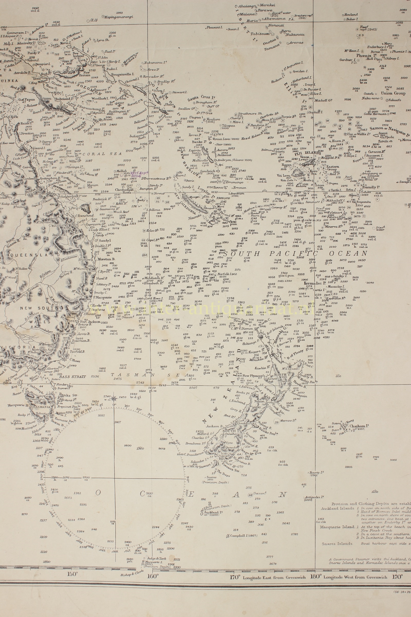
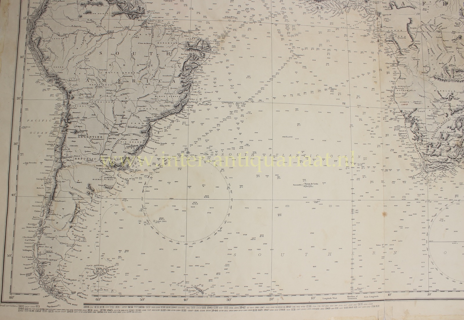
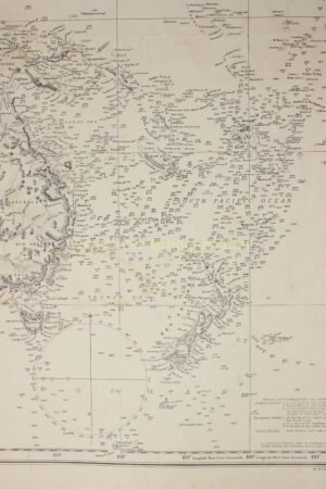
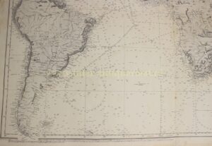
Charts often showed a great deal of detail of features on land as well as sea. Depths were shown by individual soundings while hills and mountains were shown by hatch marks. Printing was in black and white, although some charts were hand-coloured. Copper plate printing continued to be the main method well into the 20th-Century.
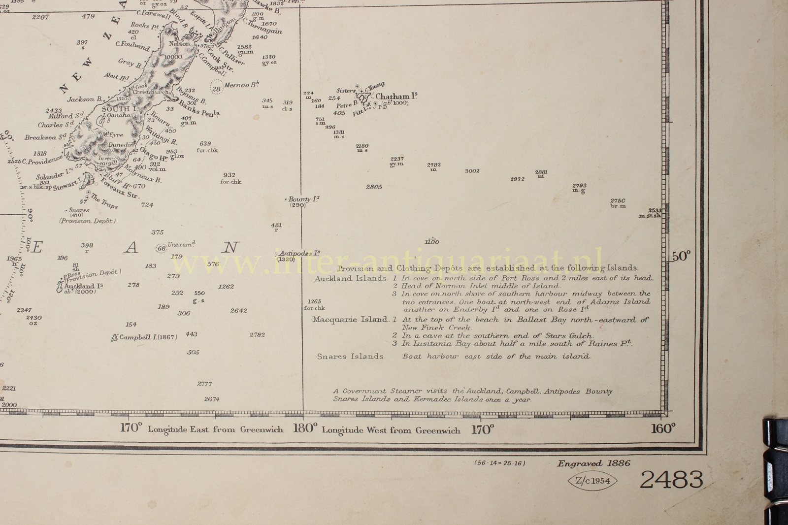
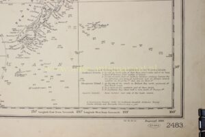
Bearing in mind its purpose, this particular map has location notes on several castaway depots on the New Zealand’s subantarctic islands. These “provision and clothing depots” were equipped with a range of emergency rations (tinned meat and biscuits), clothing, blankets, fishing equipment, medicine, matches and tools, and weapons and ammunition (to hunt food). Various animals were released onto the islands to breed and provide food for castaways. Pigs were released on the Auckland Islands from the early 19th century, followed later by goats. Sheep and rabbits were also widespread.
The map is also covered with rich topographic detail. Hachures were employed with prolific abandon to delineate a wide range of hills and mountains. The details of hundreds of rivers and their minor tributaries were laboriously engraved and named. In addition, there is a wealth of other information, for example the Kalahari Desert is “covered with dense wood but devoid of water”.
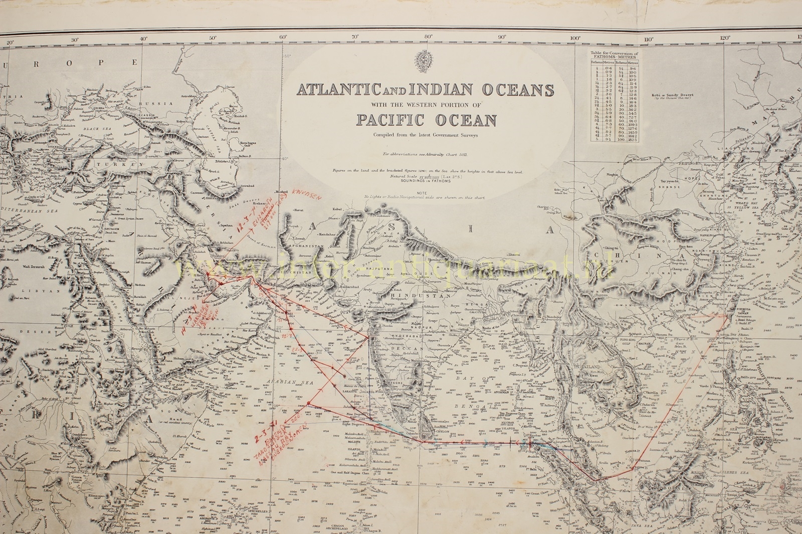
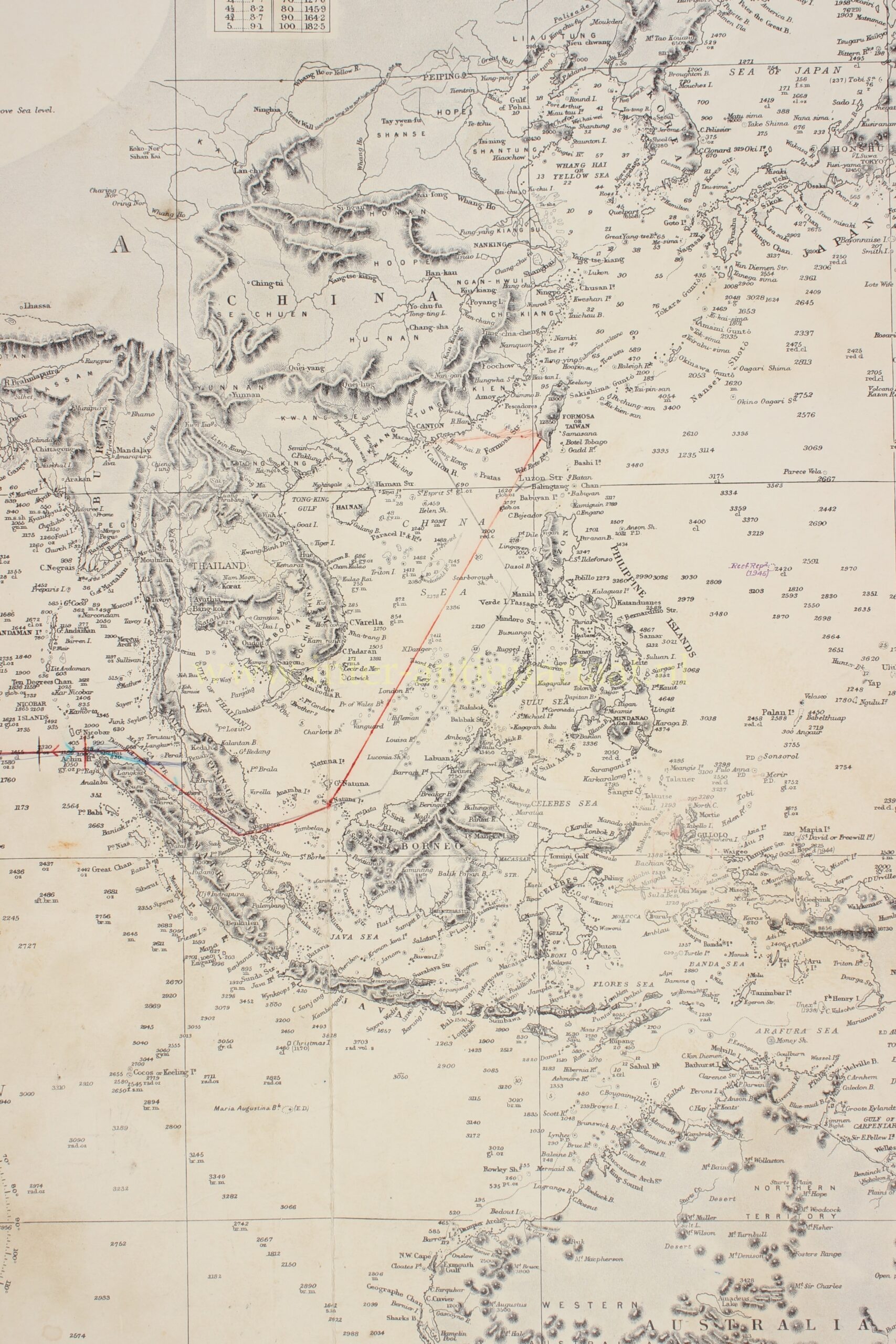
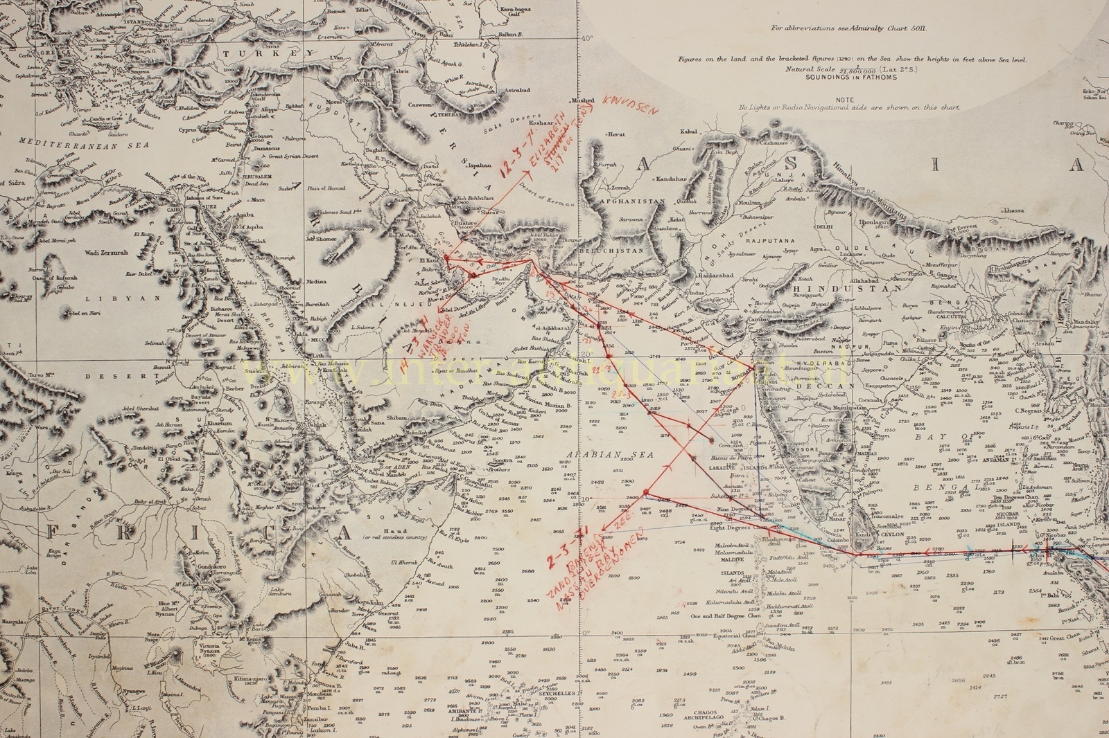
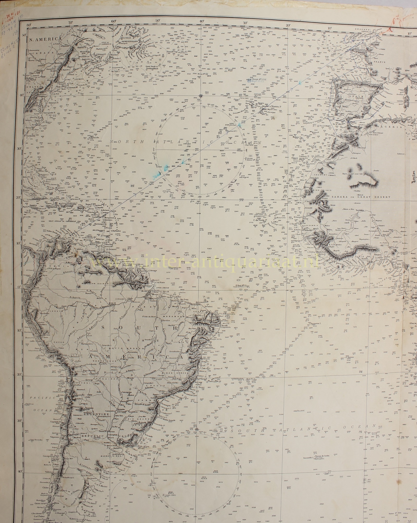
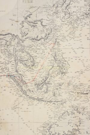
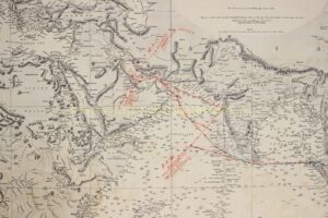
A Dutch seafarer plotted his routes with pen/pencil on this map from Europe to the Dutch Antilles and from the Middle East via India to Taiwan and back.
The Hydrographic Office of the Admiralty (which is still in operation today) was established under Earl Spencer in 1795, consisting of the Hydrographer, Alexander Dalrymple, one assistant and a draughtsman. Initially charts were produced only for use by the Navy, but in 1821, Thomas Hurd, who had succeeded Dalrymple as Hydrographer in 1808, persuaded the Admiralty to allow sales to the public.
Price: Euro 450,-