FIRST MAP OF NEW SOUTH WALES
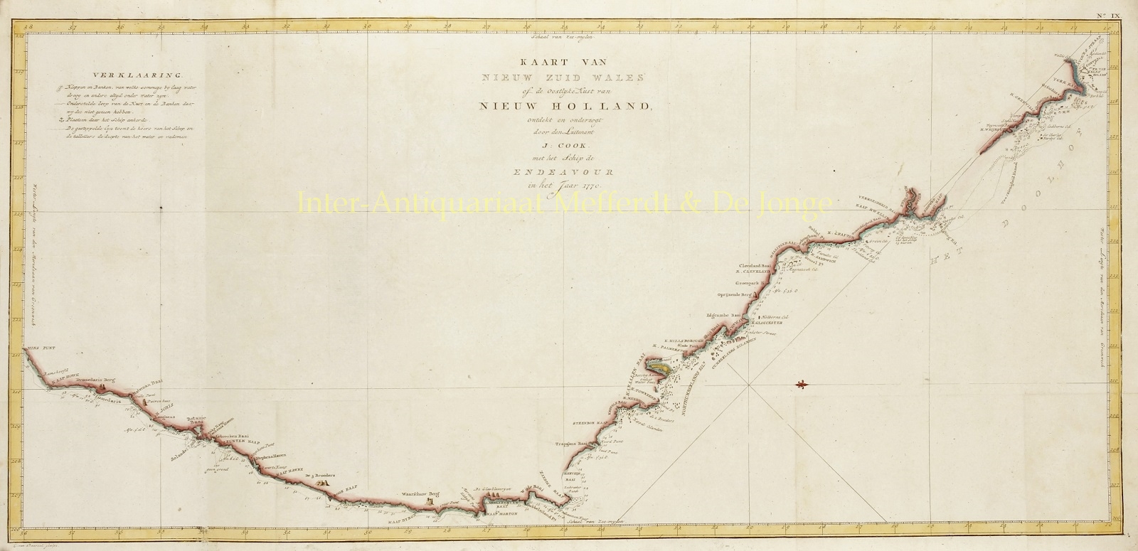
“Kaart van Nieuw Zuid Wales of de Oostlijke Kust van Nieuw Holland, ontdekt en onderzogt door Luitenant J. Cook met het schip de Endeavour in het Jaar 1770.” [Map of New South Wales or the east coast of New Holland, discovered and researched by lieutenant J. Cook with the ship the Endeavour in the year 1770.] Copper engraving made by Cornelis van Baarsel, published around 1797 as part of the James Cook’s “Reize rond de waereld”. With original hand colouring. Size: 35,6 x 77,5 cm.
This is the Dutch edition of James Cook‘s important first map of New South Wales, Australia. Oriented to the West, the map extends from Cape York, Prince of Wales Island, and the Endeavour Straits to Point Hicks (Victoria). The map is a product of Cook’s search for the often speculated upon southern continent or “Terra Australis”, which (based upon ancient Greek texts) scholars from the 16th century onwards, believed to exist at the base of the world.
In June 1769, Cook sailed westward, planning to return to England via the Cape of Good Hope, as he believed the Endeavour would not survive a second trip around Cape Horn. Instead he sailed west, where he hoped to discover “Terra Australis”. He sailed around New Zealand and headed for Tasmania, intending to follow up on Abel Tasman‘s work, when gales forced him northward. On April 19, 1770, his second, Zachary Hicks, signed land, what Cook immediately named Point Hicks (“Hiks Punt”). While Cook was most certainly aware he had not discovered “Terra Australis”, he did spend several months mapping the long sought east coast of New Holland (Australia), what he came to call New South Wales. He proceeded northwards, navigating the coast with great care, naming notable locations along the way.
It is of note that the coast between Cape Flattery (“Kaap Vlei”) and Weymouth remains unmapped. This area is so full of small islands and dangerous reefs that Cook aptly named it The Labyrinth (“Het Doolhof”). Just as he entered this area, near Cape Tribulation, the Endeavour struck a reef. On our map there is a note reading “Op deze Klip zat het Schip 13 uuren” (On this ledge the ship laid 13 hours). Rather than risk his ship further, Cook sailed the Endeavour further out to sea, around the perilous reefs, landing at Cape York to officially name New South Wales and claim the land for England.
Until this time it was assumed that Australia, or New Holland as it was known, was a barren wasteland, as the Dutch navigators had explored only a small part of the arid western coast. Cook on the other hand, sailed up the fertile east coast, and was impressed by what he saw. It was Cook who recommended settlement and persuaded Joseph Banks to argue for using the remote continent as a penal colony.
Price: SOLD


