

17TH CENTURY ELECTORATE OF BAVARIA (Kurfürstentum Bayern)
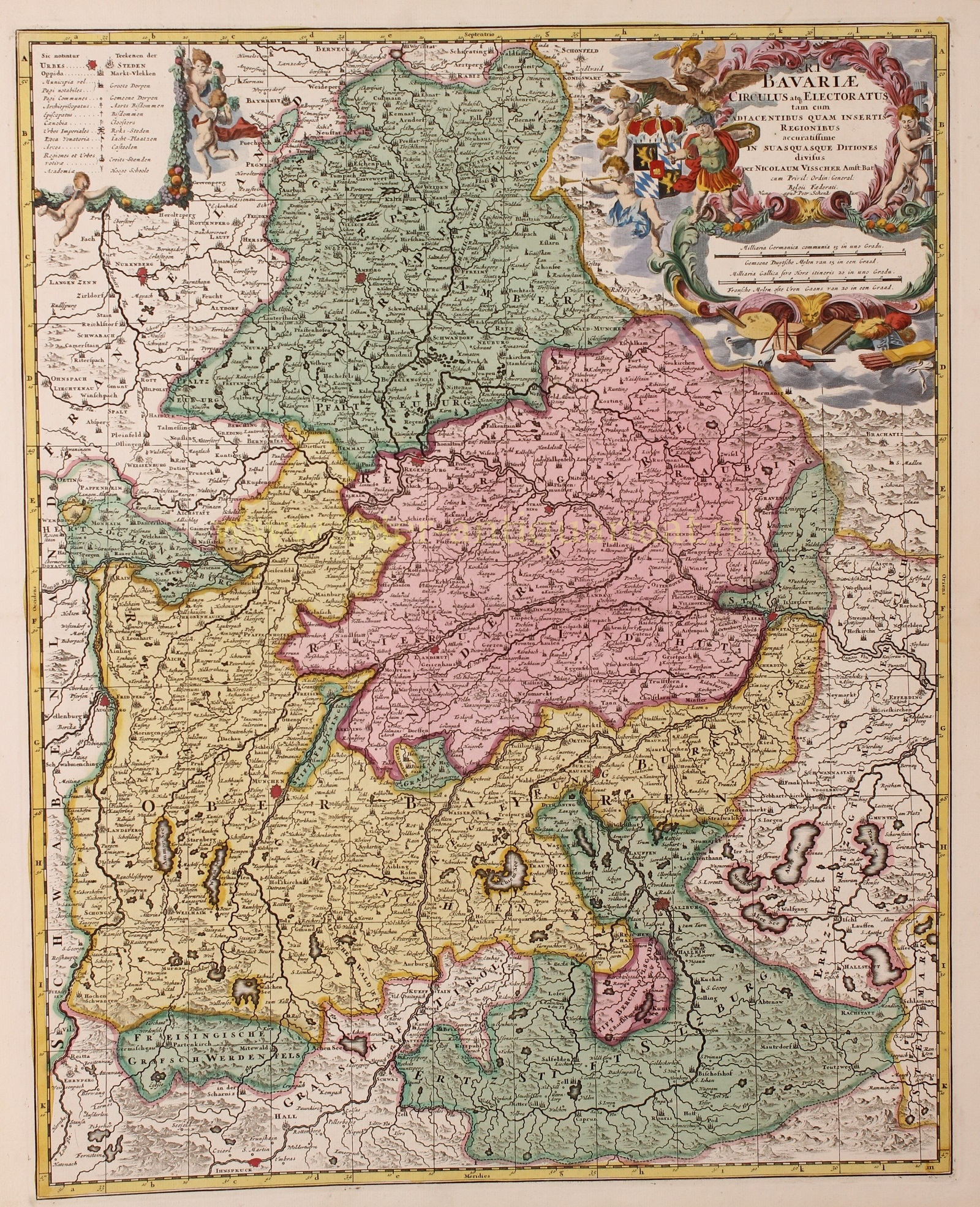
“S.R.I. Bavariae Circulus atq. Electoratus tam cum Adjacentibus quam insertis Regionibus accuratissime in suas quasque ditiones divisus.” Copper engraving first published by Nicolaes Visscher around 1680-1690, here in an edition by Pieter Schenk of around 1720. Coloured by a later hand. Size: approx.. 57,5 x 46 cm.
The Electorate of Bavaria consisted of most of the modern regions of Upper Bavaria, Lower Bavaria, and the Upper Palatinate. When the map was published it also included the Innviertel (now part of modern Austria). There were a considerable number of independent enclaves and jurisdictions within those broad areas, however, including the principalities of Palatinate-Neuburg and Palatinate-Sulzbach in the Upper Palatinate, which were held by cadet branches of the Palatinate line of the Wittelsbachs; the ecclesiastical states of Freising, Regensburg, and Passau, and the imperial free city of Regensburg. For administration purposes Bavaria was already from 1507 divided into four stewardships (D: Rentämter): Munich, Burghausen, Landshut and Straubing. With the acquisition of the Upper Palatinate during the Thirty Years’ War the stewardship Amberg was added.
Price: Euro 475,-